Guise elevation
Guise (Hauts-de-France, Département de l'Aisne), France elevation is 98 meters and Guise elevation in feet is 322 ft above sea level [src 1]. Guise is a populated place (feature code) with elevation that is 76 meters (249 ft) smaller than average city elevation in France.
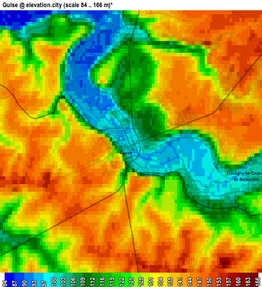
Below is the Elevation map of Guise, which displays elevation range with different colors. Scale of the first map is from 84 to 166 m (276 to 545 ft) with average elevation of 128.9 meters (=423 ft) [note 1]
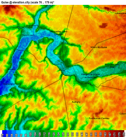
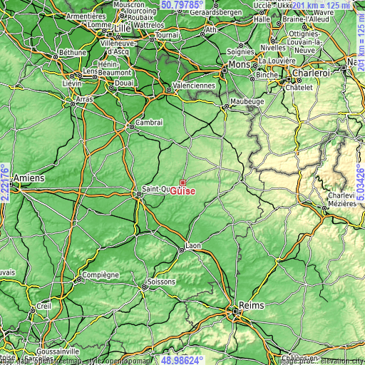
These maps also provides idea of topography and contour of this city, they are displayed at different zoom levels. More info about maps, scale and edge coordinates you can find below images.
| \ | Map #1 | Map #2 | Topo.Map |
| Scale [m] | 84..166 m | 76..179 m | × |
| Scale [ft] | 276..545 ft | 249..587 ft | × |
| Average | 128.9 m = 423 ft | 132.8 m = 436 ft | × |
| Width | 6.29 km = 3.9 mi | 12.59 km = 7.8 mi | 201.4 km = 125.1 mi |
| Height | 6.29 km = 3.9 mi | 12.59 km = 7.8 mi | 201.4 km = 125.1 mi |
| ↑Max Latitude | 49.928848° | 49.957129° | 50.79785° |
| Latitude at center | 49.90055° | 49.90055° | 49.90055° |
| ↓Min Latitude | 49.872236° | 49.843905° | 48.98624° |
| ← Min Longitude | 3.584065° | 3.540119° | 2.22176° |
| Longitude center | 3.62801° | 3.62801° | 3.62801° |
| →Max Longitude | 3.671955° | 3.715901° | 5.03426° |
Nearby cities:
Cities around Guise sort by population:
• Bohain-en-Vermandois elevation 139 m
15.8 km,  307°
307°
• Fresnoy-le-Grand 116 m
15.9 km,  289°
289°
• Le Nouvion-en-Thiérache 177 m
17.1 km,  41°
41°
• Ribemont 83 m
16.8 km,  226°
226°
• Origny-Sainte-Benoite 106 m
11.8 km, 230°
• Étreux 138 m
9.3 km,  9°
9°
• Saint-Souplet 135 m
18.6 km,  338°
338°
• Boué 147 m
13.3 km,  21°
21°
• Esquéhéries 169 m
12.6 km, 42°
• Buironfosse 204 m
16.6 km,  63°
63°
• Seboncourt 155 m
12.3 km,  298°
298°
• Wassigny 160 m
12.7 km,  350°
350°
Multilingual:
 En español:
Guisa elevación 98 m.
 En France:
Guise élévation 98 m.


Sources and notes:
- [note 1] Map square and city borders are not equal. Map elevation data is calculated only from area inside that square.
- [src 1] Elevation data from geonames database provided with same terms of usage.
- [src 2] The elevation map of Guise is generated using elevation data from NASA's 3 arcsec (90m) resolution SRTM data.
- [src 3] Base (background) map © OpenStreetMap contributors tiles are generated by Geofabrik and OpenTopoMap.
Copyright & License:
This Guise Elevation Map is licensed under CC BY-SA. You may reuse any part from this page, if you give a proper credit by linking to this URL:
 More info on terms of use page.