Harfleur elevation
Harfleur (Normandy, Seine-Maritime), France elevation is 4 meters and Harfleur elevation in feet is 13 ft above sea level [src 1]. Harfleur is a populated place (feature code) with elevation that is 170 meters (558 ft) smaller than average city elevation in France.
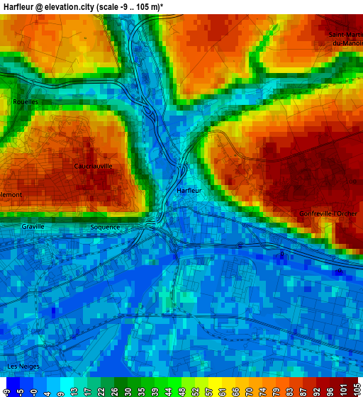
Below is the Elevation map of Harfleur, which displays elevation range with different colors. Scale of the first map is from -9 to 105 m (-30 to 344 ft) with average elevation of 36.7 meters (=120 ft) [note 1]
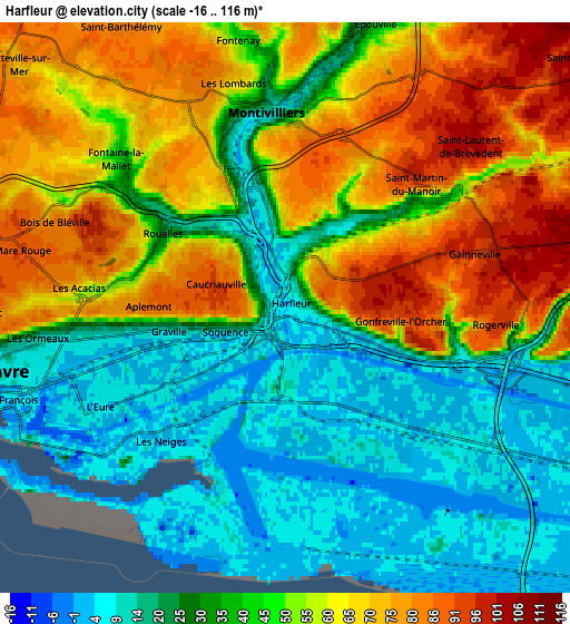
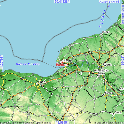
These maps also provides idea of topography and contour of this city, they are displayed at different zoom levels. More info about maps, scale and edge coordinates you can find below images.
| \ | Map #1 | Map #2 | Topo.Map |
| Scale [m] | -9..105 m | -16..116 m | × |
| Scale [ft] | -30..344 ft | -52..381 ft | × |
| Average | 36.7 m = 120 ft | 44.5 m = 146 ft | × |
| Width | 6.35 km = 3.9 mi | 12.69 km = 7.9 mi | 203.1 km = 126.2 mi |
| Height | 6.35 km = 3.9 mi | 12.69 km = 7.9 mi | 203.1 km = 126.2 mi |
| ↑Max Latitude | 49.535128° | 49.563639° | 50.41126° |
| Latitude at center | 49.5066° | 49.5066° | 49.5066° |
| ↓Min Latitude | 49.478055° | 49.449494° | 48.5849° |
| ← Min Longitude | 0.154325° | 0.110379° | -1.20798° |
| Longitude center | 0.19827° | 0.19827° | 0.19827° |
| →Max Longitude | 0.242215° | 0.286161° | 1.60452° |
Nearby cities:
Cities around Harfleur sort by population:
• Le Havre elevation 12 m
6.7 km,  257°
257°
• Montivilliers 14 m
4.4 km,  349°
349°
• Sainte-Adresse 44 m
8.2 km,  271°
271°
• Octeville-sur-Mer 78 m
8 km,  312°
312°
• Épouville 32 m
6.6 km,  16°
16°
• Fontaine-la-Mallet 41 m
5 km, 311°
• Gainneville 98 m
4.8 km,  73°
73°
• Saint-Laurent-de-Brévedent 85 m
4.6 km,  62°
62°
• Saint-Martin-du-Manoir 97 m
4 km,  44°
44°
• Rogerville 94 m
4.8 km,  94°
94°
• Manéglise 70 m
7.8 km,  32°
32°
• Fontenay 40 m
6 km, 350°
Multilingual:
 En español:
Harfleur elevación 4 m.
 En France:
Harfleur élévation 4 m.


Sources and notes:
- [note 1] Map square and city borders are not equal. Map elevation data is calculated only from area inside that square.
- [src 1] Elevation data from geonames database provided with same terms of usage.
- [src 2] The elevation map of Harfleur is generated using elevation data from NASA's 3 arcsec (90m) resolution SRTM data.
- [src 3] Base (background) map © OpenStreetMap contributors tiles are generated by Geofabrik and OpenTopoMap.
Copyright & License:
This Harfleur Elevation Map is licensed under CC BY-SA. You may reuse any part from this page, if you give a proper credit by linking to this URL:
 More info on terms of use page.