Hayange elevation
Hayange (Grand Est, Moselle), France elevation is 193 meters and Hayange elevation in feet is 633 ft above sea level [src 1]. Hayange is a populated place (feature code) with elevation that is 19 meters (62 ft) bigger than average city elevation in France.
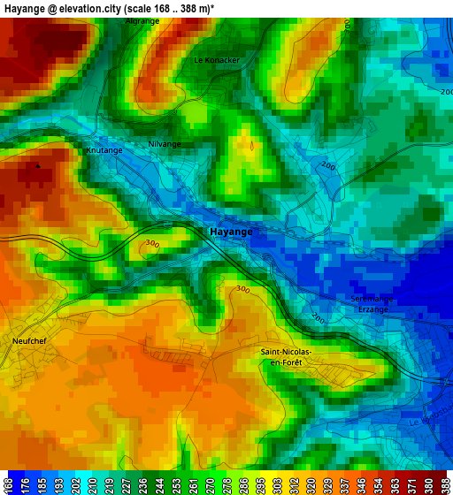
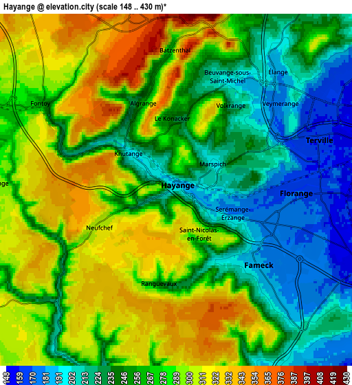
Below is the Elevation map of Hayange, which displays elevation range with different colors. Scale of the first map is from 168 to 388 m (551 to 1273 ft) with average elevation of 262.7 meters (=862 ft) [note 1]
These maps also provides idea of topography and contour of this city, they are displayed at different zoom levels. More info about maps, scale and edge coordinates you can find below images.
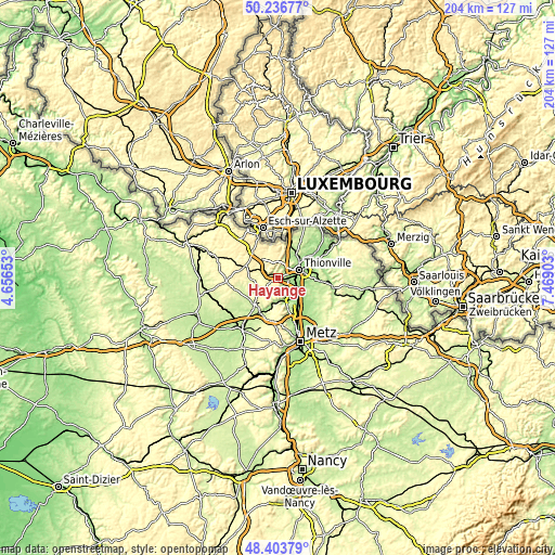
| \ | Map #1 | Map #2 | Topo.Map |
| Scale [m] | 168..388 m | 148..430 m | × |
| Scale [ft] | 551..1273 ft | 486..1411 ft | × |
| Average | 262.7 m = 862 ft | 267 m = 876 ft | × |
| Width | 6.37 km = 4 mi | 12.74 km = 7.9 mi | 203.8 km = 126.6 mi |
| Height | 6.37 km = 4 mi | 12.74 km = 7.9 mi | 203.8 km = 126.6 mi |
| ↑Max Latitude | 49.357442° | 49.386057° | 50.23677° |
| Latitude at center | 49.32881° | 49.32881° | 49.32881° |
| ↓Min Latitude | 49.300162° | 49.271497° | 48.40379° |
| ← Min Longitude | 6.018835° | 5.974889° | 4.65653° |
| Longitude center | 6.06278° | 6.06278° | 6.06278° |
| →Max Longitude | 6.106725° | 6.150671° | 7.46903° |
Nearby cities:
Cities around Hayange sort by population:
• Fameck elevation 180 m
4.7 km,  134°
134°
• Florange 171 m
4.3 km,  97°
97°
• Uckange 157 m
6.9 km,  114°
114°
• Terville 157 m
5.5 km,  68°
68°
• Algrange 330 m
3.9 km,  347°
347°
• Nilvange 270 m
1.8 km,  327°
327°
• Serémange-Erzange 178 m
2.2 km, 114°
• Knutange 200 m
2.1 km,  303°
303°
• Fontoy 284 m
5.9 km, 300°
• Neufchef 305 m
3.1 km,  244°
244°
• Gandrange 176 m
7.8 km,  144°
144°
• Angevillers 377 m
6.7 km, 348°
Multilingual:
 En español:
Hayange elevación 193 m.
 En France:
Hayange élévation 193 m.


Sources and notes:
- [note 1] Map square and city borders are not equal. Map elevation data is calculated only from area inside that square.
- [src 1] Elevation data from geonames database provided with same terms of usage.
- [src 2] The elevation map of Hayange is generated using elevation data from NASA's 3 arcsec (90m) resolution SRTM data.
- [src 3] Base (background) map © OpenStreetMap contributors tiles are generated by Geofabrik and OpenTopoMap.
Copyright & License:
This Hayange Elevation Map is licensed under CC BY-SA. You may reuse any part from this page, if you give a proper credit by linking to this URL:
 More info on terms of use page.