Héric elevation
Héric (Pays de la Loire, Loire-Atlantique), France elevation is 35 meters and Héric elevation in feet is 115 ft above sea level [src 1]. Héric is a populated place (feature code) with elevation that is 139 meters (456 ft) smaller than average city elevation in France.
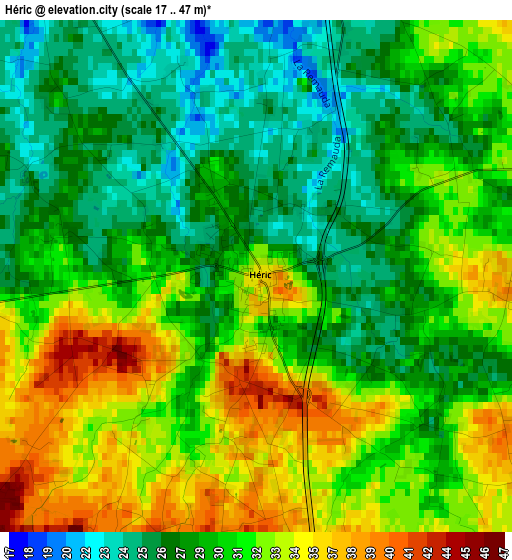
Below is the Elevation map of Héric, which displays elevation range with different colors. Scale of the first map is from 17 to 47 m (56 to 154 ft) with average elevation of 30.2 meters (=99 ft) [note 1]
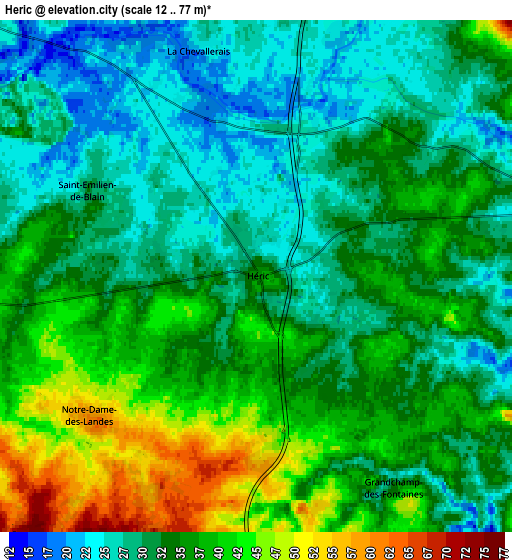
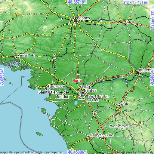
These maps also provides idea of topography and contour of this city, they are displayed at different zoom levels. More info about maps, scale and edge coordinates you can find below images.
| \ | Map #1 | Map #2 | Topo.Map |
| Scale [m] | 17..47 m | 12..77 m | × |
| Scale [ft] | 56..154 ft | 39..253 ft | × |
| Average | 30.2 m = 99 ft | 33.6 m = 110 ft | × |
| Width | 6.61 km = 4.1 mi | 13.23 km = 8.2 mi | 211.6 km = 131.5 mi |
| Height | 6.61 km = 4.1 mi | 13.23 km = 8.2 mi | 211.6 km = 131.5 mi |
| ↑Max Latitude | 47.443899° | 47.473611° | 48.35718° |
| Latitude at center | 47.41417° | 47.41417° | 47.41417° |
| ↓Min Latitude | 47.384424° | 47.354661° | 46.45396° |
| ← Min Longitude | -1.697035° | -1.740981° | -3.05934° |
| Longitude center | -1.65309° | -1.65309° | -1.65309° |
| →Max Longitude | -1.609145° | -1.565199° | -0.24684° |
Nearby cities:
Cities around Héric sort by population:
• Blain elevation 27 m
10.8 km,  310°
310°
• Treillières 58 m
9.6 km,  164°
164°
• Nort-sur-Erdre 8 m
12 km,  76°
76°
• Sucé-sur-Erdre 22 m
12.7 km,  134°
134°
• Vigneux-de-Bretagne 63 m
11.7 km,  212°
212°
• Saffré 27 m
11.2 km,  30°
30°
• Fay-de-Bretagne 48 m
10.4 km,  270°
270°
• Notre-Dame-des-Landes 58 m
5.6 km,  228°
228°
• Le Temple-de-Bretagne 87 m
14.1 km, 226°
• Casson 32 m
7.8 km,  112°
112°
• La Grigonnais 55 m
12.6 km,  354°
354°
• Le Gâvre 31 m
13.9 km,  328°
328°
Multilingual:
 En español:
Héric elevación 35 m.
 En France:
Héric élévation 35 m.


Sources and notes:
- [note 1] Map square and city borders are not equal. Map elevation data is calculated only from area inside that square.
- [src 1] Elevation data from geonames database provided with same terms of usage.
- [src 2] The elevation map of Héric is generated using elevation data from NASA's 3 arcsec (90m) resolution SRTM data.
- [src 3] Base (background) map © OpenStreetMap contributors tiles are generated by Geofabrik and OpenTopoMap.
Copyright & License:
This Héric Elevation Map is licensed under CC BY-SA. You may reuse any part from this page, if you give a proper credit by linking to this URL:
 More info on terms of use page.