Houdain elevation
Houdain (Hauts-de-France, Pas-de-Calais), France elevation is 57 meters and Houdain elevation in feet is 187 ft above sea level [src 1]. Houdain is a populated place (feature code) with elevation that is 117 meters (384 ft) smaller than average city elevation in France.
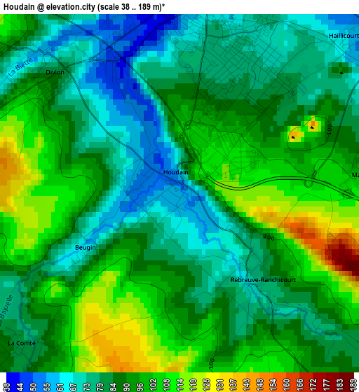
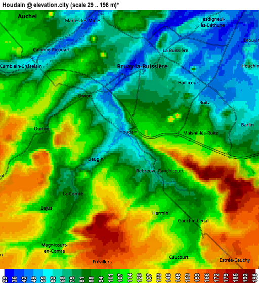
Below is the Elevation map of Houdain, which displays elevation range with different colors. Scale of the first map is from 38 to 189 m (125 to 620 ft) with average elevation of 89.4 meters (=293 ft) [note 1]
These maps also provides idea of topography and contour of this city, they are displayed at different zoom levels. More info about maps, scale and edge coordinates you can find below images.
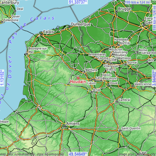
| \ | Map #1 | Map #2 | Topo.Map |
| Scale [m] | 38..189 m | 29..198 m | × |
| Scale [ft] | 125..620 ft | 95..650 ft | × |
| Average | 89.4 m = 293 ft | 100 m = 328 ft | × |
| Width | 6.22 km = 3.9 mi | 12.45 km = 7.7 mi | 199.1 km = 123.7 mi |
| Height | 6.22 km = 3.9 mi | 12.45 km = 7.7 mi | 199.1 km = 123.7 mi |
| ↑Max Latitude | 50.478374° | 50.506331° | 51.33737° |
| Latitude at center | 50.4504° | 50.4504° | 50.4504° |
| ↓Min Latitude | 50.42241° | 50.394403° | 49.54649° |
| ← Min Longitude | 2.493825° | 2.449879° | 1.13152° |
| Longitude center | 2.53777° | 2.53777° | 2.53777° |
| →Max Longitude | 2.581715° | 2.625661° | 3.94402° |
Nearby cities:
Cities around Houdain sort by population:
• Bruay-la-Buissière elevation 60 m
3.8 km,  13°
13°
• Barlin 78 m
5.8 km,  87°
87°
• Divion 61 m
3.3 km,  315°
315°
• Marles-les-Mines 46 m
6.4 km,  341°
341°
• Calonne-Ricouart 53 m
6 km,  310°
310°
• Haillicourt 65 m
3.8 km,  43°
43°
• Lapugnoy 41 m
7.3 km,  358°
358°
• Ruitz 59 m
4 km,  63°
63°
• Camblain-Châtelain 64 m
6.9 km,  302°
302°
• Maisnil-lès-Ruitz 106 m
3.7 km,  84°
84°
• Gosnay 35 m
7.2 km,  30°
30°
• Ranchicourt 74 m
2.1 km,  140°
140°
Multilingual:
 En español:
Houdain elevación 57 m.
 En France:
Houdain élévation 57 m.


Sources and notes:
- [note 1] Map square and city borders are not equal. Map elevation data is calculated only from area inside that square.
- [src 1] Elevation data from geonames database provided with same terms of usage.
- [src 2] The elevation map of Houdain is generated using elevation data from NASA's 3 arcsec (90m) resolution SRTM data.
- [src 3] Base (background) map © OpenStreetMap contributors tiles are generated by Geofabrik and OpenTopoMap.
Copyright & License:
This Houdain Elevation Map is licensed under CC BY-SA. You may reuse any part from this page, if you give a proper credit by linking to this URL:
 More info on terms of use page.