Houplines elevation
Houplines (Hauts-de-France, Nord), France elevation is 17 meters and Houplines elevation in feet is 56 ft above sea level [src 1]. Houplines is a populated place (feature code) with elevation that is 157 meters (515 ft) smaller than average city elevation in France.
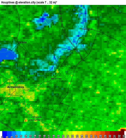
Below is the Elevation map of Houplines, which displays elevation range with different colors. Scale of the first map is from 7 to 32 m (23 to 105 ft) with average elevation of 16.6 meters (=54 ft) [note 1]
These maps also provides idea of topography and contour of this city, they are displayed at different zoom levels. More info about maps, scale and edge coordinates you can find below images.
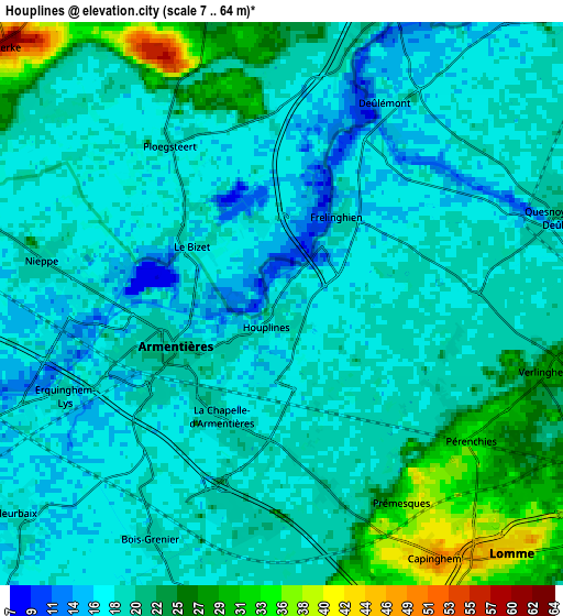
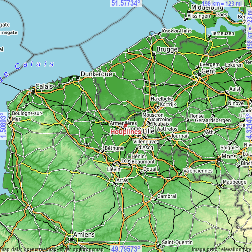
| \ | Map #1 | Map #2 | Topo.Map |
| Scale [m] | 7..32 m | 7..64 m | × |
| Scale [ft] | 23..105 ft | 23..210 ft | × |
| Average | 16.6 m = 54 ft | 19.7 m = 65 ft | × |
| Width | 6.19 km = 3.8 mi | 12.38 km = 7.7 mi | 198.1 km = 123.1 mi |
| Height | 6.19 km = 3.8 mi | 12.38 km = 7.7 mi | 198.1 km = 123.1 mi |
| ↑Max Latitude | 50.722819° | 50.750631° | 51.57734° |
| Latitude at center | 50.69499° | 50.69499° | 50.69499° |
| ↓Min Latitude | 50.667145° | 50.639283° | 49.79573° |
| ← Min Longitude | 2.871235° | 2.827289° | 1.50893° |
| Longitude center | 2.91518° | 2.91518° | 2.91518° |
| →Max Longitude | 2.959125° | 3.003071° | 4.32143° |
Nearby cities:
Cities around Houplines sort by population:
• Armentières elevation 21 m
2.5 km,  246°
246°
• Pérenchies 32 m
4.8 km,  125°
125°
• Nieppe 19 m
5.7 km,  280°
280°
• Quesnoy-sur-Deûle 21 m
6.3 km,  70°
70°
• Erquinghem-Lys 19 m
5.4 km, 246°
• Verlinghem 28 m
6.1 km,  102°
102°
• Lompret 25 m
6 km,  118°
118°
• Frelinghien 15 m
2.7 km,  27°
27°
• Prémesques 33 m
5.1 km,  149°
149°
• Capinghem 46 m
6.4 km, 149°
• Deûlémont 17 m
4.9 km, 29°
• Bois-Grenier 19 m
5.8 km,  209°
209°
Multilingual:
 En español:
Houplines elevación 17 m.
 En France:
Houplines élévation 17 m.
 Auf Deutsch:
Houplines höhe über dem Meeresspiegel ist 17 m.

Sources and notes:
- [note 1] Map square and city borders are not equal. Map elevation data is calculated only from area inside that square.
- [src 1] Elevation data from geonames database provided with same terms of usage.
- [src 2] The elevation map of Houplines is generated using elevation data from NASA's 3 arcsec (90m) resolution SRTM data.
- [src 3] Base (background) map © OpenStreetMap contributors tiles are generated by Geofabrik and OpenTopoMap.
Copyright & License:
This Houplines Elevation Map is licensed under CC BY-SA. You may reuse any part from this page, if you give a proper credit by linking to this URL:
 More info on terms of use page.