Ingré elevation
Ingré (Centre, Loiret), France elevation is 119 meters and Ingré elevation in feet is 390 ft above sea level [src 1]. Ingré is a populated place (feature code) with elevation that is 55 meters (180 ft) smaller than average city elevation in France.
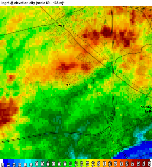
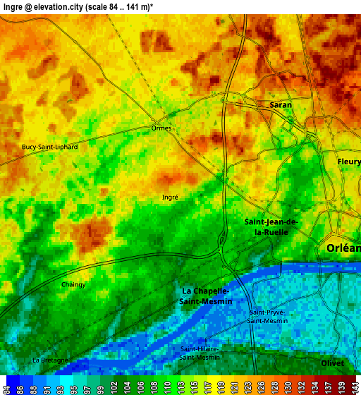
Below is the Elevation map of Ingré, which displays elevation range with different colors. Scale of the first map is from 89 to 136 m (292 to 446 ft) with average elevation of 113.9 meters (=374 ft) [note 1]
These maps also provides idea of topography and contour of this city, they are displayed at different zoom levels. More info about maps, scale and edge coordinates you can find below images.
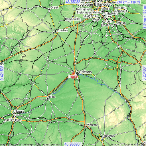
| \ | Map #1 | Map #2 | Topo.Map |
| Scale [m] | 89..136 m | 84..141 m | × |
| Scale [ft] | 292..446 ft | 276..463 ft | × |
| Average | 113.9 m = 374 ft | 112.6 m = 369 ft | × |
| Width | 6.55 km = 4.1 mi | 13.1 km = 8.1 mi | 209.6 km = 130.2 mi |
| Height | 6.55 km = 4.1 mi | 13.1 km = 8.1 mi | 209.6 km = 130.2 mi |
| ↑Max Latitude | 47.949392° | 47.978818° | 48.8538° |
| Latitude at center | 47.91995° | 47.91995° | 47.91995° |
| ↓Min Latitude | 47.890491° | 47.861015° | 46.96893° |
| ← Min Longitude | 1.783835° | 1.739889° | 0.42153° |
| Longitude center | 1.82778° | 1.82778° | 1.82778° |
| →Max Longitude | 1.871725° | 1.915671° | 3.23403° |
Nearby cities:
Cities around Ingré sort by population:
• Orléans elevation 115 m
6 km,  108°
108°
• Fleury-les-Aubrais 120 m
6.9 km,  77°
77°
• Saint-Jean-de-la-Ruelle 110 m
2.9 km, 109°
• Saran 121 m
4.9 km,  46°
46°
• La Chapelle-Saint-Mesmin 102 m
3.8 km,  172°
172°
• Saint-Jean-le-Blanc 96 m
7.2 km, 114°
• Saint-Pryvé-Saint-Mesmin 93 m
5.3 km,  143°
143°
• Ormes 117 m
2.5 km,  343°
343°
• Chaingy 110 m
5.9 km,  226°
226°
• Saint-Hilaire-Saint-Mesmin 101 m
6 km,  175°
175°
• Gidy 122 m
7.3 km,  6°
6°
• Mareau-aux-Prés 94 m
6.8 km,  209°
209°
Multilingual:
 En español:
Ingré elevación 119 m.
 En France:
Ingré élévation 119 m.


Sources and notes:
- [note 1] Map square and city borders are not equal. Map elevation data is calculated only from area inside that square.
- [src 1] Elevation data from geonames database provided with same terms of usage.
- [src 2] The elevation map of Ingré is generated using elevation data from NASA's 3 arcsec (90m) resolution SRTM data.
- [src 3] Base (background) map © OpenStreetMap contributors tiles are generated by Geofabrik and OpenTopoMap.
Copyright & License:
This Ingré Elevation Map is licensed under CC BY-SA. You may reuse any part from this page, if you give a proper credit by linking to this URL:
 More info on terms of use page.