Irigny elevation
Irigny (Auvergne-Rhône-Alpes, Département du Rhône), France elevation is 178 meters and Irigny elevation in feet is 584 ft above sea level [src 1]. Irigny is a populated place (feature code) with elevation that is 4 meters (13 ft) bigger than average city elevation in France.
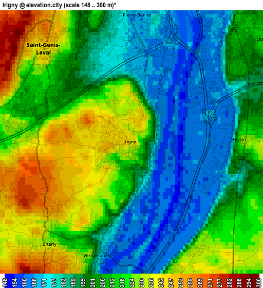
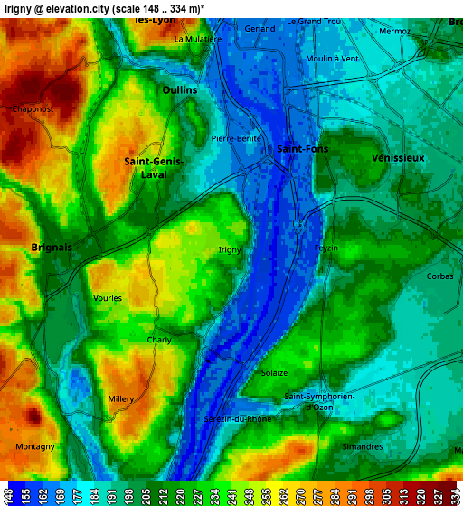
Below is the Elevation map of Irigny, which displays elevation range with different colors. Scale of the first map is from 148 to 300 m (486 to 984 ft) with average elevation of 205.6 meters (=675 ft) [note 1]
These maps also provides idea of topography and contour of this city, they are displayed at different zoom levels. More info about maps, scale and edge coordinates you can find below images.
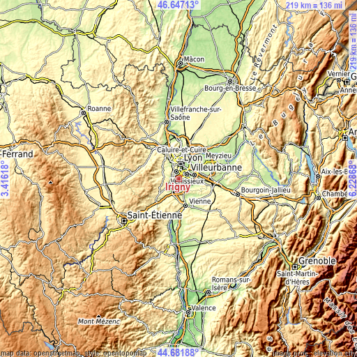
| \ | Map #1 | Map #2 | Topo.Map |
| Scale [m] | 148..300 m | 148..334 m | × |
| Scale [ft] | 486..984 ft | 486..1096 ft | × |
| Average | 205.6 m = 675 ft | 215.3 m = 706 ft | × |
| Width | 6.83 km = 4.2 mi | 13.66 km = 8.5 mi | 218.5 km = 135.8 mi |
| Height | 6.83 km = 4.2 mi | 13.66 km = 8.5 mi | 218.5 km = 135.8 mi |
| ↑Max Latitude | 45.703828° | 45.73451° | 46.64713° |
| Latitude at center | 45.67313° | 45.67313° | 45.67313° |
| ↓Min Latitude | 45.642415° | 45.611683° | 44.68188° |
| ← Min Longitude | 4.778485° | 4.734539° | 3.41618° |
| Longitude center | 4.82243° | 4.82243° | 4.82243° |
| →Max Longitude | 4.866375° | 4.910321° | 6.22868° |
Nearby cities:
Cities around Irigny sort by population:
• Oullins elevation 187 m
4.7 km,  345°
345°
• Saint-Genis-Laval 245 m
3.4 km,  317°
317°
• Saint-Fons 181 m
4.6 km,  31°
31°
• Brignais 209 m
5.3 km,  270°
270°
• Pierre-Bénite 170 m
3.4 km,  2°
2°
• Feyzin 225 m
2.8 km,  90°
90°
• Vernaison 160 m
2.9 km,  196°
196°
• Charly 233 m
3.5 km,  218°
218°
• Millery 285 m
5.5 km,  214°
214°
• Vourles 259 m
4.1 km,  247°
247°
• Sérézin-du-Rhône 170 m
4.9 km,  178°
178°
• Solaize 223 m
4 km,  159°
159°
Multilingual:
 En español:
Irigny elevación 178 m.
 En France:
Irigny élévation 178 m.


Sources and notes:
- [note 1] Map square and city borders are not equal. Map elevation data is calculated only from area inside that square.
- [src 1] Elevation data from geonames database provided with same terms of usage.
- [src 2] The elevation map of Irigny is generated using elevation data from NASA's 3 arcsec (90m) resolution SRTM data.
- [src 3] Base (background) map © OpenStreetMap contributors tiles are generated by Geofabrik and OpenTopoMap.
Copyright & License:
This Irigny Elevation Map is licensed under CC BY-SA. You may reuse any part from this page, if you give a proper credit by linking to this URL:
 More info on terms of use page.