Is-sur-Tille elevation
Is-sur-Tille (Bourgogne-Franche-Comté, Département de la Côte-d'Or), France elevation is 278 meters and Is-sur-Tille elevation in feet is 912 ft above sea level [src 1]. Is-sur-Tille is a populated place (feature code) with elevation that is 104 meters (341 ft) bigger than average city elevation in France.
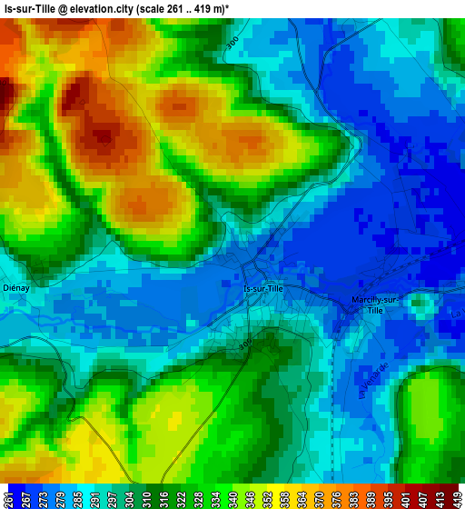
Below is the Elevation map of Is-sur-Tille, which displays elevation range with different colors. Scale of the first map is from 261 to 419 m (856 to 1375 ft) with average elevation of 313.4 meters (=1028 ft) [note 1]
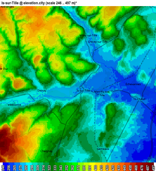
These maps also provides idea of topography and contour of this city, they are displayed at different zoom levels. More info about maps, scale and edge coordinates you can find below images.
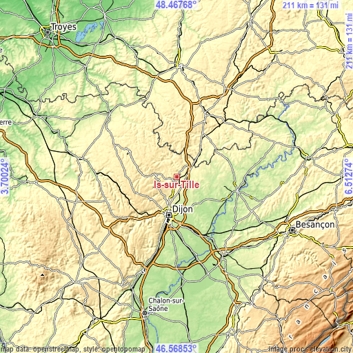
| \ | Map #1 | Map #2 | Topo.Map |
| Scale [m] | 261..419 m | 246..497 m | × |
| Scale [ft] | 856..1375 ft | 807..1631 ft | × |
| Average | 313.4 m = 1028 ft | 330.7 m = 1085 ft | × |
| Width | 6.6 km = 4.1 mi | 13.2 km = 8.2 mi | 211.2 km = 131.2 mi |
| Height | 6.6 km = 4.1 mi | 13.2 km = 8.2 mi | 211.2 km = 131.2 mi |
| ↑Max Latitude | 47.556366° | 47.586014° | 48.46768° |
| Latitude at center | 47.5267° | 47.5267° | 47.5267° |
| ↓Min Latitude | 47.497018° | 47.467319° | 46.56853° |
| ← Min Longitude | 5.062545° | 5.018599° | 3.70024° |
| Longitude center | 5.10649° | 5.10649° | 5.10649° |
| →Max Longitude | 5.150435° | 5.194381° | 6.51274° |
Nearby cities:
Cities around Is-sur-Tille sort by population:
• Fontaine-lès-Dijon elevation 293 m
21.5 km,  197°
197°
• Arc-sur-Tille 219 m
21.2 km,  163°
163°
• Selongey 298 m
9 km,  40°
40°
• Varois-et-Chaignot 229 m
19.7 km,  175°
175°
• Mirebeau-sur-Bèze 201 m
21.5 km,  131°
131°
• Marcilly-sur-Tille 286 m
2.1 km,  121°
121°
• Daix 329 m
21.1 km, 202°
• Ahuy 281 m
18.6 km, 200°
• Messigny-et-Vantoux 312 m
14.9 km,  206°
206°
• Saint-Julien 236 m
14.3 km,  169°
169°
• Ruffey-lès-Echirey 242 m
17.9 km,  185°
185°
• Hauteville-lès-Dijon 386 m
19.8 km, 205°
Multilingual:
 En español:
Is-sur-Tille elevación 278 m.
 En France:
Is-sur-Tille élévation 278 m.
 Auf Deutsch:
Is-sur-Tille höhe über dem Meeresspiegel ist 278 m.

Sources and notes:
- [note 1] Map square and city borders are not equal. Map elevation data is calculated only from area inside that square.
- [src 1] Elevation data from geonames database provided with same terms of usage.
- [src 2] The elevation map of Is-sur-Tille is generated using elevation data from NASA's 3 arcsec (90m) resolution SRTM data.
- [src 3] Base (background) map © OpenStreetMap contributors tiles are generated by Geofabrik and OpenTopoMap.
Copyright & License:
This Is-sur-Tille Elevation Map is licensed under CC BY-SA. You may reuse any part from this page, if you give a proper credit by linking to this URL:
 More info on terms of use page.