Juillan elevation
Juillan (Occitanie, Département des Hautes-Pyrénées), France elevation is 329 meters and Juillan elevation in feet is 1079 ft above sea level [src 1]. Juillan is a populated place (feature code) with elevation that is 155 meters (509 ft) bigger than average city elevation in France.
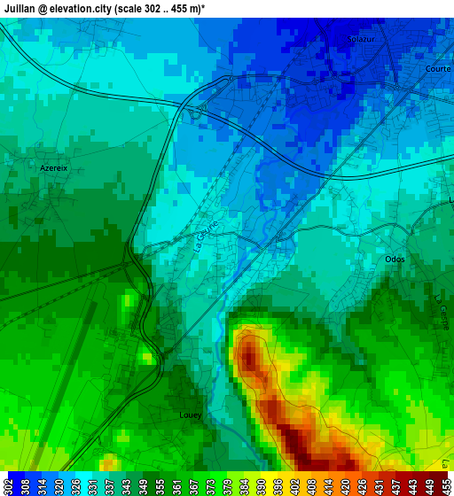
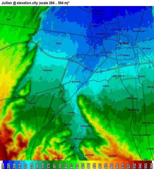
Below is the Elevation map of Juillan, which displays elevation range with different colors. Scale of the first map is from 302 to 455 m (991 to 1493 ft) with average elevation of 344.3 meters (=1130 ft) [note 1]
These maps also provides idea of topography and contour of this city, they are displayed at different zoom levels. More info about maps, scale and edge coordinates you can find below images.
| \ | Map #1 | Map #2 | Topo.Map |
| Scale [m] | 302..455 m | 284..564 m | × |
| Scale [ft] | 991..1493 ft | 932..1850 ft | × |
| Average | 344.3 m = 1130 ft | 370.2 m = 1215 ft | × |
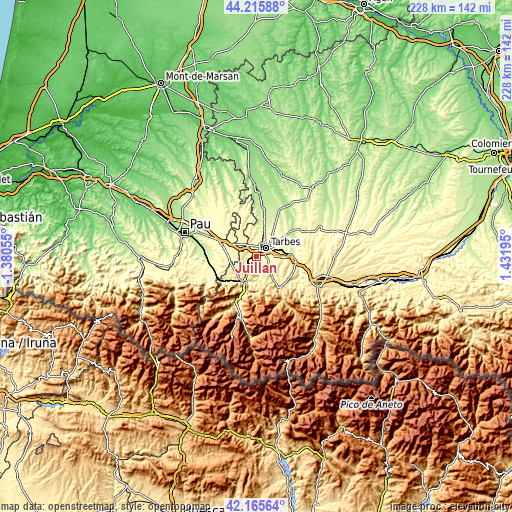
| Width | 7.12 km = 4.4 mi | 14.25 km = 8.9 mi | 228 km = 141.7 mi |
| Height | 7.12 km = 4.4 mi | 14.25 km = 8.9 mi | 228 km = 141.7 mi |
| ↑Max Latitude | 43.231397° | 43.263407° | 44.21588° |
| Latitude at center | 43.19937° | 43.19937° | 43.19937° |
| ↓Min Latitude | 43.167327° | 43.135266° | 42.16564° |
| ← Min Longitude | -0.018245° | -0.062191° | -1.38055° |
| Longitude center | 0.0257° | 0.0257° | 0.0257° |
| →Max Longitude | 0.069645° | 0.113591° | 1.43195° |
Nearby cities:
Cities around Juillan sort by population:
• Tarbes elevation 315 m
6 km,  51°
51°
• Aureilhan 309 m
7.5 km, 49°
• Séméac 321 m
7.3 km,  63°
63°
• Odos 341 m
2.6 km,  97°
97°
• Barbazan-Debat 358 m
7.7 km,  92°
92°
• Soues 342 m
6 km,  81°
81°
• Ibos 321 m
4.3 km,  331°
331°
• Ossun 385 m
5.1 km,  249°
249°
• Ger 409 m
8.3 km,  312°
312°
• Laloubère 338 m
3.9 km, 81°
• Oursbelille 280 m
9.6 km,  4°
4°
• Horgues 360 m
5.1 km, 103°
Multilingual:
 En español:
Juillan elevación 329 m.
 En France:
Juillan élévation 329 m.


Sources and notes:
- [note 1] Map square and city borders are not equal. Map elevation data is calculated only from area inside that square.
- [src 1] Elevation data from geonames database provided with same terms of usage.
- [src 2] The elevation map of Juillan is generated using elevation data from NASA's 3 arcsec (90m) resolution SRTM data.
- [src 3] Base (background) map © OpenStreetMap contributors tiles are generated by Geofabrik and OpenTopoMap.
Copyright & License:
This Juillan Elevation Map is licensed under CC BY-SA. You may reuse any part from this page, if you give a proper credit by linking to this URL:
 More info on terms of use page.