Kembs elevation
Kembs (Grand Est, Haut-Rhin), France elevation is 240 meters and Kembs elevation in feet is 787 ft above sea level [src 1]. Kembs is a populated place (feature code) with elevation that is 66 meters (217 ft) bigger than average city elevation in France.
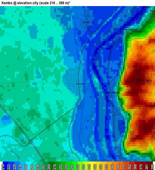
Below is the Elevation map of Kembs, which displays elevation range with different colors. Scale of the first map is from 216 to 388 m (709 to 1273 ft) with average elevation of 258.5 meters (=848 ft) [note 1]
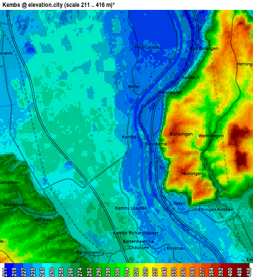
These maps also provides idea of topography and contour of this city, they are displayed at different zoom levels. More info about maps, scale and edge coordinates you can find below images.
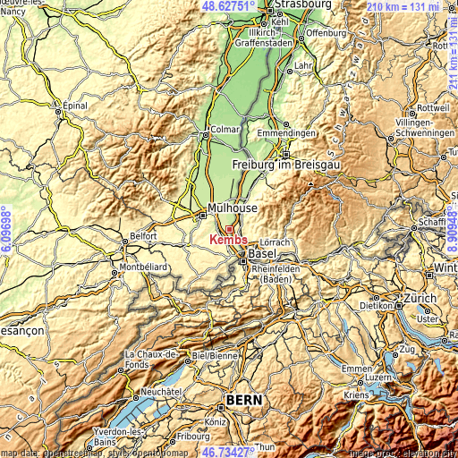
| \ | Map #1 | Map #2 | Topo.Map |
| Scale [m] | 216..388 m | 211..416 m | × |
| Scale [ft] | 709..1273 ft | 692..1365 ft | × |
| Average | 258.5 m = 848 ft | 266.5 m = 874 ft | × |
| Width | 6.58 km = 4.1 mi | 13.16 km = 8.2 mi | 210.5 km = 130.8 mi |
| Height | 6.58 km = 4.1 mi | 13.16 km = 8.2 mi | 210.5 km = 130.8 mi |
| ↑Max Latitude | 47.719053° | 47.74861° | 48.62751° |
| Latitude at center | 47.68948° | 47.68948° | 47.68948° |
| ↓Min Latitude | 47.65989° | 47.630283° | 46.73427° |
| ← Min Longitude | 7.459285° | 7.415339° | 6.09698° |
| Longitude center | 7.50323° | 7.50323° | 7.50323° |
| →Max Longitude | 7.547175° | 7.591121° | 8.90948° |
Nearby cities:
Cities around Kembs sort by population:
• Rixheim elevation 240 m
10.1 km,  311°
311°
• Habsheim 242 m
7.8 km, 305°
• Blotzheim 268 m
9.7 km,  182°
182°
• Village-Neuf 239 m
10.5 km,  151°
151°
• Bartenheim 259 m
6.5 km,  195°
195°
• Sierentz 254 m
5.1 km,  226°
226°
• Ottmarsheim 226 m
11 km,  1°
1°
• Rosenau 239 m
6.3 km,  157°
157°
• Landser 260 m
8.5 km,  266°
266°
• Eschentzwiller 271 m
8.3 km,  288°
288°
• Dietwiller 250 m
7.5 km, 272°
• Zimmersheim 263 m
9.3 km, 292°
Multilingual:
 En español:
Kembs elevación 240 m.
 En France:
Kembs élévation 240 m.


Sources and notes:
- [note 1] Map square and city borders are not equal. Map elevation data is calculated only from area inside that square.
- [src 1] Elevation data from geonames database provided with same terms of usage.
- [src 2] The elevation map of Kembs is generated using elevation data from NASA's 3 arcsec (90m) resolution SRTM data.
- [src 3] Base (background) map © OpenStreetMap contributors tiles are generated by Geofabrik and OpenTopoMap.
Copyright & License:
This Kembs Elevation Map is licensed under CC BY-SA. You may reuse any part from this page, if you give a proper credit by linking to this URL:
 More info on terms of use page.