Labège elevation
Labège (Occitanie, Haute-Garonne), France elevation is 158 meters and Labège elevation in feet is 518 ft above sea level [src 1]. Labège is a populated place (feature code) with elevation that is 16 meters (52 ft) smaller than average city elevation in France.
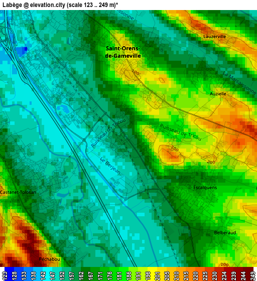
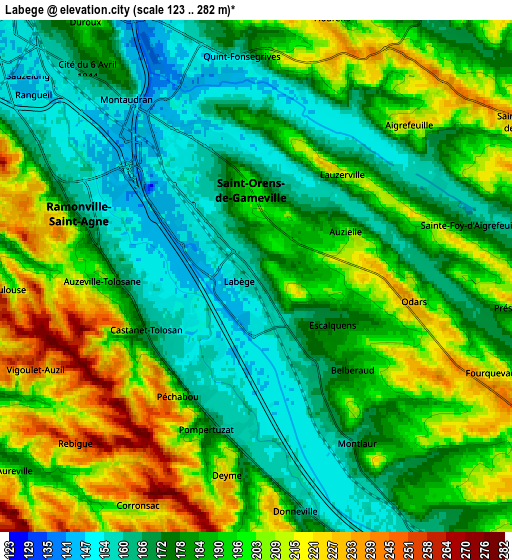
Below is the Elevation map of Labège, which displays elevation range with different colors. Scale of the first map is from 123 to 249 m (404 to 817 ft) with average elevation of 169.2 meters (=555 ft) [note 1]
These maps also provides idea of topography and contour of this city, they are displayed at different zoom levels. More info about maps, scale and edge coordinates you can find below images.
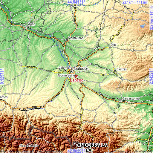
| \ | Map #1 | Map #2 | Topo.Map |
| Scale [m] | 123..249 m | 123..282 m | × |
| Scale [ft] | 404..817 ft | 404..925 ft | × |
| Average | 169.2 m = 555 ft | 186.9 m = 613 ft | × |
| Width | 7.09 km = 4.4 mi | 14.17 km = 8.8 mi | 226.7 km = 140.9 mi |
| Height | 7.09 km = 4.4 mi | 14.17 km = 8.8 mi | 226.7 km = 140.9 mi |
| ↑Max Latitude | 43.562242° | 43.594078° | 44.54131° |
| Latitude at center | 43.53039° | 43.53039° | 43.53039° |
| ↓Min Latitude | 43.498521° | 43.466635° | 42.50223° |
| ← Min Longitude | 1.492015° | 1.448069° | 0.12971° |
| Longitude center | 1.53596° | 1.53596° | 1.53596° |
| →Max Longitude | 1.579905° | 1.623851° | 2.94221° |
Nearby cities:
Cities around Labège sort by population:
• Saint-Orens-de-Gameville elevation 201 m
2.6 km,  356°
356°
• Ramonville-Saint-Agne 163 m
5.2 km,  289°
289°
• Castanet-Tolosan 167 m
3.4 km,  241°
241°
• Escalquens 171 m
2.3 km,  127°
127°
• Auzeville-Tolosane 193 m
4.3 km,  266°
266°
• Auzielle 200 m
2.7 km,  62°
62°
• Flourens 225 m
7.3 km,  17°
17°
• Péchabou 186 m
3.8 km,  214°
214°
• Pompertuzat 183 m
4.5 km,  201°
201°
• Belberaud 178 m
3.7 km,  137°
137°
• Vieille-Toulouse 220 m
7.6 km,  264°
264°
• Montlaur 161 m
5.2 km,  150°
150°
Multilingual:
 En español:
Labège elevación 158 m.
 En France:
Labège élévation 158 m.


Sources and notes:
- [note 1] Map square and city borders are not equal. Map elevation data is calculated only from area inside that square.
- [src 1] Elevation data from geonames database provided with same terms of usage.
- [src 2] The elevation map of Labège is generated using elevation data from NASA's 3 arcsec (90m) resolution SRTM data.
- [src 3] Base (background) map © OpenStreetMap contributors tiles are generated by Geofabrik and OpenTopoMap.
Copyright & License:
This Labège Elevation Map is licensed under CC BY-SA. You may reuse any part from this page, if you give a proper credit by linking to this URL:
 More info on terms of use page.