La Chapelle-Basse-Mer elevation
La Chapelle-Basse-Mer (Pays de la Loire, Loire-Atlantique), France elevation is 52 meters and La Chapelle-Basse-Mer elevation in feet is 171 ft above sea level [src 1]. La Chapelle-Basse-Mer is a populated place (feature code) with elevation that is 122 meters (400 ft) smaller than average city elevation in France.
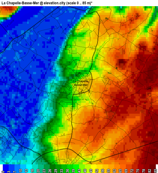
Below is the Elevation map of La Chapelle-Basse-Mer, which displays elevation range with different colors. Scale of the first map is from 0 to 85 m (0 to 279 ft) with average elevation of 40.5 meters (=133 ft) [note 1]
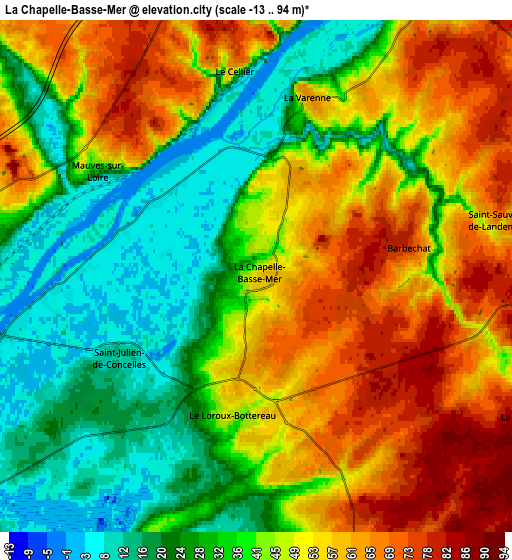
These maps also provides idea of topography and contour of this city, they are displayed at different zoom levels. More info about maps, scale and edge coordinates you can find below images.
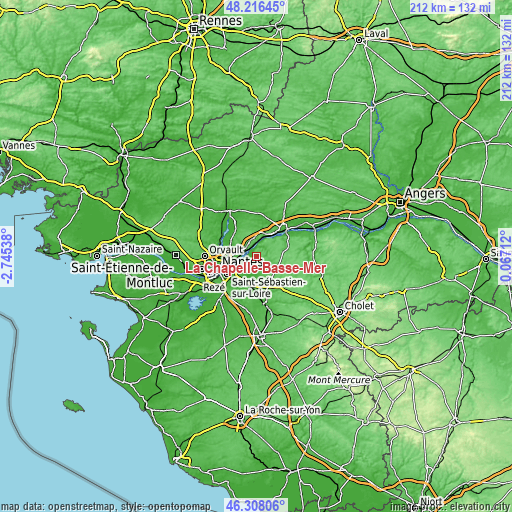
| \ | Map #1 | Map #2 | Topo.Map |
| Scale [m] | 0..85 m | -13..94 m | × |
| Scale [ft] | 0..279 ft | -43..308 ft | × |
| Average | 40.5 m = 133 ft | 43.4 m = 142 ft | × |
| Width | 6.63 km = 4.1 mi | 13.26 km = 8.2 mi | 212.2 km = 131.9 mi |
| Height | 6.63 km = 4.1 mi | 13.26 km = 8.2 mi | 212.2 km = 131.9 mi |
| ↑Max Latitude | 47.30067° | 47.330463° | 48.21645° |
| Latitude at center | 47.27086° | 47.27086° | 47.27086° |
| ↓Min Latitude | 47.241033° | 47.21119° | 46.30806° |
| ← Min Longitude | -1.383075° | -1.427021° | -2.74538° |
| Longitude center | -1.33913° | -1.33913° | -1.33913° |
| →Max Longitude | -1.295185° | -1.251239° | 0.06712° |
Nearby cities:
Cities around La Chapelle-Basse-Mer sort by population:
• Thouaré-sur-Loire elevation 14 m
7.5 km,  268°
268°
• Saint-Julien-de-Concelles 11 m
4 km,  239°
239°
• Le Loroux-Bottereau 50 m
3.8 km,  191°
191°
• Le Cellier 62 m
5.5 km,  354°
354°
• Oudon 24 m
9.5 km,  25°
25°
• Le Landreau 69 m
7.8 km,  160°
160°
• Mauves-sur-Loire 50 m
4.7 km,  308°
308°
• Champtoceaux 73 m
9.2 km,  39°
39°
• Landemont 90 m
7.5 km,  94°
94°
• La Varenne 62 m
4.7 km,  18°
18°
• Barbechat 72 m
4.1 km,  79°
79°
• La Remaudière 78 m
8.1 km,  117°
117°
Multilingual:
 En español:
La Chapelle-Basse-Mer elevación 52 m.
 En France:
La Chapelle-Basse-Mer élévation 52 m.
 Auf Deutsch:
La Chapelle-Basse-Mer höhe über dem Meeresspiegel ist 52 m.
 На русском:
La Chapelle-Basse-Mer высота над уровнем моря 52 м
Sources and notes:
- [note 1] Map square and city borders are not equal. Map elevation data is calculated only from area inside that square.
- [src 1] Elevation data from geonames database provided with same terms of usage.
- [src 2] The elevation map of La Chapelle-Basse-Mer is generated using elevation data from NASA's 3 arcsec (90m) resolution SRTM data.
- [src 3] Base (background) map © OpenStreetMap contributors tiles are generated by Geofabrik and OpenTopoMap.
Copyright & License:
This La Chapelle-Basse-Mer Elevation Map is licensed under CC BY-SA. You may reuse any part from this page, if you give a proper credit by linking to this URL:
 More info on terms of use page.