La Châtaigneraie elevation
La Châtaigneraie (Pays de la Loire, Département de la Vendée), France elevation is 157 meters and La Châtaigneraie elevation in feet is 515 ft above sea level [src 1]. La Châtaigneraie is a populated place (feature code) with elevation that is 17 meters (56 ft) smaller than average city elevation in France.
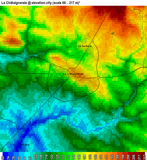
Below is the Elevation map of La Châtaigneraie, which displays elevation range with different colors. Scale of the first map is from 68 to 217 m (223 to 712 ft) with average elevation of 132.1 meters (=433 ft) [note 1]
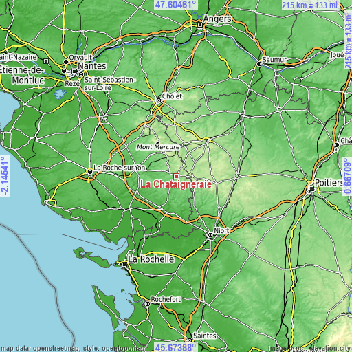
These maps also provides idea of topography and contour of this city, they are displayed at different zoom levels. More info about maps, scale and edge coordinates you can find below images.
| \ | Map #1 | Topo.Map |
| Scale [m] | 68..217 m | × |
| Scale [ft] | 223..712 ft | × |
| Average | 132.1 m = 433 ft | × |
| Width | 6.71 km = 4.2 mi | 214.7 km = 133.4 mi |
| Height | 6.71 km = 4.2 mi | 214.7 km = 133.4 mi |
| ↑Max Latitude | 46.678019° | 47.60461° |
| Latitude at center | 46.64786° | 46.64786° |
| ↓Min Latitude | 46.617684° | 45.67388° |
| ← Min Longitude | -0.783105° | -2.14541° |
| Longitude center | -0.73916° | -0.73916° |
| →Max Longitude | -0.695215° | 0.66709° |
Nearby cities:
Cities around La Châtaigneraie sort by population:
• Moncoutant elevation 197 m
14.3 km,  53°
53°
• La Forêt-sur-Sèvre 160 m
15.2 km,  26°
26°
• Saint-Mesmin 167 m
16.2 km,  1°
1°
• Montournais 169 m
10.6 km,  349°
349°
• La Meilleraie-Tillay 124 m
13.1 km,  321°
321°
• Saint-Pierre-du-Chemin 227 m
6 km, 28°
• Mouilleron-en-Pareds 109 m
9 km,  290°
290°
• Foussais-Payré 89 m
13.4 km,  161°
161°
• Antigny 83 m
3.8 km,  218°
218°
• La Tardière 154 m
1.6 km,  22°
22°
• Mervent 84 m
14 km,  185°
185°
• Bazoges-en-Pareds 75 m
13.6 km,  274°
274°
Multilingual:
 En español:
La Châtaigneraie elevación 157 m.
 En France:
La Châtaigneraie élévation 157 m.
 Auf Deutsch:
La Châtaigneraie höhe über dem Meeresspiegel ist 157 m.

Sources and notes:
- [note 1] Map square and city borders are not equal. Map elevation data is calculated only from area inside that square.
- [src 1] Elevation data from geonames database provided with same terms of usage.
- [src 2] The elevation map of La Châtaigneraie is generated using elevation data from NASA's 3 arcsec (90m) resolution SRTM data.
- [src 3] Base (background) map © OpenStreetMap contributors tiles are generated by Geofabrik and OpenTopoMap.
Copyright & License:
This La Châtaigneraie Elevation Map is licensed under CC BY-SA. You may reuse any part from this page, if you give a proper credit by linking to this URL:
 More info on terms of use page.