La Crau elevation
La Crau (Provence-Alpes-Côte d'Azur, Var), France elevation is 45 meters and La Crau elevation in feet is 148 ft above sea level [src 1]. La Crau is a populated place (feature code) with elevation that is 129 meters (423 ft) smaller than average city elevation in France.
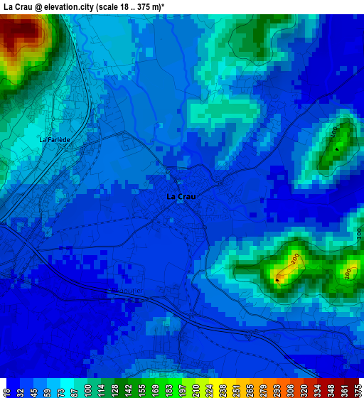
Below is the Elevation map of La Crau, which displays elevation range with different colors. Scale of the first map is from 18 to 375 m (59 to 1230 ft) with average elevation of 61 meters (=200 ft) [note 1]
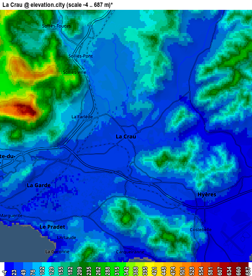
These maps also provides idea of topography and contour of this city, they are displayed at different zoom levels. More info about maps, scale and edge coordinates you can find below images.
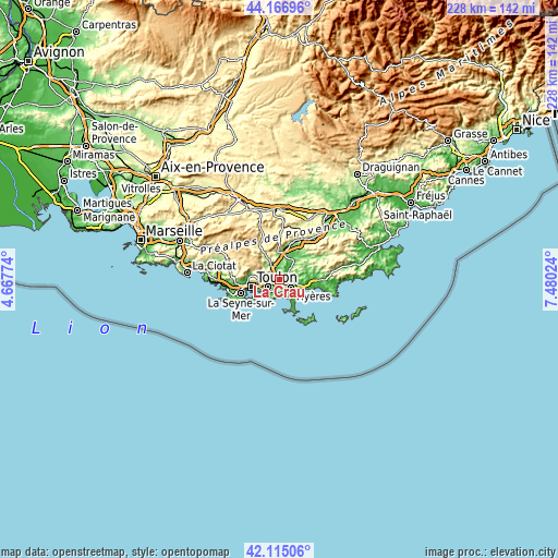
| \ | Map #1 | Map #2 | Topo.Map |
| Scale [m] | 18..375 m | -4..687 m | × |
| Scale [ft] | 59..1230 ft | -13..2254 ft | × |
| Average | 61 m = 200 ft | 99.1 m = 325 ft | × |
| Width | 7.13 km = 4.4 mi | 14.26 km = 8.9 mi | 228.1 km = 141.7 mi |
| Height | 7.13 km = 4.4 mi | 14.26 km = 8.9 mi | 228.1 km = 141.7 mi |
| ↑Max Latitude | 43.181673° | 43.213709° | 44.16696° |
| Latitude at center | 43.14962° | 43.14962° | 43.14962° |
| ↓Min Latitude | 43.11755° | 43.085464° | 42.11506° |
| ← Min Longitude | 6.030045° | 5.986099° | 4.66774° |
| Longitude center | 6.07399° | 6.07399° | 6.07399° |
| →Max Longitude | 6.117935° | 6.161881° | 7.48024° |
Nearby cities:
Cities around La Crau sort by population:
• Toulon elevation 12 m
12.1 km,  256°
256°
• Hyères 41 m
5.5 km,  126°
126°
• La Garde 28 m
5.9 km,  241°
241°
• La Valette-du-Var 69 m
7.5 km, 259°
• Le Pradet 45 m
6.4 km,  219°
219°
• Solliès-Pont 74 m
5.2 km,  329°
329°
• Carqueiranne 31 m
6.1 km,  180°
180°
• Cuers 150 m
9.8 km,  358°
358°
• La Farlède 60 m
3.3 km,  310°
310°
• Pierrefeu-du-Var 80 m
10.1 km,  34°
34°
• Solliès-Toucas 99 m
7.4 km, 327°
• Solliès-Ville 226 m
4.7 km,  321°
321°
Multilingual:
 En español:
La Crau elevación 45 m.
 En France:
La Crau élévation 45 m.


Sources and notes:
- [note 1] Map square and city borders are not equal. Map elevation data is calculated only from area inside that square.
- [src 1] Elevation data from geonames database provided with same terms of usage.
- [src 2] The elevation map of La Crau is generated using elevation data from NASA's 3 arcsec (90m) resolution SRTM data.
- [src 3] Base (background) map © OpenStreetMap contributors tiles are generated by Geofabrik and OpenTopoMap.
Copyright & License:
This La Crau Elevation Map is licensed under CC BY-SA. You may reuse any part from this page, if you give a proper credit by linking to this URL:
 More info on terms of use page.