La Ferrière-aux-Étangs elevation
La Ferrière-aux-Étangs (Normandy, Département de l'Orne), France elevation is 269 meters and La Ferrière-aux-Étangs elevation in feet is 883 ft above sea level [src 1]. La Ferrière-aux-Étangs is a populated place (feature code) with elevation that is 95 meters (312 ft) bigger than average city elevation in France.
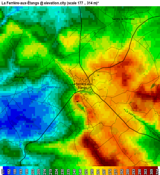
Below is the Elevation map of La Ferrière-aux-Étangs, which displays elevation range with different colors. Scale of the first map is from 177 to 314 m (581 to 1030 ft) with average elevation of 240.3 meters (=788 ft) [note 1]
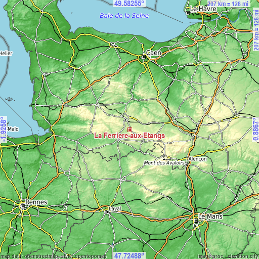
These maps also provides idea of topography and contour of this city, they are displayed at different zoom levels. More info about maps, scale and edge coordinates you can find below images.
| \ | Map #1 | Topo.Map |
| Scale [m] | 177..314 m | × |
| Scale [ft] | 581..1030 ft | × |
| Average | 240.3 m = 788 ft | × |
| Width | 6.45 km = 4 mi | 206.6 km = 128.4 mi |
| Height | 6.45 km = 4 mi | 206.5 km = 128.3 mi |
| ↑Max Latitude | 48.691287° | 49.58255° |
| Latitude at center | 48.66227° | 48.66227° |
| ↓Min Latitude | 48.633236° | 47.72488° |
| ← Min Longitude | -0.563495° | -1.9258° |
| Longitude center | -0.51955° | -0.51955° |
| →Max Longitude | -0.475605° | 0.8867° |
Nearby cities:
Cities around La Ferrière-aux-Étangs sort by population:
• Flers elevation 206 m
9.3 km,  334°
334°
• La Ferté-Macé 222 m
14.3 km,  124°
124°
• Domfront 198 m
12.1 km,  229°
229°
• Saint-Georges-des-Groseillers 222 m
12.5 km,  343°
343°
• Bagnoles-de-l'Orne 191 m
14 km,  146°
146°
• Messei 216 m
5.6 km,  346°
346°
• La Lande-Patry 207 m
12.5 km, 332°
• Briouze 216 m
11.8 km,  70°
70°
• La Selle-la-Forge 214 m
8 km, 348°
• Chanu 280 m
13.7 km,  302°
302°
• Juvigny-sous-Andaine 194 m
12.3 km,  176°
176°
• Champsecret 213 m
6.3 km,  201°
201°
Multilingual:
 En español:
La Ferrière-aux-Étangs elevación 269 m.
 En France:
La Ferrière-aux-Étangs élévation 269 m.
 Auf Deutsch:
La Ferrière-aux-Étangs höhe über dem Meeresspiegel ist 269 m.
 На русском:
La Ferrière-aux-Étangs высота над уровнем моря 269 м
Sources and notes:
- [note 1] Map square and city borders are not equal. Map elevation data is calculated only from area inside that square.
- [src 1] Elevation data from geonames database provided with same terms of usage.
- [src 2] The elevation map of La Ferrière-aux-Étangs is generated using elevation data from NASA's 3 arcsec (90m) resolution SRTM data.
- [src 3] Base (background) map © OpenStreetMap contributors tiles are generated by Geofabrik and OpenTopoMap.
Copyright & License:
This La Ferrière-aux-Étangs Elevation Map is licensed under CC BY-SA. You may reuse any part from this page, if you give a proper credit by linking to this URL:
 More info on terms of use page.