La Ferté-sous-Jouarre elevation
La Ferté-sous-Jouarre (Île-de-France, Seine-et-Marne), France elevation is 72 meters and La Ferté-sous-Jouarre elevation in feet is 236 ft above sea level [src 1]. La Ferté-sous-Jouarre is a populated place (feature code) with elevation that is 102 meters (335 ft) smaller than average city elevation in France.
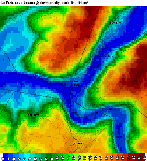
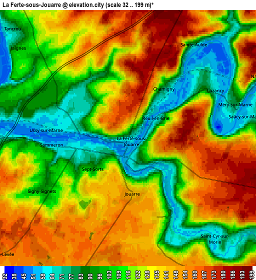
Below is the Elevation map of La Ferté-sous-Jouarre, which displays elevation range with different colors. Scale of the first map is from 49 to 191 m (161 to 627 ft) with average elevation of 108.7 meters (=357 ft) [note 1]
These maps also provides idea of topography and contour of this city, they are displayed at different zoom levels. More info about maps, scale and edge coordinates you can find below images.
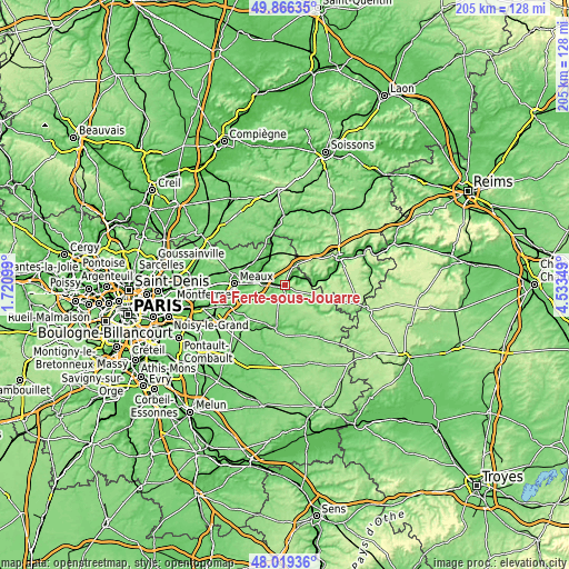
| \ | Map #1 | Map #2 | Topo.Map |
| Scale [m] | 49..191 m | 32..199 m | × |
| Scale [ft] | 161..627 ft | 105..653 ft | × |
| Average | 108.7 m = 357 ft | 122.5 m = 402 ft | × |
| Width | 6.42 km = 4 mi | 12.84 km = 8 mi | 205.4 km = 127.6 mi |
| Height | 6.42 km = 4 mi | 12.84 km = 8 mi | 205.4 km = 127.6 mi |
| ↑Max Latitude | 48.98025° | 49.009084° | 49.86635° |
| Latitude at center | 48.9514° | 48.9514° | 48.9514° |
| ↓Min Latitude | 48.922533° | 48.893649° | 48.01936° |
| ← Min Longitude | 3.083295° | 3.039349° | 1.72099° |
| Longitude center | 3.12724° | 3.12724° | 3.12724° |
| →Max Longitude | 3.171185° | 3.215131° | 4.53349° |
Nearby cities:
Cities around La Ferté-sous-Jouarre sort by population:
• Lizy-sur-Ourcq elevation 58 m
11.2 km,  316°
316°
• Jouarre 143 m
2.8 km,  173°
173°
• Saâcy-sur-Marne 61 m
6.2 km,  78°
78°
• Saint-Cyr-sur-Morin 76 m
6.3 km,  142°
142°
• Saint-Jean-les-Deux-Jumeaux 53 m
7.9 km,  270°
270°
• Chamigny 71 m
2.9 km,  37°
37°
• Armentières-en-Brie 64 m
8.3 km,  290°
290°
• Mary-sur-Marne 60 m
10.2 km,  314°
314°
• Montreuil-aux-Lions 141 m
9.2 km,  32°
32°
• Sammeron 57 m
3.2 km,  261°
261°
• Changis-sur-Marne 58 m
7.7 km,  275°
275°
• Doue 144 m
9.8 km,  164°
164°
Multilingual:
 En español:
La Ferté-sous-Jouarre elevación 72 m.
 En France:
La Ferté-sous-Jouarre élévation 72 m.
 Auf Deutsch:
La Ferté-sous-Jouarre höhe über dem Meeresspiegel ist 72 m.
 На русском:
La Ferté-sous-Jouarre высота над уровнем моря 72 м
Sources and notes:
- [note 1] Map square and city borders are not equal. Map elevation data is calculated only from area inside that square.
- [src 1] Elevation data from geonames database provided with same terms of usage.
- [src 2] The elevation map of La Ferté-sous-Jouarre is generated using elevation data from NASA's 3 arcsec (90m) resolution SRTM data.
- [src 3] Base (background) map © OpenStreetMap contributors tiles are generated by Geofabrik and OpenTopoMap.
Copyright & License:
This La Ferté-sous-Jouarre Elevation Map is licensed under CC BY-SA. You may reuse any part from this page, if you give a proper credit by linking to this URL:
 More info on terms of use page.