Laigneville elevation
Laigneville (Hauts-de-France, Département de l'Oise), France elevation is 40 meters and Laigneville elevation in feet is 131 ft above sea level [src 1]. Laigneville is a populated place (feature code) with elevation that is 134 meters (440 ft) smaller than average city elevation in France.
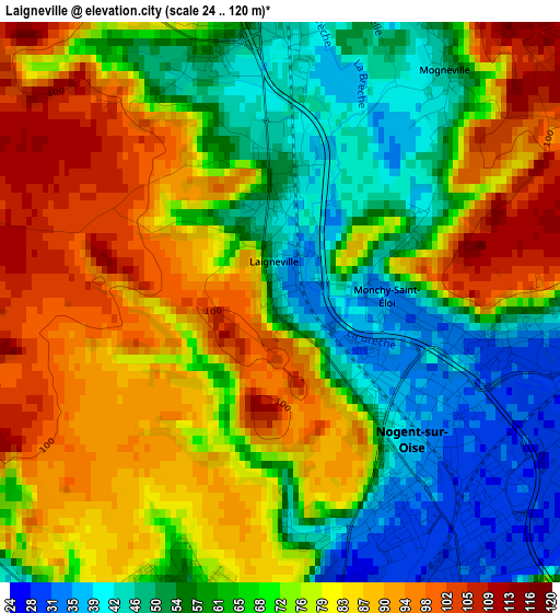
Below is the Elevation map of Laigneville, which displays elevation range with different colors. Scale of the first map is from 24 to 120 m (79 to 394 ft) with average elevation of 71.2 meters (=234 ft) [note 1]
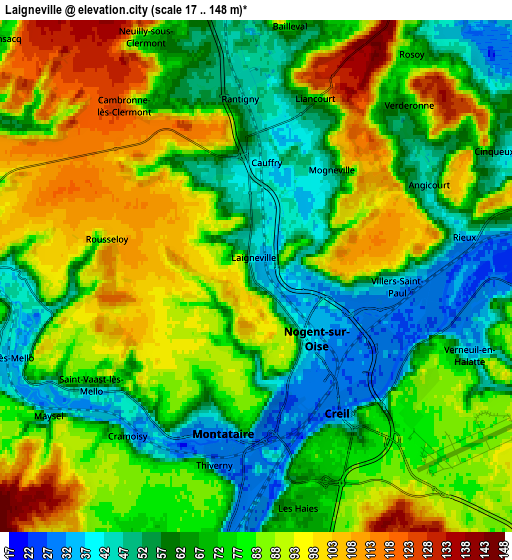
These maps also provides idea of topography and contour of this city, they are displayed at different zoom levels. More info about maps, scale and edge coordinates you can find below images.
| \ | Map #1 | Map #2 | Topo.Map |
| Scale [m] | 24..120 m | 17..148 m | × |
| Scale [ft] | 79..394 ft | 56..486 ft | × |
| Average | 71.2 m = 234 ft | 76.4 m = 251 ft | × |
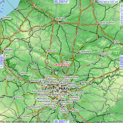
| Width | 6.37 km = 4 mi | 12.75 km = 7.9 mi | 204 km = 126.8 mi |
| Height | 6.37 km = 4 mi | 12.75 km = 7.9 mi | 203.9 km = 126.7 mi |
| ↑Max Latitude | 49.320143° | 49.34878° | 50.20014° |
| Latitude at center | 49.29149° | 49.29149° | 49.29149° |
| ↓Min Latitude | 49.26282° | 49.234133° | 48.36577° |
| ← Min Longitude | 2.401865° | 2.357919° | 1.03956° |
| Longitude center | 2.44581° | 2.44581° | 2.44581° |
| →Max Longitude | 2.489755° | 2.533701° | 3.85206° |
Nearby cities:
Cities around Laigneville sort by population:
• Creil elevation 73 m
4.8 km,  143°
143°
• Nogent-sur-Oise 31 m
2.9 km, 140°
• Montataire 75 m
3.7 km,  189°
189°
• Liancourt 61 m
4.6 km,  18°
18°
• Villers-Saint-Paul 37 m
3.2 km,  95°
95°
• Rantigny 52 m
4 km,  356°
356°
• Cauffry 47 m
3.1 km,  0°
0°
• Monchy-Saint-Éloi 35 m
1.6 km,  94°
94°
• Rieux 33 m
5.2 km,  79°
79°
• Angicourt 46 m
4.8 km,  61°
61°
• Mogneville 51 m
3.2 km,  35°
35°
• Thiverny 30 m
4.5 km, 189°
Multilingual:
 En español:
Laigneville elevación 40 m.
 En France:
Laigneville élévation 40 m.
 Auf Deutsch:
Laigneville höhe über dem Meeresspiegel ist 40 m.

Sources and notes:
- [note 1] Map square and city borders are not equal. Map elevation data is calculated only from area inside that square.
- [src 1] Elevation data from geonames database provided with same terms of usage.
- [src 2] The elevation map of Laigneville is generated using elevation data from NASA's 3 arcsec (90m) resolution SRTM data.
- [src 3] Base (background) map © OpenStreetMap contributors tiles are generated by Geofabrik and OpenTopoMap.
Copyright & License:
This Laigneville Elevation Map is licensed under CC BY-SA. You may reuse any part from this page, if you give a proper credit by linking to this URL:
 More info on terms of use page.