La Machine elevation
La Machine (Bourgogne-Franche-Comté, Département de la Nièvre), France elevation is 249 meters and La Machine elevation in feet is 817 ft above sea level [src 1]. La Machine is a populated place (feature code) with elevation that is 75 meters (246 ft) bigger than average city elevation in France.
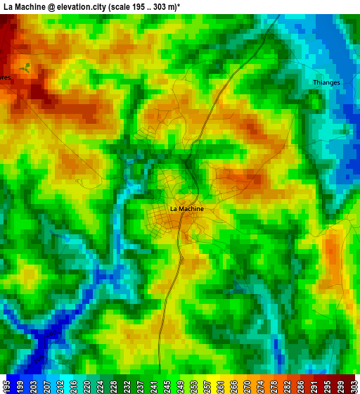
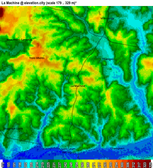
Below is the Elevation map of La Machine, which displays elevation range with different colors. Scale of the first map is from 195 to 303 m (640 to 994 ft) with average elevation of 244.4 meters (=802 ft) [note 1]
These maps also provides idea of topography and contour of this city, they are displayed at different zoom levels. More info about maps, scale and edge coordinates you can find below images.
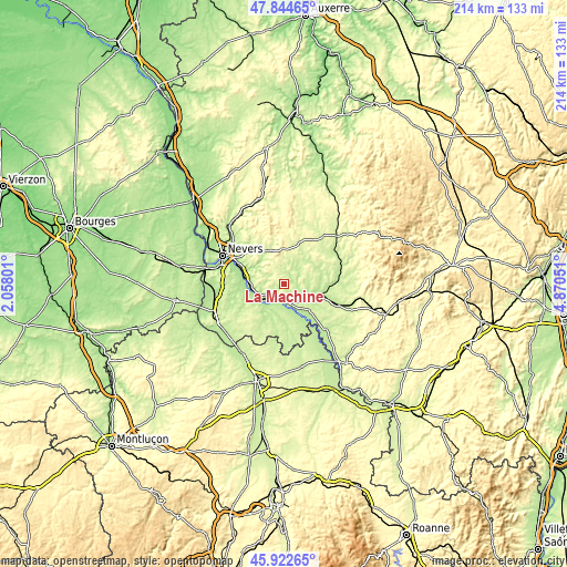
| \ | Map #1 | Map #2 | Topo.Map |
| Scale [m] | 195..303 m | 179..329 m | × |
| Scale [ft] | 640..994 ft | 587..1079 ft | × |
| Average | 244.4 m = 802 ft | 235.5 m = 773 ft | × |
| Width | 6.68 km = 4.2 mi | 13.36 km = 8.3 mi | 213.7 km = 132.8 mi |
| Height | 6.68 km = 4.2 mi | 13.36 km = 8.3 mi | 213.7 km = 132.8 mi |
| ↑Max Latitude | 46.922283° | 46.952288° | 47.84465° |
| Latitude at center | 46.89226° | 46.89226° | 46.89226° |
| ↓Min Latitude | 46.862221° | 46.832164° | 45.92265° |
| ← Min Longitude | 3.420315° | 3.376369° | 2.05801° |
| Longitude center | 3.46426° | 3.46426° | 3.46426° |
| →Max Longitude | 3.508205° | 3.552151° | 4.87051° |
Nearby cities:
Cities around La Machine sort by population:
• Decize elevation 207 m
7.1 km,  181°
181°
• Imphy 181 m
16.2 km,  287°
287°
• Cercy-la-Tour 200 m
14.3 km,  103°
103°
• Saint-Léger-des-Vignes 208 m
5.8 km,  187°
187°
• Saint-Éloi 186 m
20.5 km,  296°
296°
• Sermoise-sur-Loire 186 m
22.3 km, 286°
• Sauvigny-les-Bois 210 m
16.8 km, 299°
• Saint-Parize-le-Châtel 234 m
21.8 km,  258°
258°
• Saint-Benin-d’Azy 249 m
13.1 km,  335°
335°
• Dornes 224 m
21.3 km,  203°
203°
• Châtillon-en-Bazois 238 m
23.3 km,  39°
39°
• Lucenay-lès-Aix 214 m
21.1 km, 176°
Multilingual:
 En español:
La Machine elevación 249 m.
 En France:
La Machine élévation 249 m.
 Auf Deutsch:
La Machine höhe über dem Meeresspiegel ist 249 m.

Sources and notes:
- [note 1] Map square and city borders are not equal. Map elevation data is calculated only from area inside that square.
- [src 1] Elevation data from geonames database provided with same terms of usage.
- [src 2] The elevation map of La Machine is generated using elevation data from NASA's 3 arcsec (90m) resolution SRTM data.
- [src 3] Base (background) map © OpenStreetMap contributors tiles are generated by Geofabrik and OpenTopoMap.
Copyright & License:
This La Machine Elevation Map is licensed under CC BY-SA. You may reuse any part from this page, if you give a proper credit by linking to this URL:
 More info on terms of use page.