La Mézière elevation
La Mézière (Brittany, Département d'Ille-et-Vilaine), France elevation is 103 meters and La Mézière elevation in feet is 338 ft above sea level [src 1]. La Mézière is a populated place (feature code) with elevation that is 71 meters (233 ft) smaller than average city elevation in France.
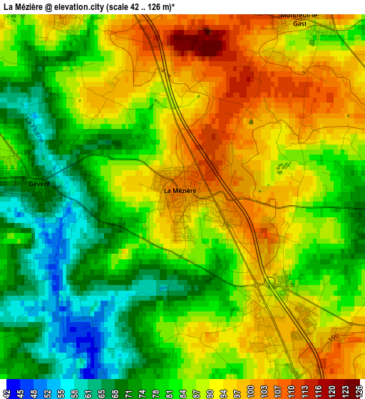
Below is the Elevation map of La Mézière, which displays elevation range with different colors. Scale of the first map is from 42 to 126 m (138 to 413 ft) with average elevation of 85.4 meters (=280 ft) [note 1]
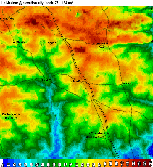
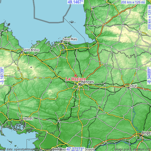
These maps also provides idea of topography and contour of this city, they are displayed at different zoom levels. More info about maps, scale and edge coordinates you can find below images.
| \ | Map #1 | Map #2 | Topo.Map |
| Scale [m] | 42..126 m | 27..134 m | × |
| Scale [ft] | 138..413 ft | 89..440 ft | × |
| Average | 85.4 m = 280 ft | 83.9 m = 275 ft | × |
| Width | 6.51 km = 4 mi | 13.02 km = 8.1 mi | 208.4 km = 129.5 mi |
| Height | 6.51 km = 4 mi | 13.02 km = 8.1 mi | 208.4 km = 129.5 mi |
| ↑Max Latitude | 48.247562° | 48.276818° | 49.1467° |
| Latitude at center | 48.21829° | 48.21829° | 48.21829° |
| ↓Min Latitude | 48.189001° | 48.159695° | 47.27273° |
| ← Min Longitude | -1.799085° | -1.843031° | -3.16139° |
| Longitude center | -1.75514° | -1.75514° | -1.75514° |
| →Max Longitude | -1.711195° | -1.667249° | -0.34889° |
Nearby cities:
Cities around La Mézière sort by population:
• Pacé elevation 53 m
7.9 km,  189°
189°
• Saint-Grégoire 44 m
9 km,  146°
146°
• Melesse 84 m
4.5 km,  90°
90°
• Saint-Gilles 52 m
8.8 km,  215°
215°
• La Chapelle-des-Fougeretz 86 m
4.9 km,  159°
159°
• Gévezé 73 m
2.5 km,  272°
272°
• Montgermont 54 m
7.6 km, 156°
• Chevaigné 69 m
9.4 km, 94°
• Montreuil-le-Gast 99 m
3.8 km,  35°
35°
• Guipel 75 m
9.4 km,  16°
16°
• Saint-Médard-sur-Ille 76 m
9.3 km,  49°
49°
• Vignoc 97 m
3.9 km,  329°
329°
Multilingual:
 En español:
La Mézière elevación 103 m.
 En France:
La Mézière élévation 103 m.
 Auf Deutsch:
La Mézière höhe über dem Meeresspiegel ist 103 m.

Sources and notes:
- [note 1] Map square and city borders are not equal. Map elevation data is calculated only from area inside that square.
- [src 1] Elevation data from geonames database provided with same terms of usage.
- [src 2] The elevation map of La Mézière is generated using elevation data from NASA's 3 arcsec (90m) resolution SRTM data.
- [src 3] Base (background) map © OpenStreetMap contributors tiles are generated by Geofabrik and OpenTopoMap.
Copyright & License:
This La Mézière Elevation Map is licensed under CC BY-SA. You may reuse any part from this page, if you give a proper credit by linking to this URL:
 More info on terms of use page.