Landrecies elevation
Landrecies (Hauts-de-France, Nord), France elevation is 141 meters and Landrecies elevation in feet is 463 ft above sea level [src 1]. Landrecies is a populated place (feature code) with elevation that is 33 meters (108 ft) smaller than average city elevation in France.
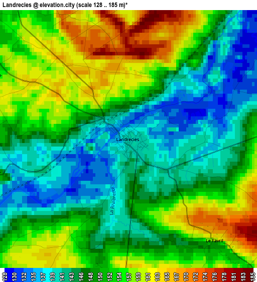
Below is the Elevation map of Landrecies, which displays elevation range with different colors. Scale of the first map is from 128 to 185 m (420 to 607 ft) with average elevation of 150.2 meters (=493 ft) [note 1]
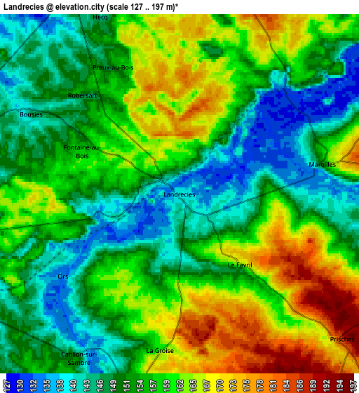
These maps also provides idea of topography and contour of this city, they are displayed at different zoom levels. More info about maps, scale and edge coordinates you can find below images.
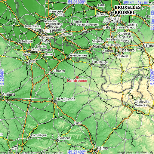
| \ | Map #1 | Map #2 | Topo.Map |
| Scale [m] | 128..185 m | 127..197 m | × |
| Scale [ft] | 420..607 ft | 417..646 ft | × |
| Average | 150.2 m = 493 ft | 155.8 m = 511 ft | × |
| Width | 6.27 km = 3.9 mi | 12.53 km = 7.8 mi | 200.5 km = 124.6 mi |
| Height | 6.27 km = 3.9 mi | 12.53 km = 7.8 mi | 200.5 km = 124.6 mi |
| ↑Max Latitude | 50.153156° | 50.181305° | 51.01808° |
| Latitude at center | 50.12499° | 50.12499° | 50.12499° |
| ↓Min Latitude | 50.096808° | 50.068609° | 49.21492° |
| ← Min Longitude | 3.647765° | 3.603819° | 2.28546° |
| Longitude center | 3.69171° | 3.69171° | 3.69171° |
| →Max Longitude | 3.735655° | 3.779601° | 5.09796° |
Nearby cities:
Cities around Landrecies sort by population:
• Aulnoye-Aymeries elevation 149 m
13.5 km,  50°
50°
• Berlaimont 143 m
12.2 km, 45°
• Le Nouvion-en-Thiérache 177 m
13.8 km,  151°
151°
• Leval 135 m
11.7 km,  57°
57°
• Poix-du-Nord 114 m
9.2 km,  320°
320°
• Bousies 143 m
6 km,  298°
298°
• Maroilles 153 m
5.1 km,  77°
77°
• Englefontaine 145 m
8.1 km,  335°
335°
• Saint-Souplet 135 m
13.7 km,  236°
236°
• Boué 147 m
12.6 km,  178°
178°
• Cartignies 149 m
11.5 km,  108°
108°
• Wassigny 160 m
14 km,  207°
207°
Multilingual:
 En español:
Landrecies elevación 141 m.
 En France:
Landrecies élévation 141 m.
 Auf Deutsch:
Landrecies höhe über dem Meeresspiegel ist 141 m.

Sources and notes:
- [note 1] Map square and city borders are not equal. Map elevation data is calculated only from area inside that square.
- [src 1] Elevation data from geonames database provided with same terms of usage.
- [src 2] The elevation map of Landrecies is generated using elevation data from NASA's 3 arcsec (90m) resolution SRTM data.
- [src 3] Base (background) map © OpenStreetMap contributors tiles are generated by Geofabrik and OpenTopoMap.
Copyright & License:
This Landrecies Elevation Map is licensed under CC BY-SA. You may reuse any part from this page, if you give a proper credit by linking to this URL:
 More info on terms of use page.