Lannilis elevation
Lannilis (Brittany, Département du Finistère), France elevation is 43 meters and Lannilis elevation in feet is 141 ft above sea level [src 1]. Lannilis is a populated place (feature code) with elevation that is 131 meters (430 ft) smaller than average city elevation in France.
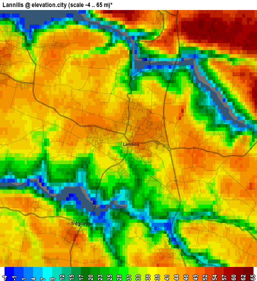
Below is the Elevation map of Lannilis, which displays elevation range with different colors. Scale of the first map is from -4 to 65 m (-13 to 213 ft) with average elevation of 36.2 meters (=119 ft) [note 1]
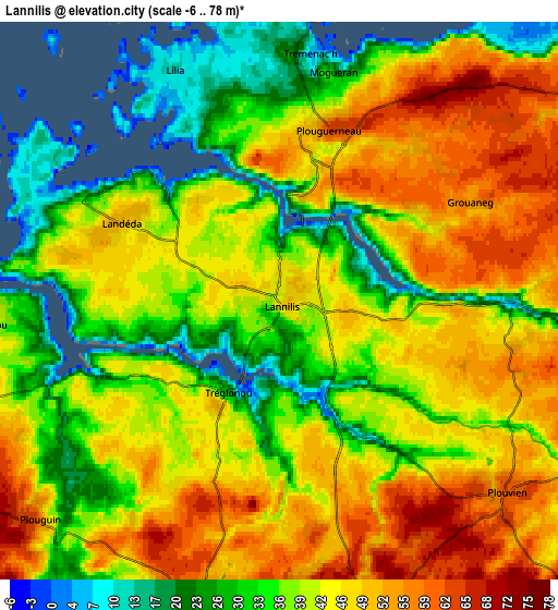
These maps also provides idea of topography and contour of this city, they are displayed at different zoom levels. More info about maps, scale and edge coordinates you can find below images.
| \ | Map #1 | Map #2 | Topo.Map |
| Scale [m] | -4..65 m | -6..78 m | × |
| Scale [ft] | -13..213 ft | -20..256 ft | × |
| Average | 36.2 m = 119 ft | 41.9 m = 137 ft | × |
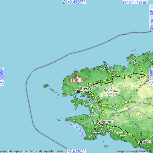
| Width | 6.47 km = 4 mi | 12.93 km = 8 mi | 206.9 km = 128.6 mi |
| Height | 6.47 km = 4 mi | 12.93 km = 8 mi | 206.9 km = 128.6 mi |
| ↑Max Latitude | 48.59998° | 48.629033° | 49.49287° |
| Latitude at center | 48.57091° | 48.57091° | 48.57091° |
| ↓Min Latitude | 48.541823° | 48.51272° | 47.63183° |
| ← Min Longitude | -4.566275° | -4.610221° | -5.92858° |
| Longitude center | -4.52233° | -4.52233° | -4.52233° |
| →Max Longitude | -4.478385° | -4.434439° | -3.11608° |
Nearby cities:
Cities around Lannilis sort by population:
• Plabennec elevation 86 m
10.4 km,  137°
137°
• Plouguerneau 52 m
3.6 km,  26°
26°
• Ploudalmézeau 63 m
10.3 km,  246°
246°
• Plouvien 60 m
6.8 km,  128°
128°
• Bourg-Blanc 60 m
8.1 km,  170°
170°
• Landéda 52 m
4 km,  297°
297°
• Milizac 88 m
12 km,  195°
195°
• Plouguin 48 m
7.1 km,  233°
233°
• Guissény 16 m
10.8 km,  50°
50°
• Le Drennec 58 m
11.9 km,  109°
109°
• Saint-Pabu 30 m
5.7 km,  265°
265°
• Kernilis 62 m
7.7 km,  90°
90°
Multilingual:
 En español:
Lannilis elevación 43 m.
 En France:
Lannilis élévation 43 m.


Sources and notes:
- [note 1] Map square and city borders are not equal. Map elevation data is calculated only from area inside that square.
- [src 1] Elevation data from geonames database provided with same terms of usage.
- [src 2] The elevation map of Lannilis is generated using elevation data from NASA's 3 arcsec (90m) resolution SRTM data.
- [src 3] Base (background) map © OpenStreetMap contributors tiles are generated by Geofabrik and OpenTopoMap.
Copyright & License:
This Lannilis Elevation Map is licensed under CC BY-SA. You may reuse any part from this page, if you give a proper credit by linking to this URL:
 More info on terms of use page.