Laruscade elevation
Laruscade (Nouvelle-Aquitaine, Gironde), France elevation is 53 meters and Laruscade elevation in feet is 174 ft above sea level [src 1]. Laruscade is a populated place (feature code) with elevation that is 121 meters (397 ft) smaller than average city elevation in France.
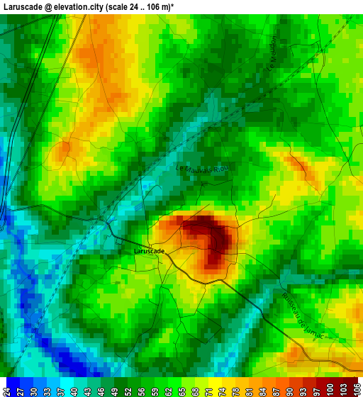
Below is the Elevation map of Laruscade, which displays elevation range with different colors. Scale of the first map is from 24 to 106 m (79 to 348 ft) with average elevation of 58.8 meters (=193 ft) [note 1]
These maps also provides idea of topography and contour of this city, they are displayed at different zoom levels. More info about maps, scale and edge coordinates you can find below images.
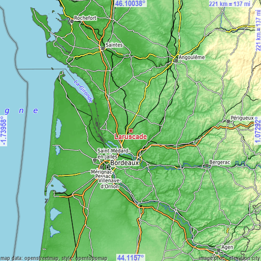
| \ | Map #1 | Topo.Map |
| Scale [m] | 24..106 m | × |
| Scale [ft] | 79..348 ft | × |
| Average | 58.8 m = 193 ft | × |
| Width | 6.9 km = 4.3 mi | 220.7 km = 137.1 mi |
| Height | 6.9 km = 4.3 mi | 220.7 km = 137.1 mi |
| ↑Max Latitude | 45.147672° | 46.10038° |
| Latitude at center | 45.11667° | 45.11667° |
| ↓Min Latitude | 45.085651° | 44.1157° |
| ← Min Longitude | -0.377275° | -1.73958° |
| Longitude center | -0.33333° | -0.33333° |
| →Max Longitude | -0.289385° | 1.07292° |
Nearby cities:
Cities around Laruscade sort by population:
• Saint-Savin elevation 51 m
9.9 km,  292°
292°
• Cézac 35 m
7.4 km,  246°
246°
• Saint-Yzan-de-Soudiac 71 m
6.7 km, 294°
• Peujard 36 m
12.3 km,  223°
223°
• Cavignac 64 m
4.8 km, 248°
• Saint-Mariens 68 m
5.3 km,  269°
269°
• Salignac 48 m
11.8 km,  198°
198°
• Saint-Ciers-d’Abzac 57 m
10.6 km,  150°
150°
• Cercoux 65 m
10.6 km,  79°
79°
• Aubie-et-Espessas 43 m
12.2 km,  206°
206°
• Gauriaguet 39 m
9.8 km, 208°
• Clérac 62 m
11.8 km,  50°
50°
Multilingual:
 En español:
Laruscade elevación 53 m.
 En France:
Laruscade élévation 53 m.
 Auf Deutsch:
Laruscade höhe über dem Meeresspiegel ist 53 m.

Sources and notes:
- [note 1] Map square and city borders are not equal. Map elevation data is calculated only from area inside that square.
- [src 1] Elevation data from geonames database provided with same terms of usage.
- [src 2] The elevation map of Laruscade is generated using elevation data from NASA's 3 arcsec (90m) resolution SRTM data.
- [src 3] Base (background) map © OpenStreetMap contributors tiles are generated by Geofabrik and OpenTopoMap.
Copyright & License:
This Laruscade Elevation Map is licensed under CC BY-SA. You may reuse any part from this page, if you give a proper credit by linking to this URL:
 More info on terms of use page.