La Souterraine elevation
La Souterraine (Nouvelle-Aquitaine, Creuse), France elevation is 374 meters and La Souterraine elevation in feet is 1227 ft above sea level [src 1]. La Souterraine is a populated place (feature code) with elevation that is 200 meters (656 ft) bigger than average city elevation in France.
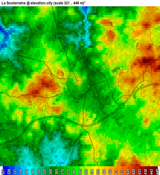
Below is the Elevation map of La Souterraine, which displays elevation range with different colors. Scale of the first map is from 321 to 448 m (1053 to 1470 ft) with average elevation of 381.1 meters (=1250 ft) [note 1]
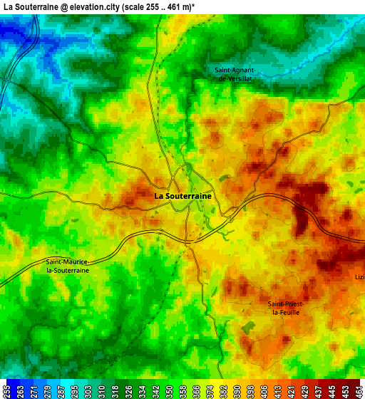
These maps also provides idea of topography and contour of this city, they are displayed at different zoom levels. More info about maps, scale and edge coordinates you can find below images.
| \ | Map #1 | Map #2 | Topo.Map |
| Scale [m] | 321..448 m | 255..461 m | × |
| Scale [ft] | 1053..1470 ft | 837..1512 ft | × |
| Average | 381.1 m = 1250 ft | 360.7 m = 1183 ft | × |
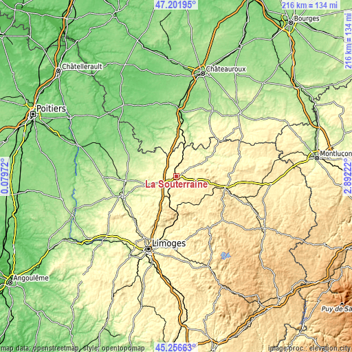
| Width | 6.76 km = 4.2 mi | 13.52 km = 8.4 mi | 216.3 km = 134.4 mi |
| Height | 6.76 km = 4.2 mi | 13.52 km = 8.4 mi | 216.3 km = 134.4 mi |
| ↑Max Latitude | 46.268297° | 46.298667° | 47.20195° |
| Latitude at center | 46.23791° | 46.23791° | 46.23791° |
| ↓Min Latitude | 46.207506° | 46.177085° | 45.25663° |
| ← Min Longitude | 1.442025° | 1.398079° | 0.07972° |
| Longitude center | 1.48597° | 1.48597° | 1.48597° |
| →Max Longitude | 1.529915° | 1.573861° | 2.89222° |
Nearby cities:
Cities around La Souterraine sort by population:
• Bessines-sur-Gartempe elevation 306 m
17 km,  212°
212°
• Châteauponsac 289 m
19.9 km,  234°
234°
• Saint-Vaury 457 m
21.1 km,  100°
100°
• Chantôme 298 m
19.9 km,  15°
15°
• Éguzon-Chantôme 252 m
24.7 km, 17°
• Le Grand-Bourg 390 m
15 km,  125°
125°
• Saint-Sulpice-les-Feuilles 289 m
12.8 km,  314°
314°
• Dun-le-Palestel 370 m
15.7 km,  61°
61°
• Saint-Agnant-de-Versillat 310 m
4.9 km, 22°
• Bussière-Dunoise 422 m
21.4 km,  83°
83°
• Saint-Maurice-la-Souterraine 364 m
5.1 km,  238°
238°
• Arnac-la-Poste 309 m
9.2 km,  289°
289°
Multilingual:
 En español:
La Souterraine elevación 374 m.
 En France:
La Souterraine élévation 374 m.
 Auf Deutsch:
La Souterraine höhe über dem Meeresspiegel ist 374 m.

Sources and notes:
- [note 1] Map square and city borders are not equal. Map elevation data is calculated only from area inside that square.
- [src 1] Elevation data from geonames database provided with same terms of usage.
- [src 2] The elevation map of La Souterraine is generated using elevation data from NASA's 3 arcsec (90m) resolution SRTM data.
- [src 3] Base (background) map © OpenStreetMap contributors tiles are generated by Geofabrik and OpenTopoMap.
Copyright & License:
This La Souterraine Elevation Map is licensed under CC BY-SA. You may reuse any part from this page, if you give a proper credit by linking to this URL:
 More info on terms of use page.