Le Cendre elevation
Le Cendre (Auvergne-Rhône-Alpes, Département du Puy-de-Dôme), France elevation is 347 meters and Le Cendre elevation in feet is 1138 ft above sea level [src 1]. Le Cendre is a populated place (feature code) with elevation that is 173 meters (568 ft) bigger than average city elevation in France.
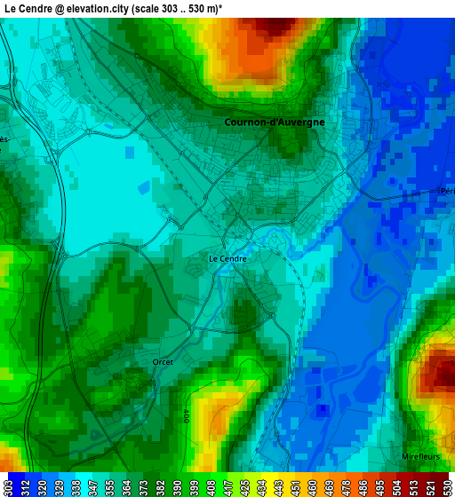
Below is the Elevation map of Le Cendre, which displays elevation range with different colors. Scale of the first map is from 303 to 530 m (994 to 1739 ft) with average elevation of 363.5 meters (=1193 ft) [note 1]
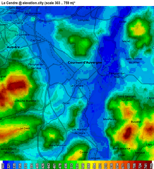
These maps also provides idea of topography and contour of this city, they are displayed at different zoom levels. More info about maps, scale and edge coordinates you can find below images.
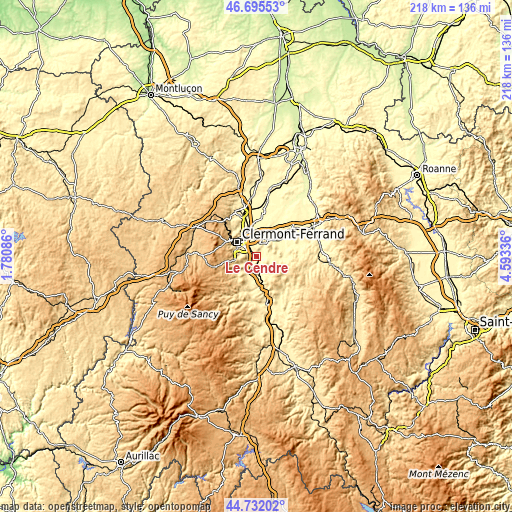
| \ | Map #1 | Map #2 | Topo.Map |
| Scale [m] | 303..530 m | 303..759 m | × |
| Scale [ft] | 994..1739 ft | 994..2490 ft | × |
| Average | 363.5 m = 1193 ft | 415.6 m = 1364 ft | × |
| Width | 6.82 km = 4.2 mi | 13.65 km = 8.5 mi | 218.3 km = 135.6 mi |
| Height | 6.82 km = 4.2 mi | 13.65 km = 8.5 mi | 218.3 km = 135.6 mi |
| ↑Max Latitude | 45.753071° | 45.783726° | 46.69553° |
| Latitude at center | 45.7224° | 45.7224° | 45.7224° |
| ↓Min Latitude | 45.691712° | 45.661007° | 44.73202° |
| ← Min Longitude | 3.143165° | 3.099219° | 1.78086° |
| Longitude center | 3.18711° | 3.18711° | 3.18711° |
| →Max Longitude | 3.231055° | 3.275001° | 4.59336° |
Nearby cities:
Cities around Le Cendre sort by population:
• Cournon-d’Auvergne elevation 359 m
2.2 km,  19°
19°
• Aubière 366 m
6.7 km,  298°
298°
• Veyre-Monton 365 m
6.1 km,  191°
191°
• La Roche-Blanche 469 m
5.3 km,  242°
242°
• Orcet 391 m
2.5 km,  214°
214°
• Pérignat-lès-Sarliève 353 m
4 km,  293°
293°
• Mirefleurs 396 m
4.3 km,  138°
138°
• Mezel 382 m
5.6 km,  49°
49°
• Pérignat-sur-Allier 354 m
3.5 km,  79°
79°
• Dallet 331 m
6.7 km,  36°
36°
• Le Crest 582 m
6.1 km,  229°
229°
• Saint-Georges-sur-Allier 448 m
4.5 km,  107°
107°
Multilingual:
 En español:
Le Cendre elevación 347 m.
 En France:
Le Cendre élévation 347 m.
 Auf Deutsch:
Le Cendre höhe über dem Meeresspiegel ist 347 m.

Sources and notes:
- [note 1] Map square and city borders are not equal. Map elevation data is calculated only from area inside that square.
- [src 1] Elevation data from geonames database provided with same terms of usage.
- [src 2] The elevation map of Le Cendre is generated using elevation data from NASA's 3 arcsec (90m) resolution SRTM data.
- [src 3] Base (background) map © OpenStreetMap contributors tiles are generated by Geofabrik and OpenTopoMap.
Copyright & License:
This Le Cendre Elevation Map is licensed under CC BY-SA. You may reuse any part from this page, if you give a proper credit by linking to this URL:
 More info on terms of use page.