Le Crès elevation
Le Crès (Occitanie, Département de l'Hérault), France elevation is 60 meters and Le Crès elevation in feet is 197 ft above sea level [src 1]. Le Crès is a populated place (feature code) with elevation that is 114 meters (374 ft) smaller than average city elevation in France.
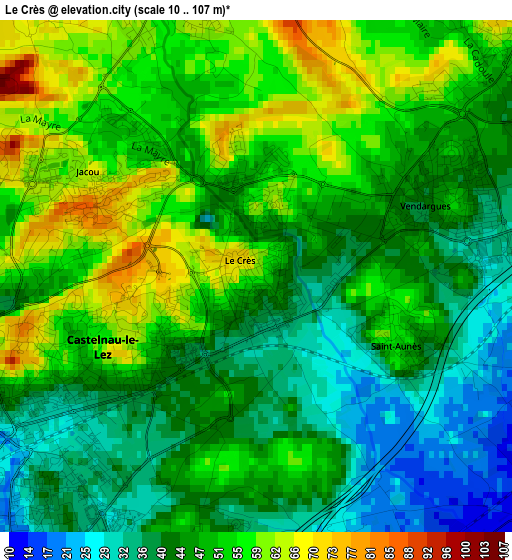
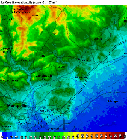
Below is the Elevation map of Le Crès, which displays elevation range with different colors. Scale of the first map is from 10 to 107 m (33 to 351 ft) with average elevation of 47.6 meters (=156 ft) [note 1]
These maps also provides idea of topography and contour of this city, they are displayed at different zoom levels. More info about maps, scale and edge coordinates you can find below images.
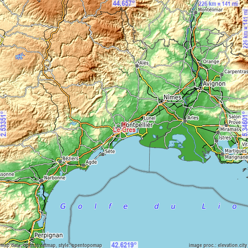
| \ | Map #1 | Map #2 | Topo.Map |
| Scale [m] | 10..107 m | -3..167 m | × |
| Scale [ft] | 33..351 ft | -10..548 ft | × |
| Average | 47.6 m = 156 ft | 47 m = 154 ft | × |
| Width | 7.07 km = 4.4 mi | 14.14 km = 8.8 mi | 226.3 km = 140.6 mi |
| Height | 7.07 km = 4.4 mi | 14.14 km = 8.8 mi | 226.3 km = 140.6 mi |
| ↑Max Latitude | 43.67986° | 43.711633° | 44.657° |
| Latitude at center | 43.64807° | 43.64807° | 43.64807° |
| ↓Min Latitude | 43.616263° | 43.584439° | 42.6219° |
| ← Min Longitude | 3.895815° | 3.851869° | 2.53351° |
| Longitude center | 3.93976° | 3.93976° | 3.93976° |
| →Max Longitude | 3.983705° | 4.027651° | 5.34601° |
Nearby cities:
Cities around Le Crès sort by population:
• Montpellier elevation 56 m
6.5 km,  230°
230°
• Mauguio 10 m
6.4 km,  121°
121°
• Castelnau-le-Lez 40 m
3.6 km,  242°
242°
• Baillargues 30 m
6.4 km,  75°
75°
• Vendargues 44 m
2.7 km,  64°
64°
• Castries 72 m
4.9 km,  44°
44°
• Clapiers 82 m
4.2 km,  285°
285°
• Jacou 64 m
2.7 km,  303°
303°
• Teyran 96 m
4.2 km,  348°
348°
• Montferrier-sur-Lez 84 m
7.2 km, 287°
• Saint-Aunès 49 m
2.2 km,  110°
110°
• Assas 116 m
6.9 km,  332°
332°
Multilingual:
 En español:
Le Crès elevación 60 m.
 En France:
Le Crès élévation 60 m.


Sources and notes:
- [note 1] Map square and city borders are not equal. Map elevation data is calculated only from area inside that square.
- [src 1] Elevation data from geonames database provided with same terms of usage.
- [src 2] The elevation map of Le Crès is generated using elevation data from NASA's 3 arcsec (90m) resolution SRTM data.
- [src 3] Base (background) map © OpenStreetMap contributors tiles are generated by Geofabrik and OpenTopoMap.
Copyright & License:
This Le Crès Elevation Map is licensed under CC BY-SA. You may reuse any part from this page, if you give a proper credit by linking to this URL:
 More info on terms of use page.