Legé elevation
Legé (Pays de la Loire, Loire-Atlantique), France elevation is 44 meters and Legé elevation in feet is 144 ft above sea level [src 1]. Legé is a populated place (feature code) with elevation that is 130 meters (427 ft) smaller than average city elevation in France.
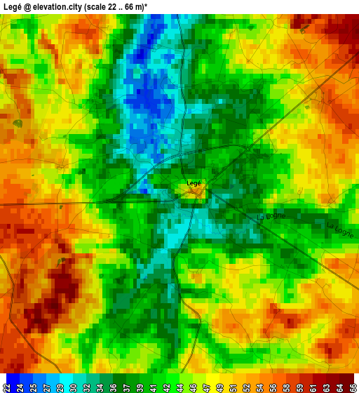
Below is the Elevation map of Legé, which displays elevation range with different colors. Scale of the first map is from 22 to 66 m (72 to 217 ft) with average elevation of 44.9 meters (=147 ft) [note 1]
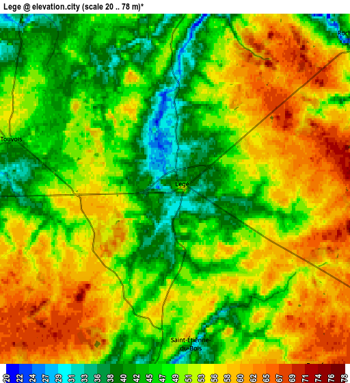
These maps also provides idea of topography and contour of this city, they are displayed at different zoom levels. More info about maps, scale and edge coordinates you can find below images.
| \ | Map #1 | Map #2 | Topo.Map |
| Scale [m] | 22..66 m | 20..78 m | × |
| Scale [ft] | 72..217 ft | 66..256 ft | × |
| Average | 44.9 m = 147 ft | 50.9 m = 167 ft | × |
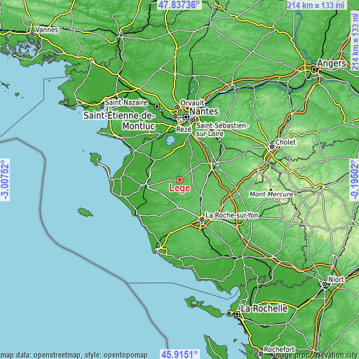
| Width | 6.68 km = 4.2 mi | 13.36 km = 8.3 mi | 213.7 km = 132.8 mi |
| Height | 6.68 km = 4.2 mi | 13.36 km = 8.3 mi | 213.7 km = 132.8 mi |
| ↑Max Latitude | 46.914867° | 46.944877° | 47.83736° |
| Latitude at center | 46.88484° | 46.88484° | 46.88484° |
| ↓Min Latitude | 46.854796° | 46.824736° | 45.9151° |
| ← Min Longitude | -1.645215° | -1.689161° | -3.00752° |
| Longitude center | -1.60127° | -1.60127° | -1.60127° |
| →Max Longitude | -1.557325° | -1.513379° | -0.19502° |
Nearby cities:
Cities around Legé sort by population:
• Les Lucs-sur-Boulogne elevation 68 m
9.3 km,  118°
118°
• Corcoué-sur-Logne 41 m
9.2 km,  8°
8°
• Saint-Philbert-de-Bouaine 18 m
12.8 km,  28°
28°
• Rocheservière 37 m
9 km,  49°
49°
• Saint-Christophe-du-Ligneron 56 m
14.2 km,  241°
241°
• Saint-Étienne-du-Bois 39 m
6.1 km,  177°
177°
• La Limouzinière 24 m
12 km,  1°
1°
• Paulx 17 m
14.5 km,  306°
306°
• Touvois 47 m
6.5 km,  287°
287°
• Falleron 34 m
7.7 km,  267°
267°
• Saint-Étienne-de-Mer-Morte 31 m
11.8 km, 294°
• Froidfond 43 m
12 km,  261°
261°
Multilingual:
 En español:
Legé elevación 44 m.
 En France:
Legé élévation 44 m.


Sources and notes:
- [note 1] Map square and city borders are not equal. Map elevation data is calculated only from area inside that square.
- [src 1] Elevation data from geonames database provided with same terms of usage.
- [src 2] The elevation map of Legé is generated using elevation data from NASA's 3 arcsec (90m) resolution SRTM data.
- [src 3] Base (background) map © OpenStreetMap contributors tiles are generated by Geofabrik and OpenTopoMap.
Copyright & License:
This Legé Elevation Map is licensed under CC BY-SA. You may reuse any part from this page, if you give a proper credit by linking to this URL:
 More info on terms of use page.