Le Muy elevation
Le Muy (Provence-Alpes-Côte d'Azur, Var), France elevation is 16 meters and Le Muy elevation in feet is 52 ft above sea level [src 1]. Le Muy is a populated place (feature code) with elevation that is 158 meters (518 ft) smaller than average city elevation in France.
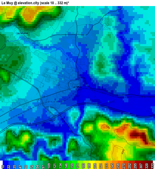
Below is the Elevation map of Le Muy, which displays elevation range with different colors. Scale of the first map is from 10 to 332 m (33 to 1089 ft) with average elevation of 74.5 meters (=244 ft) [note 1]
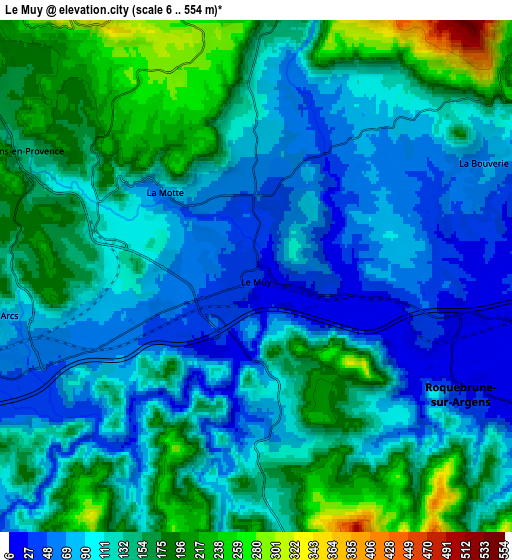
These maps also provides idea of topography and contour of this city, they are displayed at different zoom levels. More info about maps, scale and edge coordinates you can find below images.
| \ | Map #1 | Map #2 | Topo.Map |
| Scale [m] | 10..332 m | 6..554 m | × |
| Scale [ft] | 33..1089 ft | 20..1818 ft | × |
| Average | 74.5 m = 244 ft | 125.3 m = 411 ft | × |
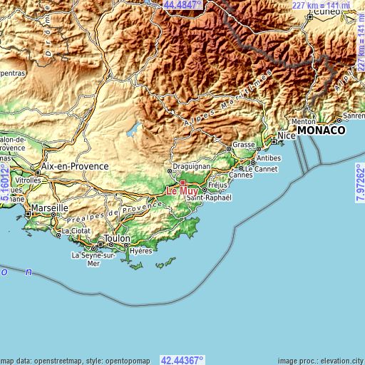
| Width | 7.09 km = 4.4 mi | 14.18 km = 8.8 mi | 226.9 km = 141 mi |
| Height | 7.09 km = 4.4 mi | 14.18 km = 8.8 mi | 226.9 km = 141 mi |
| ↑Max Latitude | 43.504683° | 43.536549° | 44.4847° |
| Latitude at center | 43.4728° | 43.4728° | 43.4728° |
| ↓Min Latitude | 43.4409° | 43.408984° | 42.44367° |
| ← Min Longitude | 6.522425° | 6.478479° | 5.16012° |
| Longitude center | 6.56637° | 6.56637° | 6.56637° |
| →Max Longitude | 6.610315° | 6.654261° | 7.97262° |
Nearby cities:
Cities around Le Muy sort by population:
• Fréjus elevation 22 m
14.3 km,  107°
107°
• Draguignan 193 m
10.9 km,  310°
310°
• Roquebrune-sur-Argens 19 m
6.6 km,  119°
119°
• Vidauban 74 m
12 km,  244°
244°
• Puget-sur-Argens 28 m
9.8 km,  101°
101°
• Les Arcs 74 m
7.1 km,  261°
261°
• Trans-en-Provence 168 m
7.3 km,  297°
297°
• La Motte 80 m
3.4 km, 313°
• Figanières 311 m
12 km,  332°
332°
• Bagnols-en-Forêt 293 m
12.8 km,  55°
55°
• Taradeau 77 m
11.4 km, 259°
• Callas 385 m
13.5 km,  350°
350°
Multilingual:
 En español:
Le Muy elevación 16 m.
 En France:
Le Muy élévation 16 m.


Sources and notes:
- [note 1] Map square and city borders are not equal. Map elevation data is calculated only from area inside that square.
- [src 1] Elevation data from geonames database provided with same terms of usage.
- [src 2] The elevation map of Le Muy is generated using elevation data from NASA's 3 arcsec (90m) resolution SRTM data.
- [src 3] Base (background) map © OpenStreetMap contributors tiles are generated by Geofabrik and OpenTopoMap.
Copyright & License:
This Le Muy Elevation Map is licensed under CC BY-SA. You may reuse any part from this page, if you give a proper credit by linking to this URL:
 More info on terms of use page.