L'Estaque elevation
L'Estaque (Provence-Alpes-Côte d'Azur, Département des Bouches-du-Rhône), France elevation is 40 meters and L'Estaque elevation in feet is 131 ft above sea level [src 1]. L'Estaque is a section of populated place (feature code) with elevation that is 134 meters (440 ft) smaller than average city elevation in France.
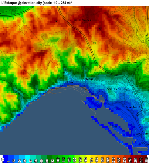
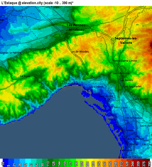
Below is the Elevation map of L'Estaque, which displays elevation range with different colors. Scale of the first map is from -10 to 284 m (-33 to 932 ft) with average elevation of 147.5 meters (=484 ft) [note 1]
These maps also provides idea of topography and contour of this city, they are displayed at different zoom levels. More info about maps, scale and edge coordinates you can find below images.
| \ | Map #1 | Map #2 | Topo.Map |
| Scale [m] | -10..284 m | -10..390 m | × |
| Scale [ft] | -33..932 ft | -33..1280 ft | × |
| Average | 147.5 m = 484 ft | 141.8 m = 465 ft | × |
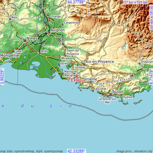
| Width | 7.1 km = 4.4 mi | 14.21 km = 8.8 mi | 227.3 km = 141.2 mi |
| Height | 7.1 km = 4.4 mi | 14.21 km = 8.8 mi | 227.3 km = 141.2 mi |
| ↑Max Latitude | 43.39579° | 43.427714° | 44.37759° |
| Latitude at center | 43.36385° | 43.36385° | 43.36385° |
| ↓Min Latitude | 43.331893° | 43.299919° | 42.33289° |
| ← Min Longitude | 5.264595° | 5.220649° | 3.90229° |
| Longitude center | 5.30854° | 5.30854° | 5.30854° |
| →Max Longitude | 5.352485° | 5.396431° | 6.71479° |
Nearby cities:
Cities around L'Estaque sort by population:
• Marseille 15 elevation 153 m
3.8 km,  75°
75°
• Marseille 16 34 m
2.1 km,  102°
102°
• Notre-Dame Limite 183 m
4.8 km,  65°
65°
• Saint-Louis 59 m
4.1 km,  115°
115°
• Verduron 158 m
3.1 km, 75°
• La Viste 120 m
3.9 km, 97°
• Saint-Antoine 135 m
4.1 km, 79°
• La Calade 34 m
4.4 km,  128°
128°
• Saint-Henri 49 m
1.8 km, 98°
• Saint-André 33 m
2.9 km,  106°
106°
• Borel 220 m
4.7 km,  88°
88°
• Le Rove 156 m
4.7 km,  278°
278°
Multilingual:
 En español:
L'Estaque elevación 40 m.
 En France:
L'Estaque élévation 40 m.
 Auf Deutsch:
L'Estaque höhe über dem Meeresspiegel ist 40 m.

Sources and notes:
- [note 1] Map square and city borders are not equal. Map elevation data is calculated only from area inside that square.
- [src 1] Elevation data from geonames database provided with same terms of usage.
- [src 2] The elevation map of L'Estaque is generated using elevation data from NASA's 3 arcsec (90m) resolution SRTM data.
- [src 3] Base (background) map © OpenStreetMap contributors tiles are generated by Geofabrik and OpenTopoMap.
Copyright & License:
This L'Estaque Elevation Map is licensed under CC BY-SA. You may reuse any part from this page, if you give a proper credit by linking to this URL:
 More info on terms of use page.