Loctudy elevation
Loctudy (Brittany, Département du Finistère), France elevation is 8 meters and Loctudy elevation in feet is 26 ft above sea level [src 1]. Loctudy is a populated place (feature code) with elevation that is 166 meters (545 ft) smaller than average city elevation in France.
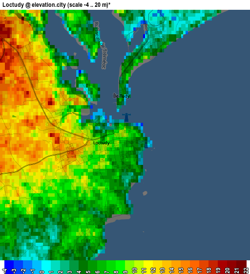
Below is the Elevation map of Loctudy, which displays elevation range with different colors. Scale of the first map is from -4 to 20 m (-13 to 66 ft) with average elevation of 7.9 meters (=26 ft) [note 1]
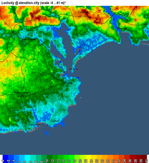
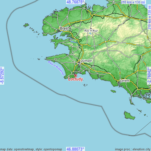
These maps also provides idea of topography and contour of this city, they are displayed at different zoom levels. More info about maps, scale and edge coordinates you can find below images.
| \ | Map #1 | Map #2 | Topo.Map |
| Scale [m] | -4..20 m | -4..41 m | × |
| Scale [ft] | -13..66 ft | -13..135 ft | × |
| Average | 7.9 m = 26 ft | 13.6 m = 45 ft | × |
| Width | 6.56 km = 4.1 mi | 13.12 km = 8.2 mi | 209.9 km = 130.4 mi |
| Height | 6.56 km = 4.1 mi | 13.12 km = 8.2 mi | 209.9 km = 130.4 mi |
| ↑Max Latitude | 47.862822° | 47.892297° | 48.76875° |
| Latitude at center | 47.83333° | 47.83333° | 47.83333° |
| ↓Min Latitude | 47.803822° | 47.774296° | 46.88073° |
| ← Min Longitude | -4.210615° | -4.254561° | -5.57292° |
| Longitude center | -4.16667° | -4.16667° | -4.16667° |
| →Max Longitude | -4.122725° | -4.078779° | -2.76042° |
Nearby cities:
Cities around Loctudy sort by population:
• Pont-l’Abbé elevation 6 m
5.3 km,  314°
314°
• Plonéour-Lanvern 60 m
11.4 km, 310°
• Plomelin 45 m
11.2 km,  6°
6°
• Plomeur 26 m
8.7 km,  270°
270°
• Combrit 33 m
6 km, 6°
• Guilvinec 6 m
9.4 km,  245°
245°
• Plobannalec-Lesconil 10 m
4.2 km,  243°
243°
• Bénodet 14 m
6.5 km,  44°
44°
• Pleuven 75 m
12.4 km,  53°
53°
• Gouesnach 40 m
9.4 km,  24°
24°
• Treffiagat 18 m
7.7 km,  256°
256°
• Clohars-Fouesnant 39 m
10.4 km, 47°
Multilingual:
 En español:
Loctudy elevación 8 m.
 En France:
Loctudy élévation 8 m.


Sources and notes:
- [note 1] Map square and city borders are not equal. Map elevation data is calculated only from area inside that square.
- [src 1] Elevation data from geonames database provided with same terms of usage.
- [src 2] The elevation map of Loctudy is generated using elevation data from NASA's 3 arcsec (90m) resolution SRTM data.
- [src 3] Base (background) map © OpenStreetMap contributors tiles are generated by Geofabrik and OpenTopoMap.
Copyright & License:
This Loctudy Elevation Map is licensed under CC BY-SA. You may reuse any part from this page, if you give a proper credit by linking to this URL:
 More info on terms of use page.