Longnes elevation
Longnes (Île-de-France, Yvelines), France elevation is 136 meters and Longnes elevation in feet is 446 ft above sea level [src 1]. Longnes is a populated place (feature code) with elevation that is 38 meters (125 ft) smaller than average city elevation in France.
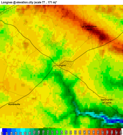
Below is the Elevation map of Longnes, which displays elevation range with different colors. Scale of the first map is from 77 to 171 m (253 to 561 ft) with average elevation of 132 meters (=433 ft) [note 1]
These maps also provides idea of topography and contour of this city, they are displayed at different zoom levels. More info about maps, scale and edge coordinates you can find below images.
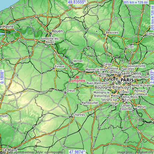
| \ | Map #1 | Topo.Map |
| Scale [m] | 77..171 m | × |
| Scale [ft] | 253..561 ft | × |
| Average | 132 m = 433 ft | × |
| Width | 6.42 km = 4 mi | 205.5 km = 127.7 mi |
| Height | 6.42 km = 4 mi | 205.5 km = 127.7 mi |
| ↑Max Latitude | 48.948889° | 49.83555° |
| Latitude at center | 48.92002° | 48.92002° |
| ↓Min Latitude | 48.891135° | 47.9874° |
| ← Min Longitude | 1.543105° | 0.1808° |
| Longitude center | 1.58705° | 1.58705° |
| →Max Longitude | 1.630995° | 2.9933° |
Nearby cities:
Cities around Longnes sort by population:
• Mantes-la-Ville elevation 80 m
10.3 km,  54°
54°
• Magnanville 140 m
8.5 km, 51°
• Rosny-sur-Seine 35 m
9.3 km,  20°
20°
• Ivry-la-Bataille 65 m
10.2 km,  246°
246°
• Buchelay 69 m
9 km,  42°
42°
• Septeuil 97 m
7.7 km,  113°
113°
• Guerville 92 m
11.1 km,  76°
76°
• Garennes-sur-Eure 58 m
10.9 km,  264°
264°
• Bréval 127 m
4.9 km,  305°
305°
• Bueil 74 m
10.6 km,  277°
277°
• Oulins 76 m
10.5 km,  234°
234°
• Tacoignières 145 m
11.3 km,  145°
145°
Multilingual:
 En español:
Longnes elevación 136 m.
 En France:
Longnes élévation 136 m.


Sources and notes:
- [note 1] Map square and city borders are not equal. Map elevation data is calculated only from area inside that square.
- [src 1] Elevation data from geonames database provided with same terms of usage.
- [src 2] The elevation map of Longnes is generated using elevation data from NASA's 3 arcsec (90m) resolution SRTM data.
- [src 3] Base (background) map © OpenStreetMap contributors tiles are generated by Geofabrik and OpenTopoMap.
Copyright & License:
This Longnes Elevation Map is licensed under CC BY-SA. You may reuse any part from this page, if you give a proper credit by linking to this URL:
 More info on terms of use page.