Longwy elevation
Longwy (Grand Est, Meurthe-et-Moselle), France elevation is 270 meters and Longwy elevation in feet is 886 ft above sea level [src 1]. Longwy is a populated place (feature code) with elevation that is 96 meters (315 ft) bigger than average city elevation in France.
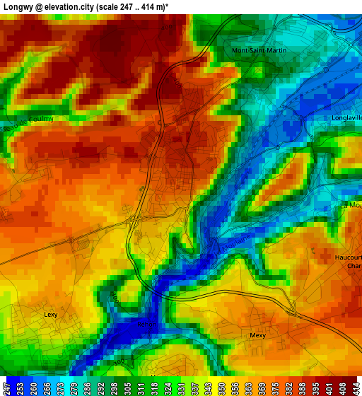
Below is the Elevation map of Longwy, which displays elevation range with different colors. Scale of the first map is from 247 to 414 m (810 to 1358 ft) with average elevation of 341.1 meters (=1119 ft) [note 1]
These maps also provides idea of topography and contour of this city, they are displayed at different zoom levels. More info about maps, scale and edge coordinates you can find below images.
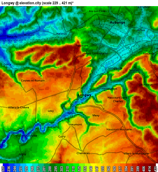
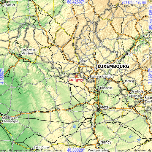
| \ | Map #1 | Map #2 | Topo.Map |
| Scale [m] | 247..414 m | 229..421 m | × |
| Scale [ft] | 810..1358 ft | 751..1381 ft | × |
| Average | 341.1 m = 1119 ft | 327.8 m = 1075 ft | × |
| Width | 6.34 km = 3.9 mi | 12.69 km = 7.9 mi | 203 km = 126.1 mi |
| Height | 6.34 km = 3.9 mi | 12.69 km = 7.9 mi | 203 km = 126.1 mi |
| ↑Max Latitude | 49.550219° | 49.578722° | 50.42607° |
| Latitude at center | 49.5217° | 49.5217° | 49.5217° |
| ↓Min Latitude | 49.493164° | 49.464612° | 48.60028° |
| ← Min Longitude | 5.717975° | 5.674029° | 4.35567° |
| Longitude center | 5.76192° | 5.76192° | 5.76192° |
| →Max Longitude | 5.805865° | 5.849811° | 7.16817° |
Nearby cities:
Cities around Longwy sort by population:
• Mont-Saint-Martin elevation 277 m
2.9 km,  32°
32°
• Herserange 270 m
2 km,  93°
93°
• Réhon 357 m
2.6 km,  191°
191°
• Hussigny-Godbrange 390 m
8.2 km,  111°
111°
• Lexy 283 m
3.3 km,  223°
223°
• Haucourt 377 m
4.7 km,  139°
139°
• Saulnes 323 m
4.4 km,  75°
75°
• Longlaville 290 m
3.1 km,  63°
63°
• Gorcy 310 m
5.8 km,  284°
284°
• Cosnes 378 m
3.6 km,  266°
266°
• Mexy 375 m
2.7 km,  149°
149°
• Villers-la-Montagne 390 m
7.2 km, 140°
Multilingual:
 En español:
Longwy elevación 270 m.
 En France:
Longwy élévation 270 m.


Sources and notes:
- [note 1] Map square and city borders are not equal. Map elevation data is calculated only from area inside that square.
- [src 1] Elevation data from geonames database provided with same terms of usage.
- [src 2] The elevation map of Longwy is generated using elevation data from NASA's 3 arcsec (90m) resolution SRTM data.
- [src 3] Base (background) map © OpenStreetMap contributors tiles are generated by Geofabrik and OpenTopoMap.
Copyright & License:
This Longwy Elevation Map is licensed under CC BY-SA. You may reuse any part from this page, if you give a proper credit by linking to this URL:
 More info on terms of use page.