Luynes elevation
Luynes (Centre, Département d'Indre-et-Loire), France elevation is 49 meters and Luynes elevation in feet is 161 ft above sea level [src 1]. Luynes is a populated place (feature code) with elevation that is 125 meters (410 ft) smaller than average city elevation in France.
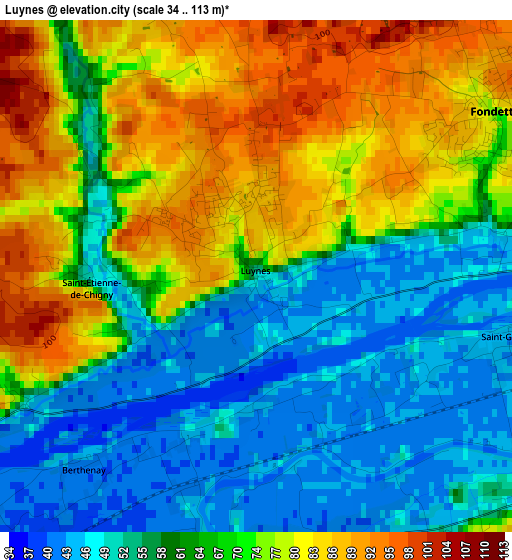
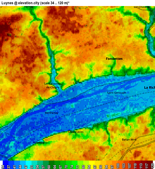
Below is the Elevation map of Luynes, which displays elevation range with different colors. Scale of the first map is from 34 to 113 m (112 to 371 ft) with average elevation of 66 meters (=217 ft) [note 1]
These maps also provides idea of topography and contour of this city, they are displayed at different zoom levels. More info about maps, scale and edge coordinates you can find below images.
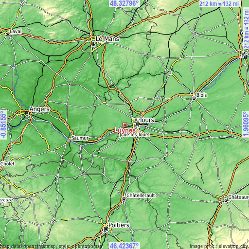
| \ | Map #1 | Map #2 | Topo.Map |
| Scale [m] | 34..113 m | 34..120 m | × |
| Scale [ft] | 112..371 ft | 112..394 ft | × |
| Average | 66 m = 217 ft | 77.9 m = 256 ft | × |
| Width | 6.62 km = 4.1 mi | 13.23 km = 8.2 mi | 211.7 km = 131.5 mi |
| Height | 6.62 km = 4.1 mi | 13.23 km = 8.2 mi | 211.7 km = 131.5 mi |
| ↑Max Latitude | 47.414156° | 47.443885° | 48.32796° |
| Latitude at center | 47.38441° | 47.38441° | 47.38441° |
| ↓Min Latitude | 47.354647° | 47.324868° | 46.42367° |
| ← Min Longitude | 0.510755° | 0.466809° | -0.85155° |
| Longitude center | 0.5547° | 0.5547° | 0.5547° |
| →Max Longitude | 0.598645° | 0.642591° | 1.96095° |
Nearby cities:
Cities around Luynes sort by population:
• Joué-lès-Tours elevation 83 m
9.3 km,  112°
112°
• Saint-Cyr-sur-Loire 83 m
8.6 km,  78°
78°
• Fondettes 80 m
3.8 km,  56°
56°
• La Riche 51 m
8.8 km,  85°
85°
• Ballan-Miré 92 m
6.6 km,  137°
137°
• La Membrolle-sur-Choisille 92 m
8.2 km,  44°
44°
• Cinq-Mars-la-Pile 48 m
8.4 km,  239°
239°
• Savonnières 62 m
4.1 km,  185°
185°
• Saint-Étienne-de-Chigny 61 m
1.6 km,  265°
265°
• Villandry 47 m
5.9 km,  214°
214°
• Mazières-de-Touraine 90 m
9.7 km, 269°
• Charentilly 91 m
10.3 km,  23°
23°
Multilingual:
 En español:
Luynes elevación 49 m.
 En France:
Luynes élévation 49 m.


Sources and notes:
- [note 1] Map square and city borders are not equal. Map elevation data is calculated only from area inside that square.
- [src 1] Elevation data from geonames database provided with same terms of usage.
- [src 2] The elevation map of Luynes is generated using elevation data from NASA's 3 arcsec (90m) resolution SRTM data.
- [src 3] Base (background) map © OpenStreetMap contributors tiles are generated by Geofabrik and OpenTopoMap.
Copyright & License:
This Luynes Elevation Map is licensed under CC BY-SA. You may reuse any part from this page, if you give a proper credit by linking to this URL:
 More info on terms of use page.