Magny-le-Hongre elevation
Magny-le-Hongre (Île-de-France, Seine-et-Marne), France elevation is 121 meters and Magny-le-Hongre elevation in feet is 397 ft above sea level [src 1]. Magny-le-Hongre is a populated place (feature code) with elevation that is 53 meters (174 ft) smaller than average city elevation in France.
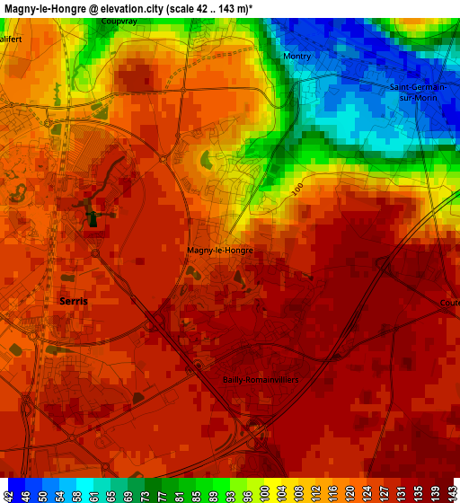
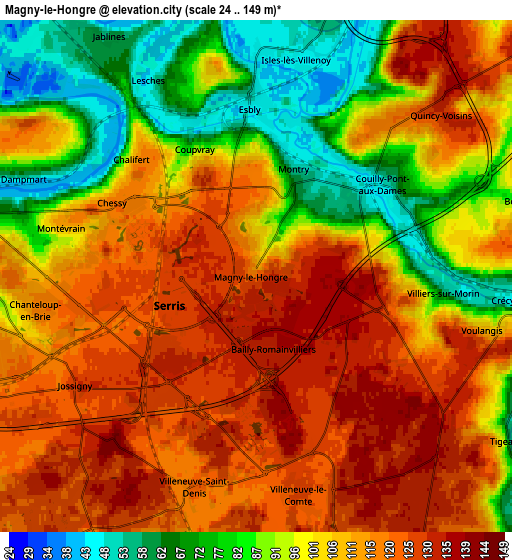
Below is the Elevation map of Magny-le-Hongre, which displays elevation range with different colors. Scale of the first map is from 42 to 143 m (138 to 469 ft) with average elevation of 116.6 meters (=383 ft) [note 1]
These maps also provides idea of topography and contour of this city, they are displayed at different zoom levels. More info about maps, scale and edge coordinates you can find below images.
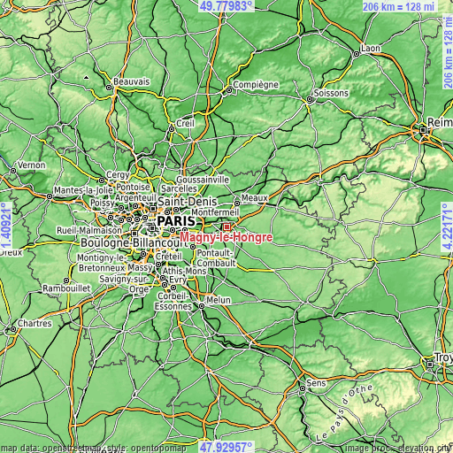
| \ | Map #1 | Map #2 | Topo.Map |
| Scale [m] | 42..143 m | 24..149 m | × |
| Scale [ft] | 138..469 ft | 79..489 ft | × |
| Average | 116.6 m = 383 ft | 104.7 m = 344 ft | × |
| Width | 6.43 km = 4 mi | 12.86 km = 8 mi | 205.7 km = 127.8 mi |
| Height | 6.43 km = 4 mi | 12.86 km = 8 mi | 205.7 km = 127.8 mi |
| ↑Max Latitude | 48.892151° | 48.921036° | 49.77983° |
| Latitude at center | 48.86325° | 48.86325° | 48.86325° |
| ↓Min Latitude | 48.834332° | 48.805397° | 47.92957° |
| ← Min Longitude | 2.771515° | 2.727569° | 1.40921° |
| Longitude center | 2.81546° | 2.81546° | 2.81546° |
| →Max Longitude | 2.859405° | 2.903351° | 4.22171° |
Nearby cities:
Cities around Magny-le-Hongre sort by population:
• Esbly elevation 56 m
4.7 km,  357°
357°
• Bailly-Romainvilliers 136 m
1.9 km,  161°
161°
• Montévrain 113 m
4.9 km,  284°
284°
• Montry 59 m
2.5 km,  23°
23°
• Saint-Germain-sur-Morin 48 m
3.4 km,  50°
50°
• Coupvray 82 m
3.6 km,  337°
337°
• Chessy 101 m
4.2 km,  302°
302°
• Serris 131 m
2.9 km,  227°
227°
• Couilly-Pont-aux-Dames 48 m
3.9 km, 51°
• Villiers-sur-Morin 52 m
4.6 km,  93°
93°
• Condé-Sainte-Libiaire 76 m
4.1 km, 24°
• Chalifert 108 m
4.3 km,  313°
313°
Multilingual:
 En español:
Magny-le-Hongre elevación 121 m.
 En France:
Magny-le-Hongre élévation 121 m.
 Auf Deutsch:
Magny Le Hongre höhe über dem Meeresspiegel ist 121 m.

Sources and notes:
- [note 1] Map square and city borders are not equal. Map elevation data is calculated only from area inside that square.
- [src 1] Elevation data from geonames database provided with same terms of usage.
- [src 2] The elevation map of Magny-le-Hongre is generated using elevation data from NASA's 3 arcsec (90m) resolution SRTM data.
- [src 3] Base (background) map © OpenStreetMap contributors tiles are generated by Geofabrik and OpenTopoMap.
Copyright & License:
This Magny-le-Hongre Elevation Map is licensed under CC BY-SA. You may reuse any part from this page, if you give a proper credit by linking to this URL:
 More info on terms of use page.