Maing elevation
Maing (Hauts-de-France, Nord), France elevation is 30 meters and Maing elevation in feet is 98 ft above sea level [src 1]. Maing is a populated place (feature code) with elevation that is 144 meters (472 ft) smaller than average city elevation in France.
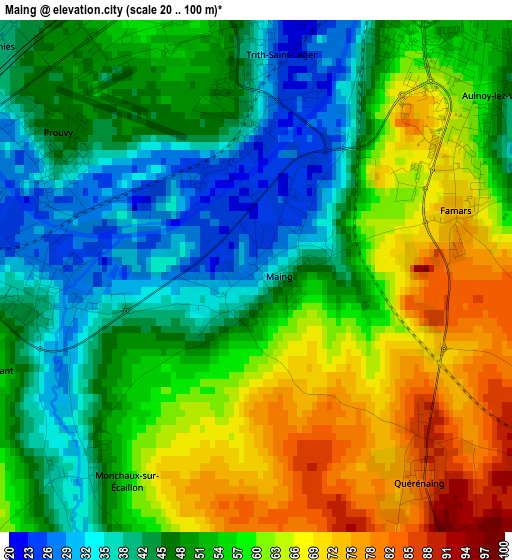
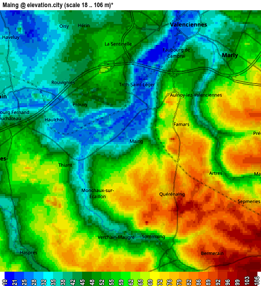
Below is the Elevation map of Maing, which displays elevation range with different colors. Scale of the first map is from 20 to 100 m (66 to 328 ft) with average elevation of 53.1 meters (=174 ft) [note 1]
These maps also provides idea of topography and contour of this city, they are displayed at different zoom levels. More info about maps, scale and edge coordinates you can find below images.
| \ | Map #1 | Map #2 | Topo.Map |
| Scale [m] | 20..100 m | 18..106 m | × |
| Scale [ft] | 66..328 ft | 59..348 ft | × |
| Average | 53.1 m = 174 ft | 55.7 m = 183 ft | × |
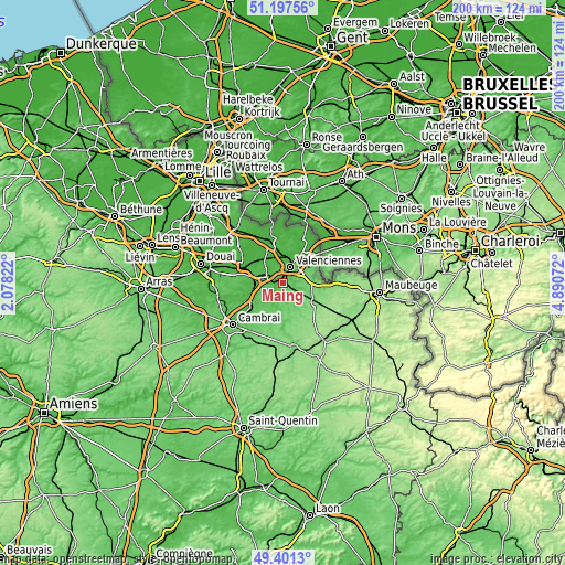
| Width | 6.24 km = 3.9 mi | 12.48 km = 7.8 mi | 199.7 km = 124.1 mi |
| Height | 6.24 km = 3.9 mi | 12.48 km = 7.8 mi | 199.7 km = 124.1 mi |
| ↑Max Latitude | 50.335968° | 50.364009° | 51.19756° |
| Latitude at center | 50.30791° | 50.30791° | 50.30791° |
| ↓Min Latitude | 50.279836° | 50.251745° | 49.4013° |
| ← Min Longitude | 3.440525° | 3.396579° | 2.07822° |
| Longitude center | 3.48447° | 3.48447° | 3.48447° |
| →Max Longitude | 3.528415° | 3.572361° | 4.89072° |
Nearby cities:
Cities around Maing sort by population:
• Marly elevation 42 m
6.2 km,  47°
47°
• Aulnoy-lez-Valenciennes 37 m
4.5 km, 50°
• Trith-Saint-Léger 24 m
1 km,  355°
355°
• Hérin 45 m
5.7 km,  337°
337°
• La Sentinelle 51 m
4.8 km, 359°
• Thiant 39 m
2.6 km,  262°
262°
• Famars 71 m
2.7 km,  66°
66°
• Prouvy 37 m
2.6 km,  295°
295°
• Haulchin 32 m
3.6 km,  286°
286°
• Wavrechain-sous-Denain 33 m
5.8 km, 297°
• Artres 60 m
4.2 km,  110°
110°
• Vendegies-sur-Écaillon 61 m
5.5 km,  158°
158°
Multilingual:
 En español:
Maing elevación 30 m.
 En France:
Maing élévation 30 m.


Sources and notes:
- [note 1] Map square and city borders are not equal. Map elevation data is calculated only from area inside that square.
- [src 1] Elevation data from geonames database provided with same terms of usage.
- [src 2] The elevation map of Maing is generated using elevation data from NASA's 3 arcsec (90m) resolution SRTM data.
- [src 3] Base (background) map © OpenStreetMap contributors tiles are generated by Geofabrik and OpenTopoMap.
Copyright & License:
This Maing Elevation Map is licensed under CC BY-SA. You may reuse any part from this page, if you give a proper credit by linking to this URL:
 More info on terms of use page.