Marckolsheim elevation
Marckolsheim (Grand Est, Bas-Rhin), France elevation is 176 meters and Marckolsheim elevation in feet is 577 ft above sea level [src 1]. Marckolsheim is a populated place (feature code) with elevation that is 2 meters (7 ft) bigger than average city elevation in France.
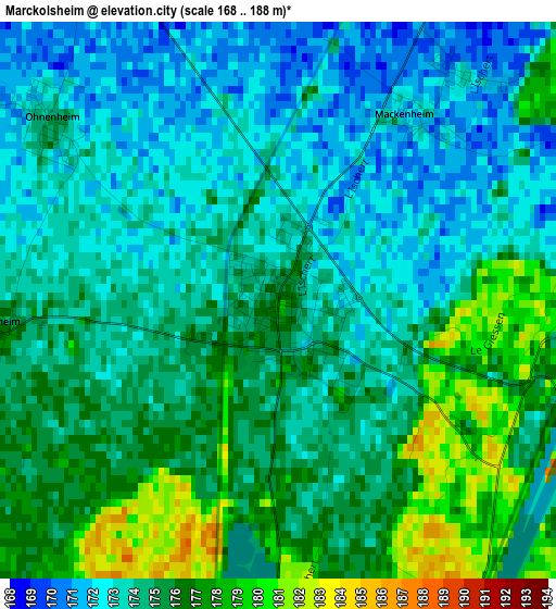
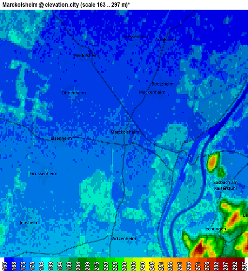
Below is the Elevation map of Marckolsheim, which displays elevation range with different colors. Scale of the first map is from 168 to 188 m (551 to 617 ft) with average elevation of 174.4 meters (=572 ft) [note 1]
These maps also provides idea of topography and contour of this city, they are displayed at different zoom levels. More info about maps, scale and edge coordinates you can find below images.
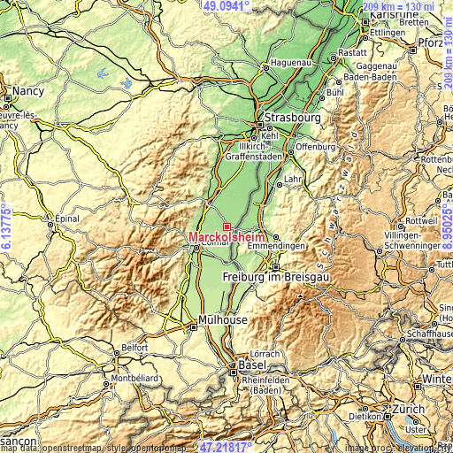
| \ | Map #1 | Map #2 | Topo.Map |
| Scale [m] | 168..188 m | 163..297 m | × |
| Scale [ft] | 551..617 ft | 535..974 ft | × |
| Average | 174.4 m = 572 ft | 177 m = 581 ft | × |
| Width | 6.52 km = 4.1 mi | 13.04 km = 8.1 mi | 208.6 km = 129.6 mi |
| Height | 6.52 km = 4.1 mi | 13.04 km = 8.1 mi | 208.6 km = 129.6 mi |
| ↑Max Latitude | 48.194013° | 48.223299° | 49.0941° |
| Latitude at center | 48.16471° | 48.16471° | 48.16471° |
| ↓Min Latitude | 48.13539° | 48.106054° | 47.21817° |
| ← Min Longitude | 7.500055° | 7.456109° | 6.13775° |
| Longitude center | 7.544° | 7.544° | 7.544° |
| →Max Longitude | 7.587945° | 7.631891° | 8.95025° |
Nearby cities:
Cities around Marckolsheim sort by population:
• Sélestat elevation 172 m
12.9 km,  326°
326°
• Wittisheim 168 m
11.5 km,  15°
15°
• Muttersholtz 166 m
11.5 km,  356°
356°
• Kunheim 186 m
9.8 km,  183°
183°
• Ostheim 181 m
12.9 km,  267°
267°
• Guémar 178 m
11.2 km,  283°
283°
• Sundhouse 169 m
10.6 km, 24°
• Mussig 172 m
7.5 km,  346°
346°
• Holtzwihr 180 m
10.8 km,  237°
237°
• Widensolen 188 m
12.2 km,  202°
202°
• Jebsheim 179 m
6.8 km,  228°
228°
• Fortschwihr 186 m
11 km,  219°
219°
Multilingual:
 En español:
Marckolsheim elevación 176 m.
 En France:
Marckolsheim élévation 176 m.
 Auf Deutsch:
Marckolsheim höhe über dem Meeresspiegel ist 176 m.

Sources and notes:
- [note 1] Map square and city borders are not equal. Map elevation data is calculated only from area inside that square.
- [src 1] Elevation data from geonames database provided with same terms of usage.
- [src 2] The elevation map of Marckolsheim is generated using elevation data from NASA's 3 arcsec (90m) resolution SRTM data.
- [src 3] Base (background) map © OpenStreetMap contributors tiles are generated by Geofabrik and OpenTopoMap.
Copyright & License:
This Marckolsheim Elevation Map is licensed under CC BY-SA. You may reuse any part from this page, if you give a proper credit by linking to this URL:
 More info on terms of use page.