Marigné-Laillé elevation
Marigné-Laillé (Pays de la Loire, Sarthe), France elevation is 105 meters and Marigné-Laillé elevation in feet is 344 ft above sea level [src 1]. Marigné-Laillé is a populated place (feature code) with elevation that is 69 meters (226 ft) smaller than average city elevation in France.
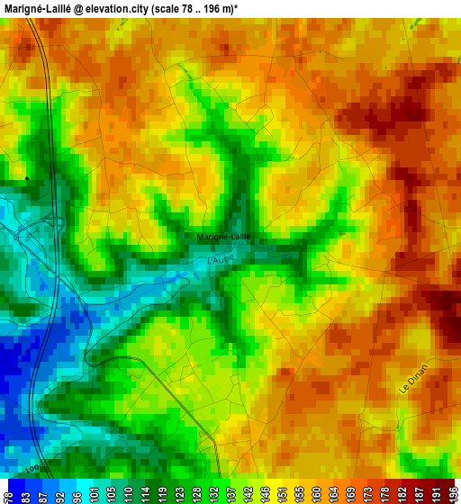
Below is the Elevation map of Marigné-Laillé, which displays elevation range with different colors. Scale of the first map is from 78 to 196 m (256 to 643 ft) with average elevation of 144.6 meters (=474 ft) [note 1]
These maps also provides idea of topography and contour of this city, they are displayed at different zoom levels. More info about maps, scale and edge coordinates you can find below images.
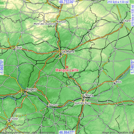
| \ | Map #1 | Topo.Map |
| Scale [m] | 78..196 m | × |
| Scale [ft] | 256..643 ft | × |
| Average | 144.6 m = 474 ft | × |
| Width | 6.56 km = 4.1 mi | 210 km = 130.5 mi |
| Height | 6.56 km = 4.1 mi | 210 km = 130.5 mi |
| ↑Max Latitude | 47.847151° | 48.75336° |
| Latitude at center | 47.81765° | 47.81765° |
| ↓Min Latitude | 47.788133° | 46.86477° |
| ← Min Longitude | 0.296555° | -1.06575° |
| Longitude center | 0.3405° | 0.3405° |
| →Max Longitude | 0.384445° | 1.74675° |
Nearby cities:
Cities around Marigné-Laillé sort by population:
• Mulsanne elevation 67 m
12.5 km,  326°
326°
• Écommoy 81 m
5 km,  280°
280°
• Mayet 81 m
8.1 km,  217°
217°
• Teloché 70 m
9.4 km, 326°
• Saint-Mars-d’Outillé 99 m
5.9 km,  353°
353°
• Laigné-en-Belin 65 m
10.7 km,  308°
308°
• Le Grand-Lucé 116 m
11 km,  60°
60°
• Saint-Gervais-en-Belin 62 m
11.3 km, 305°
• Brette-les-Pins 96 m
10.3 km,  358°
358°
• Pontvallain 55 m
13.3 km,  236°
236°
• Saint-Ouen-en-Belin 60 m
9.9 km, 279°
• Luceau 84 m
12.5 km,  160°
160°
Multilingual:
 En español:
Marigné-Laillé elevación 105 m.
 En France:
Marigné-Laillé élévation 105 m.
 Auf Deutsch:
Marigné-Laillé höhe über dem Meeresspiegel ist 105 m.

Sources and notes:
- [note 1] Map square and city borders are not equal. Map elevation data is calculated only from area inside that square.
- [src 1] Elevation data from geonames database provided with same terms of usage.
- [src 2] The elevation map of Marigné-Laillé is generated using elevation data from NASA's 3 arcsec (90m) resolution SRTM data.
- [src 3] Base (background) map © OpenStreetMap contributors tiles are generated by Geofabrik and OpenTopoMap.
Copyright & License:
This Marigné-Laillé Elevation Map is licensed under CC BY-SA. You may reuse any part from this page, if you give a proper credit by linking to this URL:
 More info on terms of use page.