Marly elevation
Marly (Grand Est, Moselle), France elevation is 171 meters and Marly elevation in feet is 561 ft above sea level [src 1]. Marly is a populated place (feature code) with elevation that is 3 meters (10 ft) smaller than average city elevation in France.
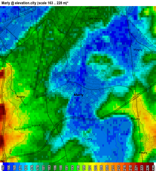
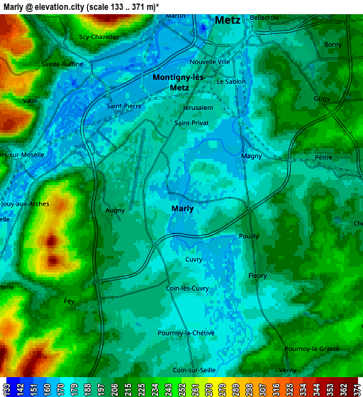
Below is the Elevation map of Marly, which displays elevation range with different colors. Scale of the first map is from 163 to 228 m (535 to 748 ft) with average elevation of 181.6 meters (=596 ft) [note 1]
These maps also provides idea of topography and contour of this city, they are displayed at different zoom levels. More info about maps, scale and edge coordinates you can find below images.
| \ | Map #1 | Map #2 | Topo.Map |
| Scale [m] | 163..228 m | 133..371 m | × |
| Scale [ft] | 535..748 ft | 436..1217 ft | × |
| Average | 181.6 m = 596 ft | 201.6 m = 661 ft | × |
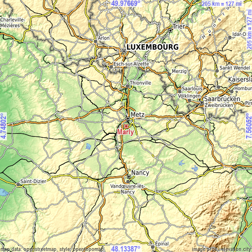
| Width | 6.4 km = 4 mi | 12.81 km = 8 mi | 204.9 km = 127.3 mi |
| Height | 6.4 km = 4 mi | 12.81 km = 8 mi | 204.9 km = 127.3 mi |
| ↑Max Latitude | 49.092605° | 49.121374° | 49.97669° |
| Latitude at center | 49.06382° | 49.06382° | 49.06382° |
| ↓Min Latitude | 49.035018° | 49.006199° | 48.13387° |
| ← Min Longitude | 6.110325° | 6.066379° | 4.74802° |
| Longitude center | 6.15427° | 6.15427° | 6.15427° |
| →Max Longitude | 6.198215° | 6.242161° | 7.56052° |
Nearby cities:
Cities around Marly sort by population:
• Metz elevation 182 m
6.3 km,  12°
12°
• Montigny-lès-Metz 185 m
3.5 km,  358°
358°
• Ars-sur-Moselle 180 m
6 km,  285°
285°
• Moulins-lès-Metz 167 m
5.6 km,  323°
323°
• Le Ban Saint-Martin 166 m
6.5 km, 357°
• Longeville-lès-Metz 167 m
5.7 km,  346°
346°
• Scy-Chazelles 194 m
6.2 km,  332°
332°
• Augny 194 m
2.6 km,  263°
263°
• Peltre 197 m
5.5 km,  77°
77°
• Jouy-aux-Arches 255 m
5.5 km,  267°
267°
• Ancy-sur-Moselle 173 m
7.1 km, 263°
• Fleury 215 m
3.8 km,  130°
130°
Multilingual:
 En español:
Marly elevación 171 m.
 En France:
Marly élévation 171 m.


Sources and notes:
- [note 1] Map square and city borders are not equal. Map elevation data is calculated only from area inside that square.
- [src 1] Elevation data from geonames database provided with same terms of usage.
- [src 2] The elevation map of Marly is generated using elevation data from NASA's 3 arcsec (90m) resolution SRTM data.
- [src 3] Base (background) map © OpenStreetMap contributors tiles are generated by Geofabrik and OpenTopoMap.
Copyright & License:
This Marly Elevation Map is licensed under CC BY-SA. You may reuse any part from this page, if you give a proper credit by linking to this URL:
 More info on terms of use page.