Mazingarbe elevation
Mazingarbe (Hauts-de-France, Pas-de-Calais), France elevation is 38 meters and Mazingarbe elevation in feet is 125 ft above sea level [src 1]. Mazingarbe is a populated place (feature code) with elevation that is 136 meters (446 ft) smaller than average city elevation in France.
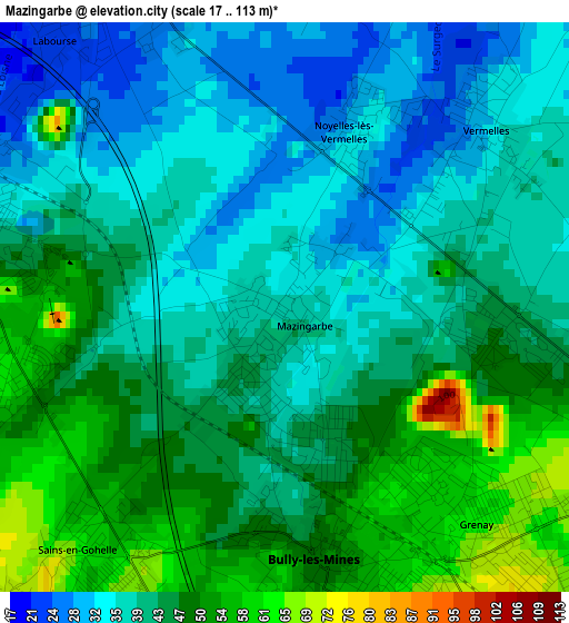
Below is the Elevation map of Mazingarbe, which displays elevation range with different colors. Scale of the first map is from 17 to 113 m (56 to 371 ft) with average elevation of 42.6 meters (=140 ft) [note 1]
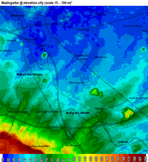
These maps also provides idea of topography and contour of this city, they are displayed at different zoom levels. More info about maps, scale and edge coordinates you can find below images.
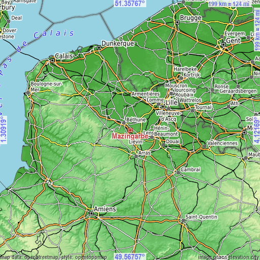
| \ | Map #1 | Map #2 | Topo.Map |
| Scale [m] | 17..113 m | 15..194 m | × |
| Scale [ft] | 56..371 ft | 49..636 ft | × |
| Average | 42.6 m = 140 ft | 51.7 m = 170 ft | × |
| Width | 6.22 km = 3.9 mi | 12.44 km = 7.7 mi | 199 km = 123.7 mi |
| Height | 6.22 km = 3.9 mi | 12.44 km = 7.7 mi | 199 km = 123.7 mi |
| ↑Max Latitude | 50.499051° | 50.526996° | 51.35767° |
| Latitude at center | 50.47109° | 50.47109° | 50.47109° |
| ↓Min Latitude | 50.443112° | 50.415117° | 49.56757° |
| ← Min Longitude | 2.671495° | 2.627549° | 1.30919° |
| Longitude center | 2.71544° | 2.71544° | 2.71544° |
| →Max Longitude | 2.759385° | 2.803331° | 4.12169° |
Nearby cities:
Cities around Mazingarbe sort by population:
• Bully-les-Mines elevation 54 m
3.1 km,  164°
164°
• Nœux-les-Mines 28 m
3.7 km,  291°
291°
• Beuvry 24 m
5.5 km,  337°
337°
• Hersin-Coupigny 74 m
5.3 km,  241°
241°
• Grenay 67 m
3.5 km,  132°
132°
• Sains-en-Gohelle 62 m
3.7 km,  218°
218°
• Vermelles 32 m
3 km,  47°
47°
• Aix-Noulette 75 m
5.1 km,  187°
187°
• Annequin 29 m
3.8 km,  5°
5°
• Sailly-Labourse 27 m
3.6 km, 338°
• Labourse 24 m
3.9 km,  321°
321°
• Noyelles-lès-Vermelles 31 m
2.2 km,  20°
20°
Multilingual:
 En español:
Mazingarbe elevación 38 m.
 En France:
Mazingarbe élévation 38 m.
 Auf Deutsch:
Mazingarbe höhe über dem Meeresspiegel ist 38 m.

Sources and notes:
- [note 1] Map square and city borders are not equal. Map elevation data is calculated only from area inside that square.
- [src 1] Elevation data from geonames database provided with same terms of usage.
- [src 2] The elevation map of Mazingarbe is generated using elevation data from NASA's 3 arcsec (90m) resolution SRTM data.
- [src 3] Base (background) map © OpenStreetMap contributors tiles are generated by Geofabrik and OpenTopoMap.
Copyright & License:
This Mazingarbe Elevation Map is licensed under CC BY-SA. You may reuse any part from this page, if you give a proper credit by linking to this URL:
 More info on terms of use page.