Moissac elevation
Moissac (Occitanie, Département du Tarn-et-Garonne), France elevation is 71 meters and Moissac elevation in feet is 233 ft above sea level [src 1]. Moissac is a populated place (feature code) with elevation that is 103 meters (338 ft) smaller than average city elevation in France.
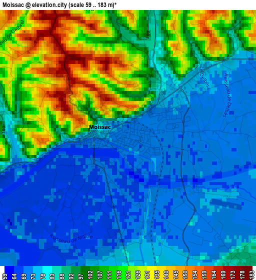
Below is the Elevation map of Moissac, which displays elevation range with different colors. Scale of the first map is from 59 to 183 m (194 to 600 ft) with average elevation of 92.3 meters (=303 ft) [note 1]
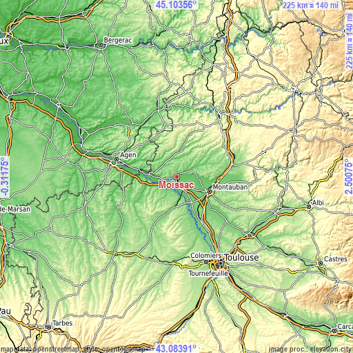
These maps also provides idea of topography and contour of this city, they are displayed at different zoom levels. More info about maps, scale and edge coordinates you can find below images.
| \ | Map #1 | Map #2 | Topo.Map |
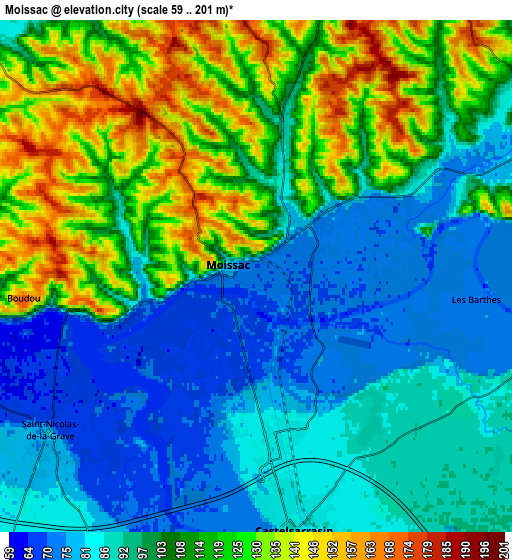
| Scale [m] | 59..183 m | 59..201 m | × |
| Scale [ft] | 194..600 ft | 194..659 ft | × |
| Average | 92.3 m = 303 ft | 103 m = 338 ft | × |
| Width | 7.02 km = 4.4 mi | 14.04 km = 8.7 mi | 224.6 km = 139.6 mi |
| Height | 7.02 km = 4.4 mi | 14.04 km = 8.7 mi | 224.6 km = 139.6 mi |
| ↑Max Latitude | 44.133909° | 44.16544° | 45.10356° |
| Latitude at center | 44.10236° | 44.10236° | 44.10236° |
| ↓Min Latitude | 44.070795° | 44.039212° | 43.08391° |
| ← Min Longitude | 1.050555° | 1.006609° | -0.31175° |
| Longitude center | 1.0945° | 1.0945° | 1.0945° |
| →Max Longitude | 1.138445° | 1.182391° | 2.50075° |
Nearby cities:
Cities around Moissac sort by population:
• Castelsarrasin elevation 82 m
7 km,  171°
171°
• Valence 71 m
16.3 km,  272°
272°
• Montech 110 m
19.4 km,  145°
145°
• Lafrançaise 186 m
12.1 km,  76°
76°
• Montbeton 84 m
19 km,  120°
120°
• Saint-Nicolas-de-la-Grave 81 m
7.1 km,  233°
233°
• Lavit 221 m
21.4 km,  220°
220°
• Lauzerte 184 m
17.4 km,  11°
11°
• Cazes-Mondenard 150 m
16.3 km,  32°
32°
• Lamagistère 55 m
21.7 km,  276°
276°
• Saint-Porquier 93 m
12.9 km, 148°
• Auvillar 112 m
15.8 km,  256°
256°
Multilingual:
 En español:
Moissac elevación 71 m.
 En France:
Moissac élévation 71 m.


Sources and notes:
- [note 1] Map square and city borders are not equal. Map elevation data is calculated only from area inside that square.
- [src 1] Elevation data from geonames database provided with same terms of usage.
- [src 2] The elevation map of Moissac is generated using elevation data from NASA's 3 arcsec (90m) resolution SRTM data.
- [src 3] Base (background) map © OpenStreetMap contributors tiles are generated by Geofabrik and OpenTopoMap.
Copyright & License:
This Moissac Elevation Map is licensed under CC BY-SA. You may reuse any part from this page, if you give a proper credit by linking to this URL:
 More info on terms of use page.