Montferrat elevation
Montferrat (Auvergne-Rhône-Alpes, Département de l'Isère), France elevation is 564 meters and Montferrat elevation in feet is 1850 ft above sea level [src 1]. Montferrat is a populated place (feature code) with elevation that is 390 meters (1280 ft) bigger than average city elevation in France.
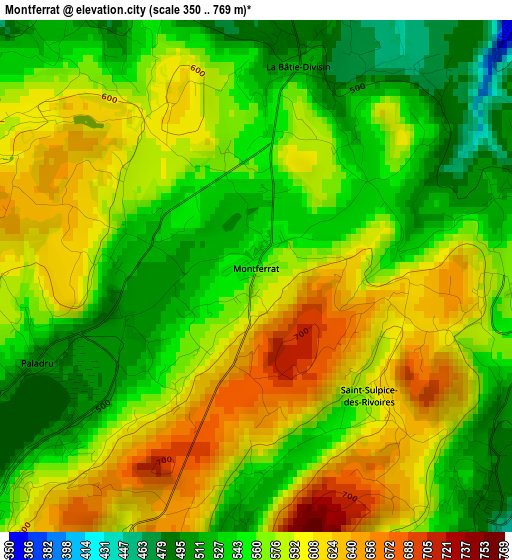
Below is the Elevation map of Montferrat, which displays elevation range with different colors. Scale of the first map is from 350 to 769 m (1148 to 2523 ft) with average elevation of 570.9 meters (=1873 ft) [note 1]
These maps also provides idea of topography and contour of this city, they are displayed at different zoom levels. More info about maps, scale and edge coordinates you can find below images.
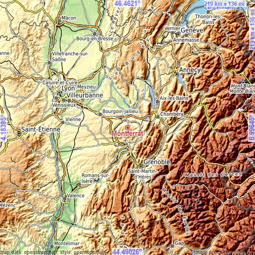
| \ | Map #1 | Topo.Map |
| Scale [m] | 350..769 m | × |
| Scale [ft] | 1148..2523 ft | × |
| Average | 570.9 m = 1873 ft | × |
| Width | 6.85 km = 4.3 mi | 219.2 km = 136.2 mi |
| Height | 6.85 km = 4.3 mi | 219.2 km = 136.2 mi |
| ↑Max Latitude | 45.515612° | 46.4621° |
| Latitude at center | 45.48481° | 45.48481° |
| ↓Min Latitude | 45.453992° | 44.49026° |
| ← Min Longitude | 5.546255° | 4.18395° |
| Longitude center | 5.5902° | 5.5902° |
| →Max Longitude | 5.634145° | 6.99645° |
Nearby cities:
Cities around Montferrat sort by population:
• Les Abrets elevation 380 m
6.7 km,  353°
353°
• Le Pont-de-Beauvoisin 258 m
8.7 km,  48°
48°
• Saint-André-le-Gaz 392 m
8.3 km,  324°
324°
• Saint-Geoire-en-Valdaine 454 m
4.7 km,  131°
131°
• Chirens 489 m
8.7 km,  197°
197°
• Charavines 506 m
8.6 km,  223°
223°
• Fitilieu 383 m
7.3 km,  342°
342°
• Romagnieu 260 m
10.3 km,  22°
22°
• Chimilin 256 m
10 km,  2°
2°
• Le Pin 525 m
7.4 km,  244°
244°
• Bilieu 600 m
5.5 km, 222°
• Virieu 414 m
8.9 km,  269°
269°
Multilingual:
 En español:
Montferrat elevación 564 m.
 En France:
Montferrat élévation 564 m.
 Auf Deutsch:
Montferrat höhe über dem Meeresspiegel ist 564 m.

Sources and notes:
- [note 1] Map square and city borders are not equal. Map elevation data is calculated only from area inside that square.
- [src 1] Elevation data from geonames database provided with same terms of usage.
- [src 2] The elevation map of Montferrat is generated using elevation data from NASA's 3 arcsec (90m) resolution SRTM data.
- [src 3] Base (background) map © OpenStreetMap contributors tiles are generated by Geofabrik and OpenTopoMap.
Copyright & License:
This Montferrat Elevation Map is licensed under CC BY-SA. You may reuse any part from this page, if you give a proper credit by linking to this URL:
 More info on terms of use page.