Montluçon elevation
Montluçon (Auvergne-Rhône-Alpes, Département de l'Allier), France elevation is 222 meters and Montluçon elevation in feet is 728 ft above sea level [src 1]. Montluçon is a seat of a third-order administrative division (feature code) with elevation that is 48 meters (157 ft) bigger than average city elevation in France.
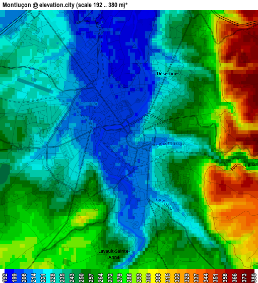
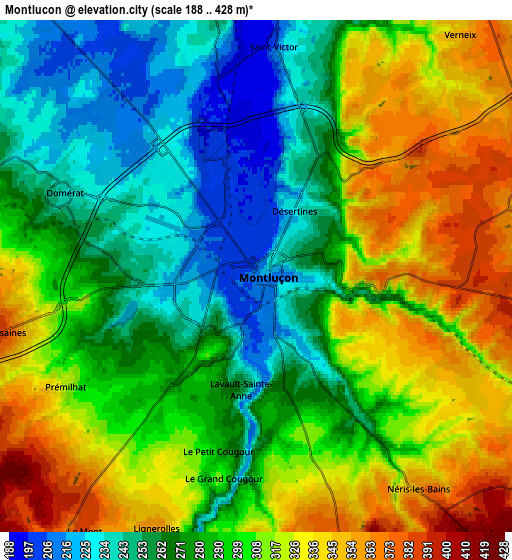
Below is the Elevation map of Montluçon, which displays elevation range with different colors. Scale of the first map is from 192 to 380 m (630 to 1247 ft) with average elevation of 251.5 meters (=825 ft) [note 1]
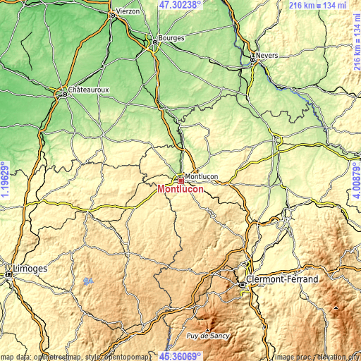
These maps also provides idea of topography and contour of this city, they are displayed at different zoom levels. More info about maps, scale and edge coordinates you can find below images.
| \ | Map #1 | Map #2 | Topo.Map |
| Scale [m] | 192..380 m | 188..428 m | × |
| Scale [ft] | 630..1247 ft | 617..1404 ft | × |
| Average | 251.5 m = 825 ft | 293.6 m = 963 ft | × |
| Width | 6.75 km = 4.2 mi | 13.49 km = 8.4 mi | 215.9 km = 134.2 mi |
| Height | 6.75 km = 4.2 mi | 13.49 km = 8.4 mi | 215.9 km = 134.2 mi |
| ↑Max Latitude | 46.37048° | 46.400794° | 47.30238° |
| Latitude at center | 46.34015° | 46.34015° | 46.34015° |
| ↓Min Latitude | 46.309803° | 46.279439° | 45.36069° |
| ← Min Longitude | 2.558595° | 2.514649° | 1.19629° |
| Longitude center | 2.60254° | 2.60254° | 2.60254° |
| →Max Longitude | 2.646485° | 2.690431° | 4.00879° |
Nearby cities:
Cities around Montluçon sort by population:
• Domérat elevation 243 m
5.7 km,  293°
293°
• Commentry 381 m
12.1 km,  118°
118°
• Désertines 257 m
2.1 km,  38°
38°
• Néris-les-Bains 359 m
7.3 km,  143°
143°
• Huriel 327 m
10.3 km, 290°
• Prémilhat 301 m
5.9 km,  239°
239°
• Saint-Victor 199 m
6.1 km,  4°
4°
• Larequille 497 m
12.4 km, 142°
• Lavault-Sainte-Anne 268 m
3.4 km,  182°
182°
• Estivareilles 208 m
9.5 km,  7°
7°
• Villebret 421 m
8.6 km,  161°
161°
• Quinssaines 362 m
7.2 km,  258°
258°
Multilingual:
 En español:
Montluçon elevación 222 m.
 En France:
Montluçon élévation 222 m.
 Auf Deutsch:
Montluçon höhe über dem Meeresspiegel ist 222 m.

Sources and notes:
- [note 1] Map square and city borders are not equal. Map elevation data is calculated only from area inside that square.
- [src 1] Elevation data from geonames database provided with same terms of usage.
- [src 2] The elevation map of Montluçon is generated using elevation data from NASA's 3 arcsec (90m) resolution SRTM data.
- [src 3] Base (background) map © OpenStreetMap contributors tiles are generated by Geofabrik and OpenTopoMap.
Copyright & License:
This Montluçon Elevation Map is licensed under CC BY-SA. You may reuse any part from this page, if you give a proper credit by linking to this URL:
 More info on terms of use page.