Montrichard elevation
Montrichard (Centre, Département du Loir-et-Cher), France elevation is 79 meters and Montrichard elevation in feet is 259 ft above sea level [src 1]. Montrichard is a populated place (feature code) with elevation that is 95 meters (312 ft) smaller than average city elevation in France.
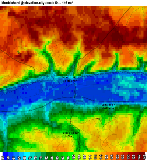
Below is the Elevation map of Montrichard, which displays elevation range with different colors. Scale of the first map is from 54 to 146 m (177 to 479 ft) with average elevation of 103 meters (=338 ft) [note 1]
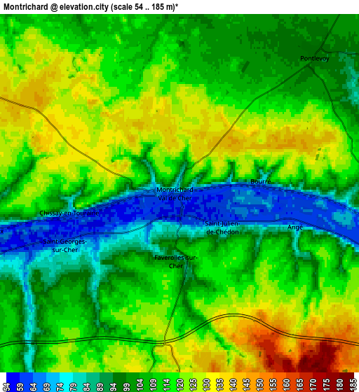
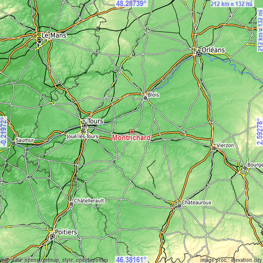
These maps also provides idea of topography and contour of this city, they are displayed at different zoom levels. More info about maps, scale and edge coordinates you can find below images.
| \ | Map #1 | Map #2 | Topo.Map |
| Scale [m] | 54..146 m | 54..185 m | × |
| Scale [ft] | 177..479 ft | 177..607 ft | × |
| Average | 103 m = 338 ft | 110.9 m = 364 ft | × |
| Width | 6.62 km = 4.1 mi | 13.24 km = 8.2 mi | 211.9 km = 131.7 mi |
| Height | 6.62 km = 4.1 mi | 13.24 km = 8.2 mi | 211.9 km = 131.7 mi |
| ↑Max Latitude | 47.372869° | 47.402622° | 48.28739° |
| Latitude at center | 47.3431° | 47.3431° | 47.3431° |
| ↓Min Latitude | 47.313314° | 47.283511° | 46.38161° |
| ← Min Longitude | 1.142585° | 1.098639° | -0.21972° |
| Longitude center | 1.18653° | 1.18653° | 1.18653° |
| →Max Longitude | 1.230475° | 1.274421° | 2.59278° |
Nearby cities:
Cities around Montrichard sort by population:
• Bléré elevation 60 m
14.8 km,  263°
263°
• Saint-Georges-sur-Cher 60 m
4.3 km,  250°
250°
• La Croix-en-Touraine 60 m
14.8 km,  268°
268°
• Pontlevoy 99 m
7.3 km,  44°
44°
• Civray-de-Touraine 65 m
10.4 km, 263°
• Saint-Romain-sur-Cher 85 m
16.3 km,  99°
99°
• Faverolles-sur-Cher 90 m
2.9 km,  174°
174°
• Thésée 68 m
9.5 km, 103°
• Mareuil-sur-Cher 69 m
12.1 km,  117°
117°
• Chaumont-sur-Loire 84 m
15.3 km,  0°
0°
• Chissay-en-Touraine 70 m
4 km, 261°
• Chargé 63 m
15.4 km,  310°
310°
Multilingual:
 En español:
Montrichard elevación 79 m.
 En France:
Montrichard élévation 79 m.
 Auf Deutsch:
Montrichard höhe über dem Meeresspiegel ist 79 m.

Sources and notes:
- [note 1] Map square and city borders are not equal. Map elevation data is calculated only from area inside that square.
- [src 1] Elevation data from geonames database provided with same terms of usage.
- [src 2] The elevation map of Montrichard is generated using elevation data from NASA's 3 arcsec (90m) resolution SRTM data.
- [src 3] Base (background) map © OpenStreetMap contributors tiles are generated by Geofabrik and OpenTopoMap.
Copyright & License:
This Montrichard Elevation Map is licensed under CC BY-SA. You may reuse any part from this page, if you give a proper credit by linking to this URL:
 More info on terms of use page.