Mont-Saint-Aignan elevation
Mont-Saint-Aignan (Normandy, Seine-Maritime), France elevation is 128 meters and Mont-Saint-Aignan elevation in feet is 420 ft above sea level [src 1]. Mont-Saint-Aignan is a populated place (feature code) with elevation that is 46 meters (151 ft) smaller than average city elevation in France.
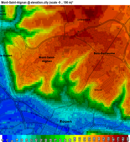
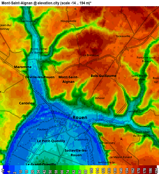
Below is the Elevation map of Mont-Saint-Aignan, which displays elevation range with different colors. Scale of the first map is from -9 to 190 m (-30 to 623 ft) with average elevation of 98.5 meters (=323 ft) [note 1]
These maps also provides idea of topography and contour of this city, they are displayed at different zoom levels. More info about maps, scale and edge coordinates you can find below images.
| \ | Map #1 | Map #2 | Topo.Map |
| Scale [m] | -9..190 m | -14..194 m | × |
| Scale [ft] | -30..623 ft | -46..636 ft | × |
| Average | 98.5 m = 323 ft | 99.1 m = 325 ft | × |
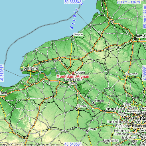
| Width | 6.35 km = 3.9 mi | 12.7 km = 7.9 mi | 203.3 km = 126.3 mi |
| Height | 6.35 km = 3.9 mi | 12.7 km = 7.9 mi | 203.2 km = 126.3 mi |
| ↑Max Latitude | 49.491623° | 49.52016° | 50.36854° |
| Latitude at center | 49.46307° | 49.46307° | 49.46307° |
| ↓Min Latitude | 49.4345° | 49.405913° | 48.54056° |
| ← Min Longitude | 1.049695° | 1.005749° | -0.31261° |
| Longitude center | 1.09364° | 1.09364° | 1.09364° |
| →Max Longitude | 1.137585° | 1.181531° | 2.49989° |
Nearby cities:
Cities around Mont-Saint-Aignan sort by population:
• Rouen elevation 21 m
2.3 km,  169°
169°
• Canteleu 115 m
5.6 km,  243°
243°
• Bois-Guillaume 160 m
2.1 km,  98°
98°
• Maromme 126 m
5.4 km,  289°
289°
• Déville-lès-Rouen 38 m
3.1 km,  283°
283°
• Darnétal 37 m
4.6 km,  115°
115°
• Bihorel 152 m
2.3 km,  114°
114°
• Notre-Dame-de-Bondeville 26 m
3.9 km,  305°
305°
• Saint-Léger-du-Bourg-Denis 30 m
5.7 km,  125°
125°
• Houppeville 152 m
5.6 km,  349°
349°
• Isneauville 148 m
5.9 km,  48°
48°
• Saint-Martin-du-Vivier 99 m
5.3 km,  85°
85°
Multilingual:
 En español:
Mont-Saint-Aignan elevación 128 m.
 En France:
Mont-Saint-Aignan élévation 128 m.
 Auf Deutsch:
Mont-Saint-Aignan höhe über dem Meeresspiegel ist 128 m.

Sources and notes:
- [note 1] Map square and city borders are not equal. Map elevation data is calculated only from area inside that square.
- [src 1] Elevation data from geonames database provided with same terms of usage.
- [src 2] The elevation map of Mont-Saint-Aignan is generated using elevation data from NASA's 3 arcsec (90m) resolution SRTM data.
- [src 3] Base (background) map © OpenStreetMap contributors tiles are generated by Geofabrik and OpenTopoMap.
Copyright & License:
This Mont-Saint-Aignan Elevation Map is licensed under CC BY-SA. You may reuse any part from this page, if you give a proper credit by linking to this URL:
 More info on terms of use page.