Nogent-sur-Seine elevation
Nogent-sur-Seine (Grand Est, Département de l'Aube), France elevation is 75 meters and Nogent-sur-Seine elevation in feet is 246 ft above sea level [src 1]. Nogent-sur-Seine is a seat of a third-order administrative division (feature code) with elevation that is 99 meters (325 ft) smaller than average city elevation in France.
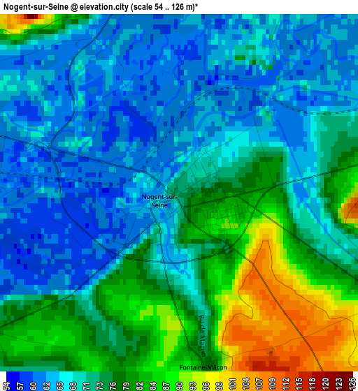
Below is the Elevation map of Nogent-sur-Seine, which displays elevation range with different colors. Scale of the first map is from 54 to 126 m (177 to 413 ft) with average elevation of 72.7 meters (=239 ft) [note 1]
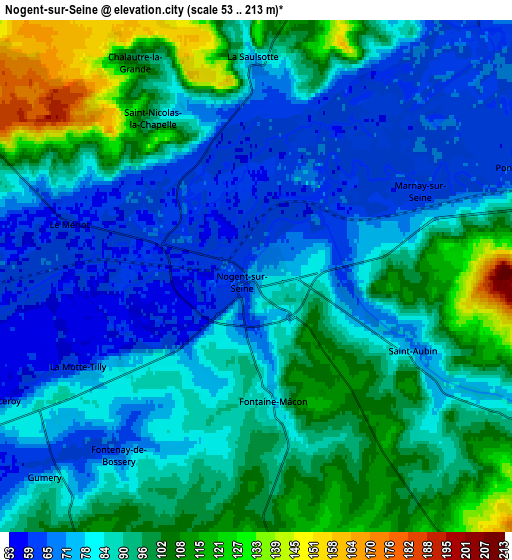
These maps also provides idea of topography and contour of this city, they are displayed at different zoom levels. More info about maps, scale and edge coordinates you can find below images.
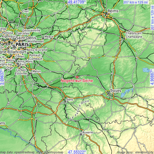
| \ | Map #1 | Map #2 | Topo.Map |
| Scale [m] | 54..126 m | 53..213 m | × |
| Scale [ft] | 177..413 ft | 174..699 ft | × |
| Average | 72.7 m = 239 ft | 88 m = 289 ft | × |
| Width | 6.48 km = 4 mi | 12.95 km = 8 mi | 207.2 km = 128.7 mi |
| Height | 6.48 km = 4 mi | 12.95 km = 8 mi | 207.2 km = 128.7 mi |
| ↑Max Latitude | 48.522834° | 48.551932° | 49.41709° |
| Latitude at center | 48.49372° | 48.49372° | 48.49372° |
| ↓Min Latitude | 48.464589° | 48.435441° | 47.55322° |
| ← Min Longitude | 3.458675° | 3.414729° | 2.09637° |
| Longitude center | 3.50262° | 3.50262° | 3.50262° |
| →Max Longitude | 3.546565° | 3.590511° | 4.90887° |
Nearby cities:
Cities around Nogent-sur-Seine sort by population:
• Romilly-sur-Seine elevation 74 m
16.6 km,  83°
83°
• Provins 91 m
16.6 km,  295°
295°
• Villenauxe-la-Grande 74 m
10.6 km,  19°
19°
• Bray-sur-Seine 58 m
21.4 km,  245°
245°
• Longueville 72 m
19 km,  277°
277°
• Sainte-Colombe 76 m
18.7 km, 282°
• Gouaix 79 m
15.4 km,  266°
266°
• Marigny-le-Châtel 110 m
19.9 km,  120°
120°
• Maizières-la-Grande-Paroisse 74 m
20.9 km,  85°
85°
• Sourdun 150 m
12.1 km,  293°
293°
• Saint-Just-Sauvage 74 m
21.8 km,  71°
71°
• Villiers-Saint-Georges 157 m
18.7 km,  338°
338°
Multilingual:
 En español:
Nogent-sur-Seine elevación 75 m.
 En France:
Nogent-sur-Seine élévation 75 m.
 Auf Deutsch:
Nogent-sur-Seine höhe über dem Meeresspiegel ist 75 m.

Sources and notes:
- [note 1] Map square and city borders are not equal. Map elevation data is calculated only from area inside that square.
- [src 1] Elevation data from geonames database provided with same terms of usage.
- [src 2] The elevation map of Nogent-sur-Seine is generated using elevation data from NASA's 3 arcsec (90m) resolution SRTM data.
- [src 3] Base (background) map © OpenStreetMap contributors tiles are generated by Geofabrik and OpenTopoMap.
Copyright & License:
This Nogent-sur-Seine Elevation Map is licensed under CC BY-SA. You may reuse any part from this page, if you give a proper credit by linking to this URL:
 More info on terms of use page.