Nolay elevation
Nolay (Bourgogne-Franche-Comté, Département de la Côte-d'Or), France elevation is 328 meters and Nolay elevation in feet is 1076 ft above sea level [src 1]. Nolay is a populated place (feature code) with elevation that is 154 meters (505 ft) bigger than average city elevation in France.
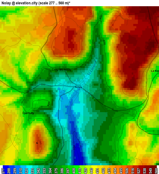
Below is the Elevation map of Nolay, which displays elevation range with different colors. Scale of the first map is from 277 to 560 m (909 to 1837 ft) with average elevation of 428.5 meters (=1406 ft) [note 1]
These maps also provides idea of topography and contour of this city, they are displayed at different zoom levels. More info about maps, scale and edge coordinates you can find below images.
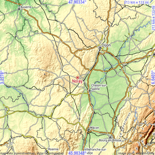
| \ | Map #1 | Topo.Map |
| Scale [m] | 277..560 m | × |
| Scale [ft] | 909..1837 ft | × |
| Average | 428.5 m = 1406 ft | × |
| Width | 6.67 km = 4.1 mi | 213.5 km = 132.7 mi |
| Height | 6.67 km = 4.1 mi | 213.5 km = 132.7 mi |
| ↑Max Latitude | 46.982009° | 47.90334° |
| Latitude at center | 46.95202° | 46.95202° |
| ↓Min Latitude | 46.922014° | 45.98348° |
| ← Min Longitude | 4.590105° | 3.2278° |
| Longitude center | 4.63405° | 4.63405° |
| →Max Longitude | 4.677995° | 6.0403° |
Nearby cities:
Cities around Nolay sort by population:
• Chagny elevation 210 m
10.1 km,  117°
117°
• Épinac 330 m
9.6 km,  291°
291°
• Fontaines 195 m
15.4 km,  137°
137°
• Meursault 249 m
10.7 km,  74°
74°
• Demigny 198 m
15.4 km,  98°
98°
• Rully 222 m
11.9 km, 135°
• Couches 384 m
10.8 km,  208°
208°
• Saint-Léger-sur-Dheune 238 m
11.8 km,  179°
179°
• Mercurey 258 m
13.9 km,  152°
152°
• Bligny-lès-Beaune 220 m
15.1 km,  75°
75°
• Mellecey 214 m
17.3 km,  155°
155°
• Corpeau 228 m
9.3 km,  105°
105°
Multilingual:
 En español:
Nolay elevación 328 m.
 En France:
Nolay élévation 328 m.


Sources and notes:
- [note 1] Map square and city borders are not equal. Map elevation data is calculated only from area inside that square.
- [src 1] Elevation data from geonames database provided with same terms of usage.
- [src 2] The elevation map of Nolay is generated using elevation data from NASA's 3 arcsec (90m) resolution SRTM data.
- [src 3] Base (background) map © OpenStreetMap contributors tiles are generated by Geofabrik and OpenTopoMap.
Copyright & License:
This Nolay Elevation Map is licensed under CC BY-SA. You may reuse any part from this page, if you give a proper credit by linking to this URL:
 More info on terms of use page.