Oisemont elevation
Oisemont (Hauts-de-France, Somme), France elevation is 122 meters and Oisemont elevation in feet is 400 ft above sea level [src 1]. Oisemont is a populated place (feature code) with elevation that is 52 meters (171 ft) smaller than average city elevation in France.
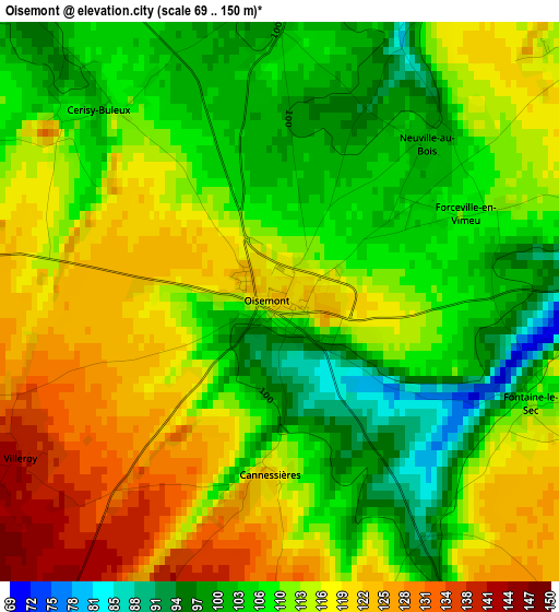
Below is the Elevation map of Oisemont, which displays elevation range with different colors. Scale of the first map is from 69 to 150 m (226 to 492 ft) with average elevation of 111.8 meters (=367 ft) [note 1]
These maps also provides idea of topography and contour of this city, they are displayed at different zoom levels. More info about maps, scale and edge coordinates you can find below images.
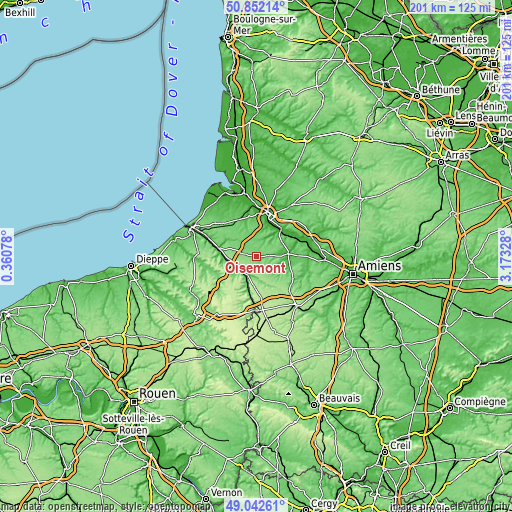
| \ | Map #1 | Topo.Map |
| Scale [m] | 69..150 m | × |
| Scale [ft] | 226..492 ft | × |
| Average | 111.8 m = 367 ft | × |
| Width | 6.29 km = 3.9 mi | 201.2 km = 125 mi |
| Height | 6.29 km = 3.9 mi | 201.2 km = 125 mi |
| ↑Max Latitude | 49.984135° | 50.85214° |
| Latitude at center | 49.95587° | 49.95587° |
| ↓Min Latitude | 49.927588° | 49.04261° |
| ← Min Longitude | 1.723085° | 0.36078° |
| Longitude center | 1.76703° | 1.76703° |
| →Max Longitude | 1.810975° | 3.17328° |
Nearby cities:
Cities around Oisemont sort by population:
• Abbeville elevation 26 m
17.3 km,  16°
16°
• Blangy-sur-Bresle 47 m
10.5 km,  255°
255°
• Gamaches 35 m
15.4 km,  282°
282°
• Feuquières-en-Vimeu 101 m
16.4 km,  314°
314°
• Airaines 24 m
12.6 km,  83°
83°
• Longpré-les-Corps-Saints 14 m
17.3 km,  68°
68°
• Pont-Remy 6 m
15 km,  45°
45°
• Hornoy-le-Bourg 165 m
15.1 km,  141°
141°
• Beaucamps-le-Vieux 186 m
12.2 km,  174°
174°
• Hallencourt 113 m
8.8 km,  62°
62°
• Chépy 95 m
14.7 km,  324°
324°
• Bouttencourt 74 m
9.7 km, 257°
Multilingual:
 En español:
Oisemont elevación 122 m.
 En France:
Oisemont élévation 122 m.
 Auf Deutsch:
Oisemont höhe über dem Meeresspiegel ist 122 m.

Sources and notes:
- [note 1] Map square and city borders are not equal. Map elevation data is calculated only from area inside that square.
- [src 1] Elevation data from geonames database provided with same terms of usage.
- [src 2] The elevation map of Oisemont is generated using elevation data from NASA's 3 arcsec (90m) resolution SRTM data.
- [src 3] Base (background) map © OpenStreetMap contributors tiles are generated by Geofabrik and OpenTopoMap.
Copyright & License:
This Oisemont Elevation Map is licensed under CC BY-SA. You may reuse any part from this page, if you give a proper credit by linking to this URL:
 More info on terms of use page.