Onnaing elevation
Onnaing (Hauts-de-France, Nord), France elevation is 29 meters and Onnaing elevation in feet is 95 ft above sea level [src 1]. Onnaing is a populated place (feature code) with elevation that is 145 meters (476 ft) smaller than average city elevation in France.
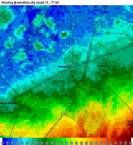
Below is the Elevation map of Onnaing, which displays elevation range with different colors. Scale of the first map is from 13 to 77 m (43 to 253 ft) with average elevation of 32.2 meters (=106 ft) [note 1]
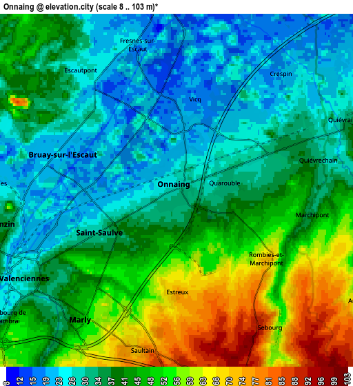
These maps also provides idea of topography and contour of this city, they are displayed at different zoom levels. More info about maps, scale and edge coordinates you can find below images.
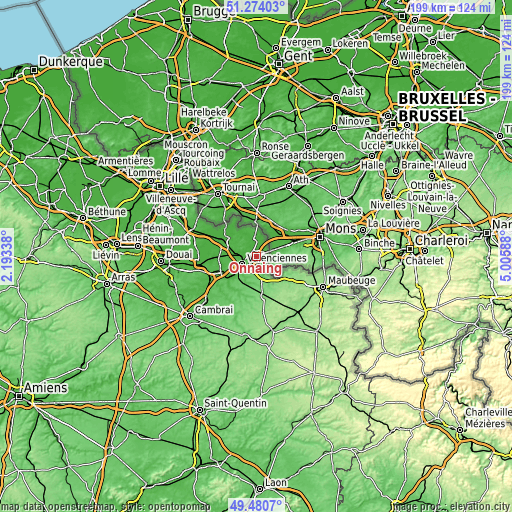
| \ | Map #1 | Map #2 | Topo.Map |
| Scale [m] | 13..77 m | 8..103 m | × |
| Scale [ft] | 43..253 ft | 26..338 ft | × |
| Average | 32.2 m = 106 ft | 39.5 m = 130 ft | × |
| Width | 6.23 km = 3.9 mi | 12.46 km = 7.7 mi | 199.4 km = 123.9 mi |
| Height | 6.23 km = 3.9 mi | 12.46 km = 7.7 mi | 199.4 km = 123.9 mi |
| ↑Max Latitude | 50.413852° | 50.441847° | 51.27403° |
| Latitude at center | 50.38584° | 50.38584° | 50.38584° |
| ↓Min Latitude | 50.357812° | 50.329767° | 49.4807° |
| ← Min Longitude | 3.555685° | 3.511739° | 2.19338° |
| Longitude center | 3.59963° | 3.59963° | 3.59963° |
| →Max Longitude | 3.643575° | 3.687521° | 5.00588° |
Nearby cities:
Cities around Onnaing sort by population:
• Valenciennes elevation 31 m
6.1 km,  240°
240°
• Bruay-sur-l’Escaut 20 m
4.2 km,  290°
290°
• Marly 42 m
5.7 km,  218°
218°
• Saint-Saulve 28 m
3.5 km, 242°
• Fresnes-sur-Escaut 25 m
5.6 km,  343°
343°
• Quiévrechain 36 m
4.9 km,  82°
82°
• Crespin 26 m
5.9 km,  48°
48°
• Escautpont 24 m
4.9 km,  318°
318°
• Quarouble 31 m
1.7 km,  88°
88°
• Saultain 70 m
5.7 km,  196°
196°
• Sebourg 86 m
5.7 km,  147°
147°
• Vicq 20 m
2.4 km,  6°
6°
Multilingual:
 En español:
Onnaing elevación 29 m.
 En France:
Onnaing élévation 29 m.


Sources and notes:
- [note 1] Map square and city borders are not equal. Map elevation data is calculated only from area inside that square.
- [src 1] Elevation data from geonames database provided with same terms of usage.
- [src 2] The elevation map of Onnaing is generated using elevation data from NASA's 3 arcsec (90m) resolution SRTM data.
- [src 3] Base (background) map © OpenStreetMap contributors tiles are generated by Geofabrik and OpenTopoMap.
Copyright & License:
This Onnaing Elevation Map is licensed under CC BY-SA. You may reuse any part from this page, if you give a proper credit by linking to this URL:
 More info on terms of use page.