Orbey elevation
Orbey (Grand Est, Haut-Rhin), France elevation is 473 meters and Orbey elevation in feet is 1552 ft above sea level [src 1]. Orbey is a populated place (feature code) with elevation that is 299 meters (981 ft) bigger than average city elevation in France.
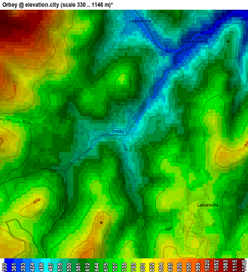
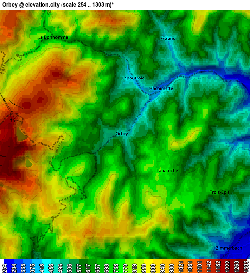
Below is the Elevation map of Orbey, which displays elevation range with different colors. Scale of the first map is from 330 to 1146 m (1083 to 3760 ft) with average elevation of 668 meters (=2192 ft) [note 1]
These maps also provides idea of topography and contour of this city, they are displayed at different zoom levels. More info about maps, scale and edge coordinates you can find below images.
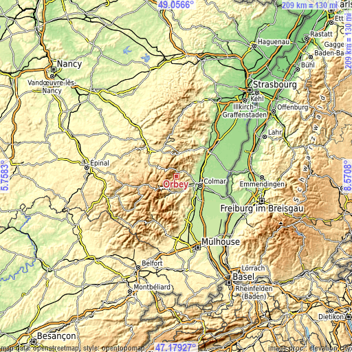
| \ | Map #1 | Map #2 | Topo.Map |
| Scale [m] | 330..1146 m | 254..1303 m | × |
| Scale [ft] | 1083..3760 ft | 833..4275 ft | × |
| Average | 668 m = 2192 ft | 727.3 m = 2386 ft | × |
| Width | 6.52 km = 4.1 mi | 13.05 km = 8.1 mi | 208.7 km = 129.7 mi |
| Height | 6.52 km = 4.1 mi | 13.05 km = 8.1 mi | 208.7 km = 129.7 mi |
| ↑Max Latitude | 48.155835° | 48.185142° | 49.0566° |
| Latitude at center | 48.12651° | 48.12651° | 48.12651° |
| ↓Min Latitude | 48.097169° | 48.067811° | 47.17927° |
| ← Min Longitude | 7.120605° | 7.076659° | 5.7583° |
| Longitude center | 7.16455° | 7.16455° | 7.16455° |
| →Max Longitude | 7.208495° | 7.252441° | 8.5708° |
Nearby cities:
Cities around Orbey sort by population:
• Munster elevation 399 m
9.7 km,  191°
191°
• Turckheim 240 m
9.4 km,  117°
117°
• Kaysersberg 251 m
7.5 km,  80°
80°
• Lapoutroie 430 m
3.1 km,  3°
3°
• Labaroche 758 m
2.7 km,  130°
130°
• Ammerschwihr 239 m
8.8 km,  90°
90°
• Fréland 434 m
5.5 km,  21°
21°
• Stosswihr 466 m
9.4 km,  210°
210°
• Wihr-au-Val 306 m
8.8 km,  160°
160°
• Riquewihr 309 m
10.8 km,  65°
65°
• Soultzeren 614 m
8.4 km, 213°
• Sigolsheim 228 m
10.1 km, 84°
Multilingual:
 En español:
Orbey elevación 473 m.
 En France:
Orbey élévation 473 m.


Sources and notes:
- [note 1] Map square and city borders are not equal. Map elevation data is calculated only from area inside that square.
- [src 1] Elevation data from geonames database provided with same terms of usage.
- [src 2] The elevation map of Orbey is generated using elevation data from NASA's 3 arcsec (90m) resolution SRTM data.
- [src 3] Base (background) map © OpenStreetMap contributors tiles are generated by Geofabrik and OpenTopoMap.
Copyright & License:
This Orbey Elevation Map is licensed under CC BY-SA. You may reuse any part from this page, if you give a proper credit by linking to this URL:
 More info on terms of use page.