Orgeval elevation
Orgeval (Île-de-France, Yvelines), France elevation is 100 meters and Orgeval elevation in feet is 328 ft above sea level [src 1]. Orgeval is a populated place (feature code) with elevation that is 74 meters (243 ft) smaller than average city elevation in France.
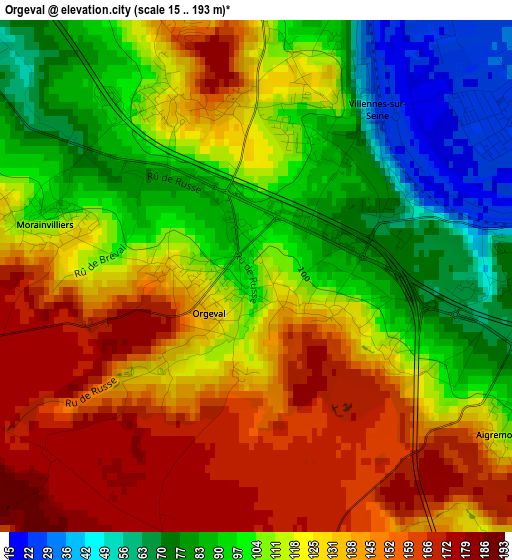
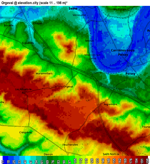
Below is the Elevation map of Orgeval, which displays elevation range with different colors. Scale of the first map is from 15 to 193 m (49 to 633 ft) with average elevation of 116.8 meters (=383 ft) [note 1]
These maps also provides idea of topography and contour of this city, they are displayed at different zoom levels. More info about maps, scale and edge coordinates you can find below images.
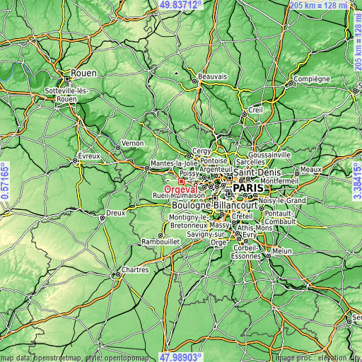
| \ | Map #1 | Map #2 | Topo.Map |
| Scale [m] | 15..193 m | 11..198 m | × |
| Scale [ft] | 49..633 ft | 36..650 ft | × |
| Average | 116.8 m = 383 ft | 104.7 m = 344 ft | × |
| Width | 6.42 km = 4 mi | 12.84 km = 8 mi | 205.5 km = 127.7 mi |
| Height | 6.42 km = 4 mi | 12.84 km = 8 mi | 205.5 km = 127.7 mi |
| ↑Max Latitude | 48.950488° | 48.979339° | 49.83712° |
| Latitude at center | 48.92162° | 48.92162° | 48.92162° |
| ↓Min Latitude | 48.892736° | 48.863834° | 47.98903° |
| ← Min Longitude | 1.933955° | 1.890009° | 0.57165° |
| Longitude center | 1.9779° | 1.9779° | 1.9779° |
| →Max Longitude | 2.021845° | 2.065791° | 3.38415° |
Nearby cities:
Cities around Orgeval sort by population:
• Poissy elevation 31 m
5.3 km,  81°
81°
• Verneuil-sur-Seine 60 m
5.9 km,  350°
350°
• Carrières-sous-Poissy 35 m
5.5 km,  55°
55°
• Vernouillet 52 m
5.5 km,  2°
2°
• Chambourcy 91 m
4.9 km,  109°
109°
• Villennes-sur-Seine 111 m
2.4 km,  24°
24°
• Ecquevilly 60 m
5.2 km,  310°
310°
• Feucherolles 128 m
5.7 km,  182°
182°
• Morainvilliers 117 m
3.2 km,  285°
285°
• Crespières 116 m
5.9 km,  223°
223°
• Médan 40 m
4 km, 18°
• Les Alluets-le-Roi 183 m
4.5 km,  258°
258°
Multilingual:
 En español:
Orgeval elevación 100 m.
 En France:
Orgeval élévation 100 m.


Sources and notes:
- [note 1] Map square and city borders are not equal. Map elevation data is calculated only from area inside that square.
- [src 1] Elevation data from geonames database provided with same terms of usage.
- [src 2] The elevation map of Orgeval is generated using elevation data from NASA's 3 arcsec (90m) resolution SRTM data.
- [src 3] Base (background) map © OpenStreetMap contributors tiles are generated by Geofabrik and OpenTopoMap.
Copyright & License:
This Orgeval Elevation Map is licensed under CC BY-SA. You may reuse any part from this page, if you give a proper credit by linking to this URL:
 More info on terms of use page.